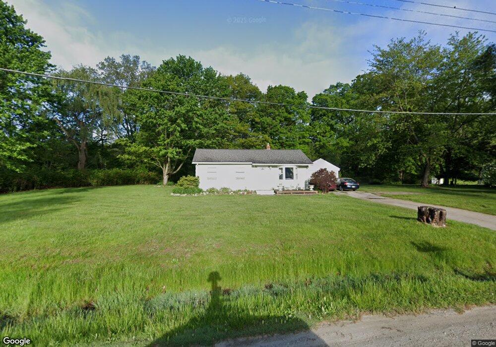
7305 Marsha St Flushing, MI 48433
Estimated Value: $160,082 - $199,000
Studio
1
Bath
1,200
Sq Ft
$148/Sq Ft
Est. Value
About This Home
This home is located at 7305 Marsha St, Flushing, MI 48433 and is currently estimated at $178,021, approximately $148 per square foot. 7305 Marsha St is a home located in Genesee County with nearby schools including Elms Elementary School, Flushing Middle School, and Flushing High School.
Ownership History
Date
Name
Owned For
Owner Type
Purchase Details
Closed on
Jan 25, 2010
Sold by
Porn Tammy Kay
Bought by
Porn David Edward
Current Estimated Value
Purchase Details
Closed on
Dec 13, 2001
Sold by
York Charles O and York Wendy
Bought by
Porn David E
Home Financials for this Owner
Home Financials are based on the most recent Mortgage that was taken out on this home.
Original Mortgage
$92,100
Outstanding Balance
$35,855
Interest Rate
6.52%
Estimated Equity
$142,166
Create a Home Valuation Report for This Property
The Home Valuation Report is an in-depth analysis detailing your home's value as well as a comparison with similar homes in the area
Home Values in the Area
Average Home Value in this Area
Purchase History
| Date | Buyer | Sale Price | Title Company |
|---|---|---|---|
| Porn David Edward | -- | None Available | |
| Porn David E | $90,000 | Centennial Title & Abstract |
Source: Public Records
Mortgage History
| Date | Status | Borrower | Loan Amount |
|---|---|---|---|
| Open | Porn David E | $92,100 |
Source: Public Records
Tax History
| Year | Tax Paid | Tax Assessment Tax Assessment Total Assessment is a certain percentage of the fair market value that is determined by local assessors to be the total taxable value of land and additions on the property. | Land | Improvement |
|---|---|---|---|---|
| 2025 | $1,660 | $68,000 | $0 | $0 |
| 2024 | $848 | $65,800 | $0 | $0 |
| 2023 | $809 | $57,800 | $0 | $0 |
| 2022 | $1,468 | $52,200 | $0 | $0 |
| 2021 | $1,453 | $49,300 | $0 | $0 |
| 2020 | $753 | $46,700 | $0 | $0 |
| 2019 | $745 | $42,600 | $0 | $0 |
| 2018 | $1,358 | $38,600 | $0 | $0 |
| 2017 | $659 | $38,600 | $0 | $0 |
| 2016 | $1,248 | $37,000 | $0 | $0 |
| 2015 | $1,110 | $36,600 | $0 | $0 |
| 2014 | $649 | $35,000 | $0 | $0 |
| 2012 | -- | $36,200 | $36,200 | $0 |
Source: Public Records
Map
Nearby Homes
- 7181 W Mount Morris Rd
- 7067 W Stanley Rd
- 7267 109th St
- 5465 Johnson Rd
- 6355 N Mckinley Rd
- 255 Grissom Ct
- 9031 N Island Dr Unit 29
- 271 Lovell Ct
- 5430 W Frances Rd
- 0 N Island Dr Unit 20230029447
- 8171 N Linden Rd
- 5012 W Stanley Rd
- 9207 N Island Ct Unit 12
- 8454 Wesley Dr
- 8522 Tim Tam Trail
- 8548 Tim Tam Trail
- 7452 Dodge Rd
- 8520 Apple Blossom Ln
- 9222 N Mckinley Rd
- 621 Ashwood Dr
Your Personal Tour Guide
Ask me questions while you tour the home.