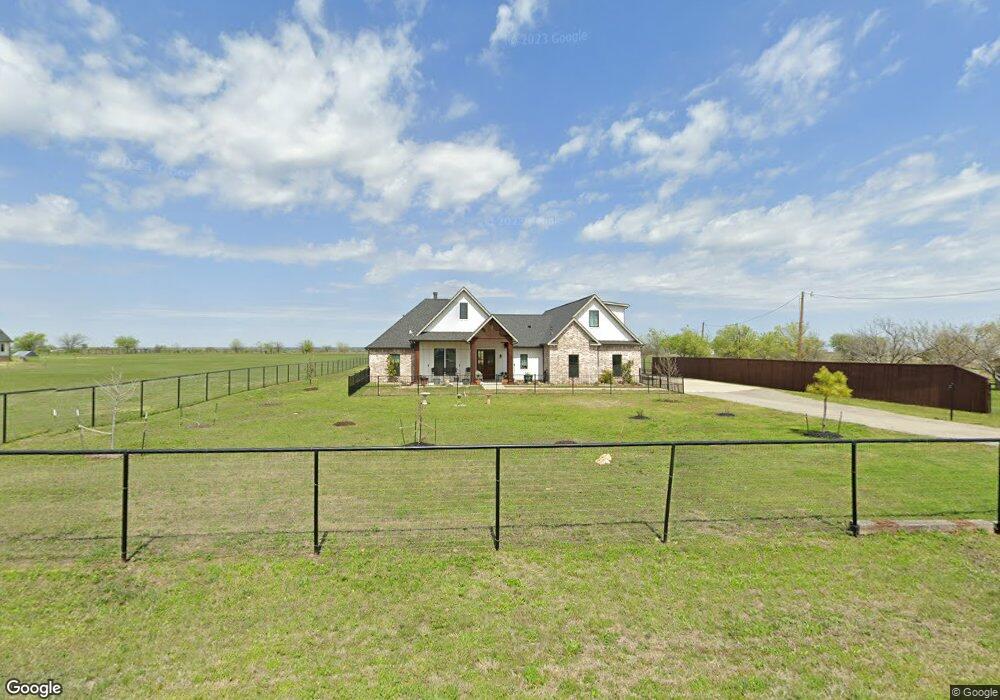
7308 Michael Rd Sanger, TX 76266
Estimated Value: $606,488 - $715,000
5
Beds
4
Baths
2,815
Sq Ft
$231/Sq Ft
Est. Value
About This Home
This home is located at 7308 Michael Rd, Sanger, TX 76266 and is currently estimated at $650,622, approximately $231 per square foot. 7308 Michael Rd is a home located in Denton County with nearby schools including Chisholm Trail Elementary School, Clear Creek Intermediate School, and Sanger Sixth Grade Campus.
Ownership History
Date
Name
Owned For
Owner Type
Purchase Details
Closed on
Apr 9, 2020
Sold by
Mjm Properties Llc
Bought by
Ryan Terry Dean and Ryan Jill Denise
Current Estimated Value
Home Financials for this Owner
Home Financials are based on the most recent Mortgage that was taken out on this home.
Original Mortgage
$382,400
Outstanding Balance
$338,760
Interest Rate
3.4%
Mortgage Type
New Conventional
Estimated Equity
$311,862
Purchase Details
Closed on
Mar 8, 2019
Sold by
Mcmaster Gage
Bought by
M J M Properties Llc
Purchase Details
Closed on
Jun 8, 2018
Sold by
Willow Tree Real Estate Llc
Bought by
Mcmaster Gage
Home Financials for this Owner
Home Financials are based on the most recent Mortgage that was taken out on this home.
Original Mortgage
$59,415
Interest Rate
4.5%
Mortgage Type
Commercial
Create a Home Valuation Report for This Property
The Home Valuation Report is an in-depth analysis detailing your home's value as well as a comparison with similar homes in the area
Home Values in the Area
Average Home Value in this Area
Purchase History
| Date | Buyer | Sale Price | Title Company |
|---|---|---|---|
| Ryan Terry Dean | -- | Capital Title | |
| M J M Properties Llc | -- | None Available | |
| Mcmaster Gage | -- | Freedom Title |
Source: Public Records
Mortgage History
| Date | Status | Borrower | Loan Amount |
|---|---|---|---|
| Open | Ryan Terry Dean | $382,400 | |
| Previous Owner | Mcmaster Gage | $59,415 |
Source: Public Records
Tax History
| Year | Tax Paid | Tax Assessment Tax Assessment Total Assessment is a certain percentage of the fair market value that is determined by local assessors to be the total taxable value of land and additions on the property. | Land | Improvement |
|---|---|---|---|---|
| 2025 | $7,481 | $579,724 | $116,624 | $463,100 |
| 2024 | $8,637 | $636,319 | $116,266 | $520,053 |
| 2023 | $7,197 | $612,270 | $116,266 | $511,741 |
| 2022 | $9,232 | $556,609 | $51,939 | $526,416 |
| 2021 | $7,383 | $506,008 | $47,650 | $458,358 |
| 2020 | $6,773 | $431,118 | $47,650 | $383,468 |
| 2019 | $780 | $47,650 | $47,650 | $0 |
| 2018 | $3 | $152 | $152 | $0 |
| 2017 | $3 | $152 | $152 | $0 |
Source: Public Records
Map
Nearby Homes
- 6958 Michael Rd
- 7140 Davidson Rd
- 14158 Crest View Rd
- 8875 Fm 2450
- 6044 Mango Dr
- TBD Michael Rd
- 6037 Amber Dr
- 6033 Mango Dr
- . Fm 2450 & Indian Trail
- 6009 Amber Dr
- 8774 Kassandra Dr
- 6210 Deer Run Rd
- 8797 Kassandra Dr
- 6713 Mustang Trail
- 6221 Deer Run Rd
- 6807 Sam Bass Rd
- 9061 Crow Wright Rd
- 7196 Hawkeye Rd
- TBD Hawkeye Rd
- 11007 Farm To Market Road 2450
- 7166 Michael Rd
- 7368 Michael Rd
- 7200 Michael Rd
- 7319 Michael Rd
- 7424 Michael Rd
- 7059 Michael Rd
- 7193 Michael Rd
- 7136 Michael Rd
- 7423 Michael Rd
- 7135 Michael Rd
- 7470 Michael Rd
- 7483 Michael Rd
- 2151 Crockett St
- 7504 Michael Rd
- 7111 Michael Rd
- 7493 Michael Rd
- 7498 Michael Rd
- 7077 Michael Rd
- 6811 Michael Rd
- 7024 Michael Rd
Your Personal Tour Guide
Ask me questions while you tour the home.