Estimated Value: $75,000 - $231,000
3
Beds
2
Baths
1,456
Sq Ft
$99/Sq Ft
Est. Value
About This Home
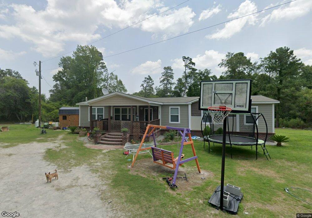
This home is located at 731 Cardinal St, Loris, SC 29569 and is currently estimated at $144,124, approximately $98 per square foot. 731 Cardinal St is a home located in Horry County with nearby schools including Loris Elementary School, Loris Middle School, and Loris High School.
Ownership History
Date
Name
Owned For
Owner Type
Purchase Details
Closed on
Sep 7, 2012
Sold by
Diaz Guzman Paula
Bought by
Diaz Guzman Leonardo
Current Estimated Value
Purchase Details
Closed on
Jan 25, 2007
Sold by
Allen Darrell and Allen Virginia M
Bought by
Diaz Guzman Leonardo and Diaz Guzman Paula
Home Financials for this Owner
Home Financials are based on the most recent Mortgage that was taken out on this home.
Original Mortgage
$63,151
Outstanding Balance
$37,783
Interest Rate
6.14%
Mortgage Type
Unknown
Estimated Equity
$106,341
Purchase Details
Closed on
Nov 26, 2003
Sold by
Ford Norma J and Ford Camilla S
Bought by
Allen Darrell and Allen Virginia M
Purchase Details
Closed on
Dec 3, 2001
Sold by
Trinks Pamela J and Trinks Scott A
Bought by
Ford Norma J and Ford Camilla S
Create a Home Valuation Report for This Property
The Home Valuation Report is an in-depth analysis detailing your home's value as well as a comparison with similar homes in the area
Home Values in the Area
Average Home Value in this Area
Purchase History
| Date | Buyer | Sale Price | Title Company |
|---|---|---|---|
| Diaz Guzman Leonardo | -- | -- | |
| Diaz Guzman Leonardo | $25,000 | None Available | |
| Allen Darrell | $4,200 | -- | |
| Ford Norma J | -- | -- | |
| Ford Norma J | -- | -- |
Source: Public Records
Mortgage History
| Date | Status | Borrower | Loan Amount |
|---|---|---|---|
| Open | Diaz Guzman Leonardo | $63,151 |
Source: Public Records
Tax History Compared to Growth
Tax History
| Year | Tax Paid | Tax Assessment Tax Assessment Total Assessment is a certain percentage of the fair market value that is determined by local assessors to be the total taxable value of land and additions on the property. | Land | Improvement |
|---|---|---|---|---|
| 2024 | -- | $1,951 | $1,951 | $0 |
| 2023 | $148 | $598 | $598 | $0 |
| 2021 | $146 | $598 | $598 | $0 |
| 2020 | $97 | $598 | $598 | $0 |
| 2019 | $278 | $2,690 | $598 | $2,092 |
| 2018 | $268 | $2,504 | $624 | $1,880 |
| 2017 | $246 | $2,504 | $624 | $1,880 |
| 2016 | $0 | $2,504 | $624 | $1,880 |
| 2015 | -- | $2,505 | $625 | $1,880 |
| 2014 | $235 | $2,505 | $625 | $1,880 |
Source: Public Records
Map
Nearby Homes
- 2064 Martin St
- 196 Warner Crossing Way Unit Newlin
- 200 Warner Crossing Way
- 167 Warner Crossing Way
- 185 Warner Crossing Way
- 171 Warner Crossing Way
- 179 Warner Crossing Way
- 155 Warner Crossing Way
- 304 Little Caboose Ct
- 191 Warner Crossing Way
- 305 Little Caboose Ct
- 163 Warner Crossing Way
- 312 Little Caboose Ct
- 164 Warner Crossing Way
- 220 Flag Patch Rd
- 450 Highway 348
- Lot 10 & 9 Powell Ln
- TBD Powell Ln Unit Lots 9 & 10 Log Cabi
- 201 Norris Ln Unit Lot 8 - Dylan 1820
- 197 Norris Ln Unit Lot 7 - Little River
- 609 Goretown Loop
- 637 Wren St Unit Quail Ridge
- 641 Wren St
- 615 Goretown Loop
- 601 Goretown Loop
- 737 Cardinal St
- 2 Goretown Loop
- 647 Wren St Unit QUAIL RIDGE; LT 2 BL
- 710 Hawk St
- 739 Cardinal St
- 636 Wren St
- 0 Goretown Loop Unit 1621512
- 704 Hawk St
- 712 Hawk St
- 743 Cardinal St
- 714 Hawk St
- 212 Dempsey Dr Unit Red Oak
- 216 Dempsey Dr
- 208 Dempsey Dr Unit Sand Dollar
- 208 Dempsey Dr