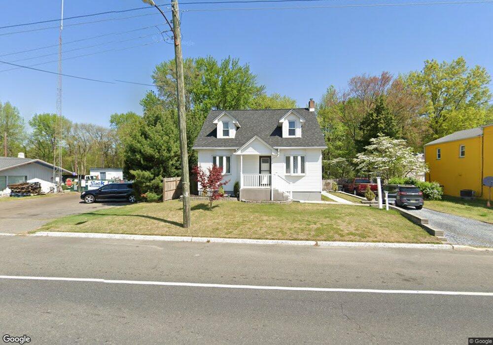
731 E Broad St Gibbstown, NJ 08027
Greenwich Township NeighborhoodEstimated Value: $234,866 - $300,000
--
Bed
--
Bath
1,433
Sq Ft
$190/Sq Ft
Est. Value
About This Home
This home is located at 731 E Broad St, Gibbstown, NJ 08027 and is currently estimated at $271,967, approximately $189 per square foot. 731 E Broad St is a home located in Gloucester County with nearby schools including Nehaunsey Middle School and Guardian Angels Regional School.
Ownership History
Date
Name
Owned For
Owner Type
Purchase Details
Closed on
Apr 24, 2020
Sold by
Barber Kevin A
Bought by
Barber Kevin A and Barber Dawn M
Current Estimated Value
Home Financials for this Owner
Home Financials are based on the most recent Mortgage that was taken out on this home.
Original Mortgage
$120,800
Interest Rate
3.3%
Mortgage Type
New Conventional
Purchase Details
Closed on
Nov 12, 1997
Sold by
Barber Eleanore R
Bought by
Barber Kevin A
Purchase Details
Closed on
Oct 26, 1995
Sold by
Barber Ronald J
Bought by
Barber Eleanore R
Create a Home Valuation Report for This Property
The Home Valuation Report is an in-depth analysis detailing your home's value as well as a comparison with similar homes in the area
Home Values in the Area
Average Home Value in this Area
Purchase History
| Date | Buyer | Sale Price | Title Company |
|---|---|---|---|
| Barber Kevin A | -- | Clientfirst Title Llc | |
| Barber Kevin A | -- | -- | |
| Barber Eleanore R | -- | -- |
Source: Public Records
Mortgage History
| Date | Status | Borrower | Loan Amount |
|---|---|---|---|
| Closed | Barber Kevin A | $120,800 |
Source: Public Records
Tax History Compared to Growth
Tax History
| Year | Tax Paid | Tax Assessment Tax Assessment Total Assessment is a certain percentage of the fair market value that is determined by local assessors to be the total taxable value of land and additions on the property. | Land | Improvement |
|---|---|---|---|---|
| 2025 | $4,713 | $136,900 | $25,700 | $111,200 |
| 2024 | $4,466 | $136,900 | $25,700 | $111,200 |
| 2023 | $4,466 | $136,900 | $25,700 | $111,200 |
| 2022 | $4,468 | $136,900 | $25,700 | $111,200 |
| 2021 | $4,422 | $136,900 | $25,700 | $111,200 |
| 2020 | $4,483 | $136,900 | $25,700 | $111,200 |
| 2019 | $4,486 | $136,900 | $25,700 | $111,200 |
| 2018 | $4,359 | $136,900 | $25,700 | $111,200 |
| 2017 | $4,253 | $136,900 | $25,700 | $111,200 |
| 2016 | $4,207 | $136,900 | $25,700 | $111,200 |
| 2015 | $4,071 | $136,900 | $25,700 | $111,200 |
| 2014 | $3,896 | $136,900 | $25,700 | $111,200 |
Source: Public Records
Map
Nearby Homes
- 836 E Broad St
- 219 Vanneman Blvd
- 330 Croce Ave
- 344 W Washington St
- 335 W Buck St
- L18 20 W Broad St
- 255 Elizabeth Ave
- 269 W Broad St
- 1043 Penn Line Rd
- 227 W Buck St
- 1214 Walter Ave
- 1224 Heddon Ave
- 140 142 W Jefferson St
- 129 W Washington St
- 122 W Washington St
- 1534 Pine St
- 1519 Pine St
- 28 W Jefferson St
- 53-55 Roosevelt St
- 46 Roosevelt St