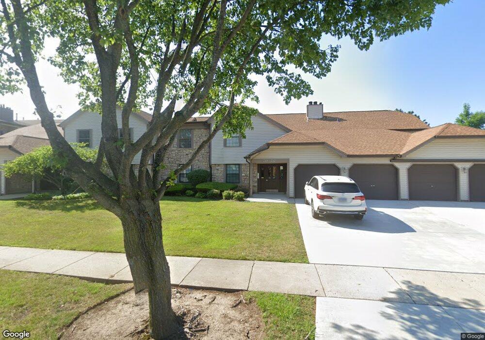
731 Hapsfield Ln Unit 1B1 Buffalo Grove, IL 60089
South Buffalo Grove NeighborhoodEstimated Value: $246,961 - $276,000
2
Beds
--
Bath
1,150
Sq Ft
$227/Sq Ft
Est. Value
About This Home
This home is located at 731 Hapsfield Ln Unit 1B1, Buffalo Grove, IL 60089 and is currently estimated at $260,990, approximately $226 per square foot. 731 Hapsfield Ln Unit 1B1 is a home located in Cook County with nearby schools including Henry W Longfellow Elementary School, Cooper Middle School, and Buffalo Grove High School.
Ownership History
Date
Name
Owned For
Owner Type
Purchase Details
Closed on
Jun 28, 1999
Sold by
Mucciante David F and Mucciante Tina M
Bought by
Riehs Judy M
Current Estimated Value
Home Financials for this Owner
Home Financials are based on the most recent Mortgage that was taken out on this home.
Original Mortgage
$94,500
Interest Rate
7.5%
Purchase Details
Closed on
Feb 28, 1996
Sold by
Werdertich Florence
Bought by
Mucciante David F and Mucciante Tina M
Home Financials for this Owner
Home Financials are based on the most recent Mortgage that was taken out on this home.
Original Mortgage
$108,550
Interest Rate
6.98%
Mortgage Type
FHA
Create a Home Valuation Report for This Property
The Home Valuation Report is an in-depth analysis detailing your home's value as well as a comparison with similar homes in the area
Home Values in the Area
Average Home Value in this Area
Purchase History
| Date | Buyer | Sale Price | Title Company |
|---|---|---|---|
| Riehs Judy M | -- | Chicago Title Insurance Co | |
| Mucciante David F | $113,000 | -- |
Source: Public Records
Mortgage History
| Date | Status | Borrower | Loan Amount |
|---|---|---|---|
| Previous Owner | Riehs Judy M | $94,500 | |
| Previous Owner | Mucciante David F | $108,550 |
Source: Public Records
Tax History Compared to Growth
Tax History
| Year | Tax Paid | Tax Assessment Tax Assessment Total Assessment is a certain percentage of the fair market value that is determined by local assessors to be the total taxable value of land and additions on the property. | Land | Improvement |
|---|---|---|---|---|
| 2024 | $1,532 | $20,033 | $2,965 | $17,068 |
| 2023 | $1,521 | $20,033 | $2,965 | $17,068 |
| 2022 | $1,521 | $20,033 | $2,965 | $17,068 |
| 2021 | $1,699 | $16,308 | $411 | $15,897 |
| 2020 | $1,540 | $16,308 | $411 | $15,897 |
| 2019 | $1,533 | $18,070 | $411 | $17,659 |
| 2018 | $1,708 | $14,456 | $329 | $14,127 |
| 2017 | $1,648 | $14,456 | $329 | $14,127 |
| 2016 | $2,290 | $14,456 | $329 | $14,127 |
| 2015 | $4,519 | $13,301 | $1,400 | $11,901 |
| 2014 | $2,506 | $13,301 | $1,400 | $11,901 |
| 2013 | $2,371 | $13,301 | $1,400 | $11,901 |
Source: Public Records
Map
Nearby Homes
- 820 Weidner Rd Unit 4013
- 820 Weidner Rd Unit 409
- 813 Stradford Cir Unit 21B2
- 665 Thornwood Dr
- 859 Beechwood Rd
- 535 Estate Dr
- 3300 N Carriageway Dr Unit 317
- 561 Park View Terrace Unit 153
- 1127 Miller Ln Unit 107
- 1115 Miller Ln Unit 104
- 972 Thornton Ln Unit 102
- 18 E Heritage Ct
- 410 Chatham Cir
- 455 Mayfair Ln
- 3157 N Daniels Ct Unit 1502
- 3227 N Heritage Ln
- 3222 N Heritage Ln
- 408 Indian Hill Dr
- 1225 Radcliffe Rd Unit 2
- 476 Raupp Blvd
- 733 Hapsfield Ln Unit 1B2
- 737 Hapsfield Ln Unit 1A2
- 727 Hapsfield Ln Unit 1C2
- 725 Hapsfield Ln Unit 1C1
- 723 Hapsfield Ln Unit 1D2
- 721 Hapsfield Ln Unit 1D1
- 811 Weidner Ct S Unit 10B1
- 807 Weidner Ct S Unit 10C2
- 805 Weidner Ct S Unit 805
- 805 Weidner Ct S Unit 10C1
- 813 Weidner Ct S Unit 10B2
- 813 Weidner Ct S Unit 813
- 813 Weidner Ct S Unit 10B2
- 803 Weidner Ct S Unit 10D2
- 815 Weidner Ct S Unit 10A1
- 801 Weidner Ct S Unit 10D1
- 817 Weidner Ct S Unit 10A2
- 724 Hapsfield Ln Unit 7D2
- 724 Hapsfield Ln Unit D
- 734 Hapsfield Ln Unit 7B2