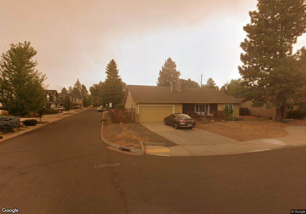
731 NE Isabella Ln Bend, OR 97701
Orchard District NeighborhoodEstimated Value: $498,000 - $552,000
3
Beds
2
Baths
1,416
Sq Ft
$374/Sq Ft
Est. Value
About This Home
This home is located at 731 NE Isabella Ln, Bend, OR 97701 and is currently estimated at $530,183, approximately $374 per square foot. 731 NE Isabella Ln is a home located in Deschutes County with nearby schools including Juniper Elementary School, Pilot Butte Middle School, and Bend Senior High School.
Ownership History
Date
Name
Owned For
Owner Type
Purchase Details
Closed on
Oct 14, 2011
Sold by
Rice Vern E and Rice Donna L
Bought by
Rice Vern E and Rice Donna L
Current Estimated Value
Purchase Details
Closed on
Apr 6, 2011
Sold by
Columbia State Bank
Bought by
Rice Vern E and Rice Donna
Home Financials for this Owner
Home Financials are based on the most recent Mortgage that was taken out on this home.
Original Mortgage
$91,500
Outstanding Balance
$63,421
Interest Rate
4.9%
Mortgage Type
New Conventional
Estimated Equity
$466,762
Create a Home Valuation Report for This Property
The Home Valuation Report is an in-depth analysis detailing your home's value as well as a comparison with similar homes in the area
Home Values in the Area
Average Home Value in this Area
Purchase History
| Date | Buyer | Sale Price | Title Company |
|---|---|---|---|
| Rice Vern E | -- | None Available | |
| Rice Vern E | $122,000 | Amerititle |
Source: Public Records
Mortgage History
| Date | Status | Borrower | Loan Amount |
|---|---|---|---|
| Open | Rice Vern E | $91,500 |
Source: Public Records
Tax History Compared to Growth
Tax History
| Year | Tax Paid | Tax Assessment Tax Assessment Total Assessment is a certain percentage of the fair market value that is determined by local assessors to be the total taxable value of land and additions on the property. | Land | Improvement |
|---|---|---|---|---|
| 2024 | $3,437 | $205,250 | -- | -- |
| 2023 | $3,186 | $199,280 | $0 | $0 |
| 2022 | $2,739 | $173,070 | $0 | $0 |
| 2021 | $2,743 | $168,030 | $0 | $0 |
| 2020 | $2,602 | $168,030 | $0 | $0 |
| 2019 | $2,530 | $163,140 | $0 | $0 |
| 2018 | $2,356 | $151,830 | $0 | $0 |
| 2017 | $2,287 | $147,410 | $0 | $0 |
| 2016 | $2,181 | $143,120 | $0 | $0 |
| 2015 | $2,121 | $138,960 | $0 | $0 |
| 2014 | $2,059 | $134,920 | $0 | $0 |
Source: Public Records
Map
Nearby Homes
- 2170 NE 8th St
- 1942 NE 6th St
- 1920 NE 8th St
- 642 NE Seward Ave
- 424 NE Thurston Ave
- 1850 NE Berg Way
- 532 NE Quimby Ave
- 2561 NE 6th St
- 2566 NE Keats Dr
- 3843 NE Petrosa Ave
- 1031 NE Penn Ave
- 1033 NE Bennington Way
- 2642 NE Keats Dr
- 468 NE Olney Ave
- 1401 NE 10th St
- 2640 NE 8th St
- 2667 NE Jones Rd
- 1000 NE Butler Market Rd Unit 1
- 1622 NE Parkridge Dr
- 1225 NE 9th St
- 2028 NE 7th St
- 761 NE Isabella Ln
- 736 NE Innes Ln
- 730 NE Isabella Ln
- 740 NE Isabella Ln
- 750 NE Isabella Ln
- 720 NE Isabella Ln
- 2012 NE 7th St
- 720 NE Innes Ln
- 760 NE Isabella Ln
- 710 NE Isabella Ln
- 760 NE Innes Ln
- 770 NE Isabella Ln
- 700 NE Isabella Ln
- 2029 NE 8th St
- 780 NE Isabella Ln
- 2025 NE 8th St
- 790 NE Isabella Ln
- 2135 NE 8th St
- 723 NE Innes Ln