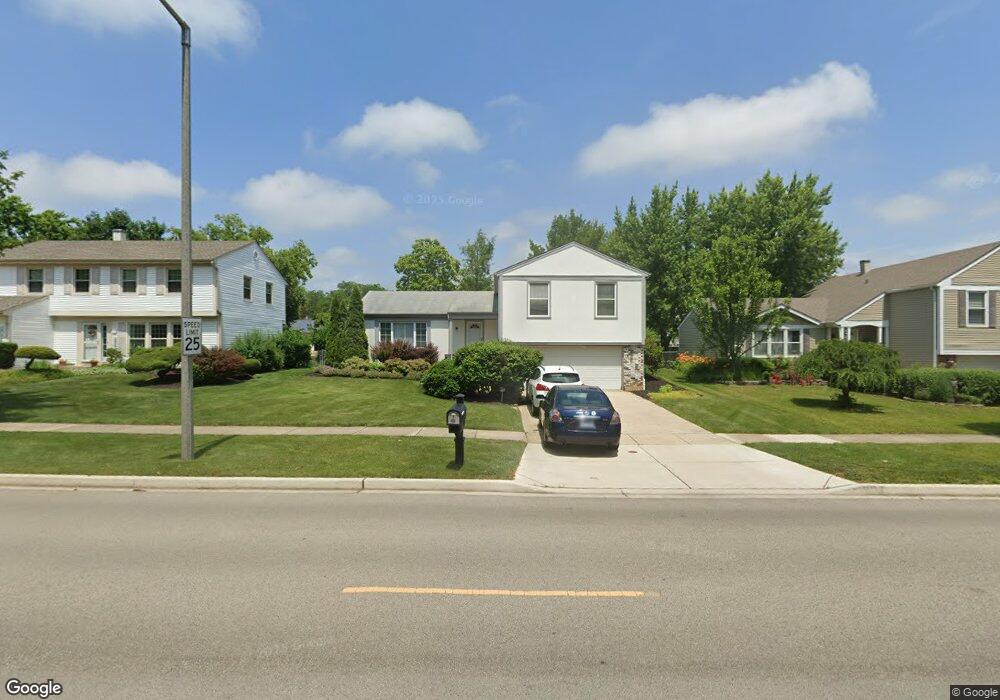
731 Thompson Blvd Buffalo Grove, IL 60089
Prairie Park-Lake County NeighborhoodEstimated Value: $480,806 - $598,000
4
Beds
3
Baths
1,670
Sq Ft
$313/Sq Ft
Est. Value
About This Home
This home is located at 731 Thompson Blvd, Buffalo Grove, IL 60089 and is currently estimated at $523,202, approximately $313 per square foot. 731 Thompson Blvd is a home located in Lake County with nearby schools including Prairie Elementary School, Twin Groves Middle School, and Adlai E Stevenson High School.
Ownership History
Date
Name
Owned For
Owner Type
Purchase Details
Closed on
Feb 28, 2008
Sold by
Polonsky Randy and Plonsky Dana
Bought by
Polonsky Randy and Polonsky Dana
Current Estimated Value
Purchase Details
Closed on
Jul 25, 2003
Sold by
Zelikson Robert and Zelikson Stacy
Bought by
Polonsky Randy and Polonsky Dana
Home Financials for this Owner
Home Financials are based on the most recent Mortgage that was taken out on this home.
Original Mortgage
$304,000
Interest Rate
6.49%
Mortgage Type
Purchase Money Mortgage
Purchase Details
Closed on
Oct 30, 1997
Sold by
Solomon Richard L and Solomon Vikki
Bought by
Zelikson Robert and Zelikson Stacy
Home Financials for this Owner
Home Financials are based on the most recent Mortgage that was taken out on this home.
Original Mortgage
$182,000
Interest Rate
7.42%
Create a Home Valuation Report for This Property
The Home Valuation Report is an in-depth analysis detailing your home's value as well as a comparison with similar homes in the area
Home Values in the Area
Average Home Value in this Area
Purchase History
| Date | Buyer | Sale Price | Title Company |
|---|---|---|---|
| Polonsky Randy | -- | Rtc | |
| Polonsky Randy | $354,000 | Ticor | |
| Zelikson Robert | $151,666 | Burnet Title |
Source: Public Records
Mortgage History
| Date | Status | Borrower | Loan Amount |
|---|---|---|---|
| Previous Owner | Polonsky Randy | $304,000 | |
| Previous Owner | Zelikson Robert | $182,000 |
Source: Public Records
Tax History Compared to Growth
Tax History
| Year | Tax Paid | Tax Assessment Tax Assessment Total Assessment is a certain percentage of the fair market value that is determined by local assessors to be the total taxable value of land and additions on the property. | Land | Improvement |
|---|---|---|---|---|
| 2024 | $11,762 | $137,677 | $29,052 | $108,625 |
| 2023 | $13,392 | $123,723 | $26,108 | $97,615 |
| 2022 | $13,392 | $134,431 | $27,199 | $107,232 |
| 2021 | $12,884 | $132,982 | $26,906 | $106,076 |
| 2020 | $12,581 | $133,436 | $26,998 | $106,438 |
| 2019 | $12,408 | $132,944 | $26,898 | $106,046 |
| 2018 | $11,538 | $127,813 | $26,584 | $101,229 |
| 2017 | $11,320 | $124,829 | $25,963 | $98,866 |
| 2016 | $11,024 | $119,534 | $24,862 | $94,672 |
| 2015 | $10,731 | $111,787 | $23,251 | $88,536 |
| 2014 | $10,269 | $105,783 | $24,971 | $80,812 |
| 2012 | $10,199 | $105,995 | $25,021 | $80,974 |
Source: Public Records
Map
Nearby Homes
- 890 Knollwood Dr
- 327 Lasalle Ln
- 1265 Devonshire Rd
- 1546 Brandywyn Ln
- 614 Lyon Ct
- 1141 Devonshire Rd
- 1032 Courtland Dr Unit 9
- 437 Caren Dr
- 538 Lasalle Ct
- 950 Belmar Ln
- 1118 Larraway Dr
- 931 Shady Grove Ln
- 5107 N Arlington Heights Rd
- 1903 Sheridan Rd
- 1113 Lockwood Dr
- 1901 Brandywyn Ln
- 12 Cloverdale Ct
- 1324 Fairfax Ln Unit B32
- 1325 Fairfax Ln
- 5255 Danbury Ct
- 721 Thompson Blvd
- 761 Thompson Blvd
- 740 Heatherdown Way
- 730 Heatherdown Way
- 750 Heatherdown Way
- 711 Thompson Blvd
- 771 Thompson Blvd
- 760 Heatherdown Way
- 720 Thompson Blvd
- 770 Thompson Blvd
- 701 Thompson Blvd
- 781 Thompson Blvd Unit 2
- 770 Heatherdown Way
- 710 Thompson Blvd
- 710 Heatherdown Way Unit 2
- 780 Thompson Blvd Unit 2
- 741 Heatherdown Way
- 791 Thompson Blvd Unit 2
- 731 Heatherdown Way
- 700 Thompson Blvd