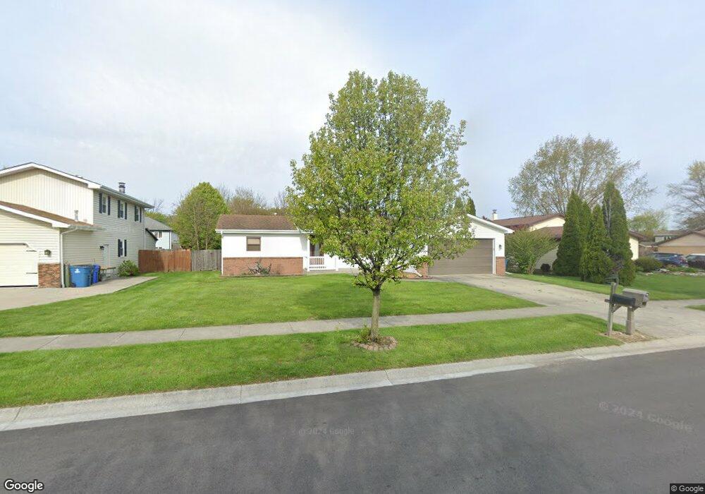
731 Wirtz Rd Crown Point, IN 46307
Estimated Value: $307,000 - $398,000
3
Beds
2
Baths
3,066
Sq Ft
$110/Sq Ft
Est. Value
About This Home
This home is located at 731 Wirtz Rd, Crown Point, IN 46307 and is currently estimated at $337,568, approximately $110 per square foot. 731 Wirtz Rd is a home located in Lake County with nearby schools including Timothy Ball Elementary School, Robert Taft Middle School, and Crown Point High School.
Ownership History
Date
Name
Owned For
Owner Type
Purchase Details
Closed on
Aug 23, 2013
Sold by
Podowski Patricia L
Bought by
Catlow Joseph C
Current Estimated Value
Home Financials for this Owner
Home Financials are based on the most recent Mortgage that was taken out on this home.
Original Mortgage
$184,103
Outstanding Balance
$135,535
Interest Rate
4.37%
Mortgage Type
FHA
Estimated Equity
$202,033
Purchase Details
Closed on
May 31, 2013
Sold by
Wilkinson Kimberly L
Bought by
Podowski Patricia L
Purchase Details
Closed on
Feb 19, 2013
Sold by
Podowski Patricia L
Bought by
Wilkinson Kimberly L
Purchase Details
Closed on
Jan 9, 2008
Sold by
Podowski Edmund and Podowski Patricia
Bought by
Podowski Edmund G and Podowski Patricia L
Create a Home Valuation Report for This Property
The Home Valuation Report is an in-depth analysis detailing your home's value as well as a comparison with similar homes in the area
Home Values in the Area
Average Home Value in this Area
Purchase History
We collect this data history from publicly available records. To have your information removed, we recommend requesting removal directly through your county’s website.
| Date | Buyer | Sale Price | Title Company |
|---|---|---|---|
| Catlow Joseph C | -- | Meridian Title | |
| Podowski Patricia L | -- | None Available | |
| Wilkinson Kimberly L | -- | None Available | |
| Wilkinson Kimberly L | -- | None Available | |
| Podowski Edmund G | -- | None Available |
Source: Public Records
Mortgage History
We collect this data history from publicly available records. To have your information removed, we recommend requesting removal directly through your county’s website.
| Date | Status | Borrower | Loan Amount |
|---|---|---|---|
| Open | Catlow Joseph C | $184,103 |
Source: Public Records
Tax History
| Year | Tax Paid | Tax Assessment Tax Assessment Total Assessment is a certain percentage of the fair market value that is determined by local assessors to be the total taxable value of land and additions on the property. | Land | Improvement |
|---|---|---|---|---|
| 2025 | $2,604 | $254,300 | $43,600 | $210,700 |
| 2024 | $6,173 | $241,500 | $43,600 | $197,900 |
| 2023 | $2,559 | $224,600 | $43,600 | $181,000 |
| 2022 | $2,424 | $213,400 | $43,600 | $169,800 |
| 2021 | $2,332 | $206,700 | $43,000 | $163,700 |
| 2020 | $2,243 | $198,300 | $43,000 | $155,300 |
| 2019 | $2,277 | $197,200 | $43,000 | $154,200 |
| 2018 | $2,465 | $190,500 | $43,000 | $147,500 |
| 2017 | $2,431 | $186,700 | $43,000 | $143,700 |
| 2016 | $2,449 | $185,100 | $43,000 | $142,100 |
| 2014 | $2,375 | $191,800 | $43,000 | $148,800 |
| 2013 | $2,499 | $198,100 | $43,000 | $155,100 |
Source: Public Records
Map
Nearby Homes
- 771 Kenmare Pkwy
- 301 Hoffman St
- 314 Hoffman St
- 509 W North St
- 114 S Chase Dr
- 317 N Main St
- 11241 Oak Ridge Ct
- 11200 Oak Ridge Ct
- 324 Maple St
- 0 W Joliet St
- 316 Oak Cir
- 200 Harrington Ave
- 123 N Main St Unit 301
- 1206 Sycamore St
- 825 N Sherman St
- 10607 Lane St
- 207 Harrington Ave
- 10813 Lane St
- 718 N Grant St
- 629 W South St
Your Personal Tour Guide
Ask me questions while you tour the home.