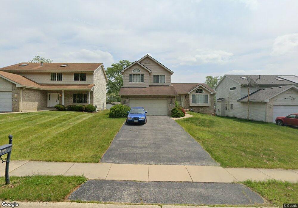
731 Wright Rd University Park, IL 60484
Estimated Value: $232,000 - $273,000
3
Beds
3
Baths
1,844
Sq Ft
$135/Sq Ft
Est. Value
About This Home
This home is located at 731 Wright Rd, University Park, IL 60484 and is currently estimated at $248,152, approximately $134 per square foot. 731 Wright Rd is a home located in Will County with nearby schools including Crete Elementary School, Crete-Monee Middle School, and Crete-Monee High School.
Ownership History
Date
Name
Owned For
Owner Type
Purchase Details
Closed on
Apr 8, 2010
Sold by
Citibank National Association
Bought by
Davis Hattie and Davis Townsell
Current Estimated Value
Purchase Details
Closed on
Mar 10, 2010
Sold by
Thomas Lore A and First Franklin Financial Corpo
Bought by
Citibank Na
Purchase Details
Closed on
Jan 27, 2010
Sold by
Thomas Lore A and First Franklin Financial Corpo
Bought by
Citibank Na
Purchase Details
Closed on
Sep 29, 2005
Sold by
Bobb Ian J
Bought by
Thomas Lore A
Home Financials for this Owner
Home Financials are based on the most recent Mortgage that was taken out on this home.
Original Mortgage
$170,000
Interest Rate
6.5%
Mortgage Type
Stand Alone First
Purchase Details
Closed on
May 23, 2002
Sold by
Fifth Third Bank
Bought by
Bobb Ian J
Home Financials for this Owner
Home Financials are based on the most recent Mortgage that was taken out on this home.
Original Mortgage
$148,748
Interest Rate
6.87%
Mortgage Type
FHA
Create a Home Valuation Report for This Property
The Home Valuation Report is an in-depth analysis detailing your home's value as well as a comparison with similar homes in the area
Home Values in the Area
Average Home Value in this Area
Purchase History
| Date | Buyer | Sale Price | Title Company |
|---|---|---|---|
| Davis Hattie | $68,000 | First American Title | |
| Citibank Na | -- | First American | |
| Citibank Na | $87,000 | None Available | |
| Thomas Lore A | $212,500 | First American | |
| Bobb Ian J | $154,500 | Chicago Title Insurance Co |
Source: Public Records
Mortgage History
| Date | Status | Borrower | Loan Amount |
|---|---|---|---|
| Previous Owner | Thomas Lore A | $170,000 | |
| Previous Owner | Bobb Ian J | $148,748 |
Source: Public Records
Tax History
| Year | Tax Paid | Tax Assessment Tax Assessment Total Assessment is a certain percentage of the fair market value that is determined by local assessors to be the total taxable value of land and additions on the property. | Land | Improvement |
|---|---|---|---|---|
| 2024 | $3,325 | $78,224 | $10,910 | $67,314 |
| 2023 | $3,325 | $67,434 | $9,405 | $58,029 |
| 2022 | $4,438 | $59,319 | $8,273 | $51,046 |
| 2021 | $4,644 | $54,888 | $7,523 | $47,365 |
| 2020 | $4,759 | $53,109 | $7,279 | $45,830 |
| 2019 | $5,106 | $50,364 | $6,903 | $43,461 |
| 2018 | $5,210 | $48,842 | $6,750 | $42,092 |
| 2017 | $5,326 | $47,384 | $6,539 | $40,845 |
| 2016 | $5,336 | $45,249 | $6,302 | $38,947 |
| 2015 | $5,265 | $42,487 | $5,831 | $36,656 |
| 2014 | $5,265 | $43,071 | $5,826 | $37,245 |
| 2013 | $5,265 | $45,100 | $6,100 | $39,000 |
Source: Public Records
Map
Nearby Homes
- 703 Circle Dr
- 735 Union Dr
- 807 Blackhawk Dr
- 807 Union Dr
- 655 Sullivan Ln
- 820 Sandra Dr Unit 2C
- 903 Blackhawk Dr
- 608 Sullivan Ln
- 882 White Oak Ln Unit 3
- 505 Barbara Ct
- 24625 S Western Ave
- 607 Sullivan Ln
- 918 Cordoba Ct
- 1015 Sierra Ct
- 401 Pebble Beach Grove Cir
- 754 Mission Dr
- 740 Mission St
- 523 Nathan Rd
- 2337 Valley View Ln
- 1031 Blackhawk Dr
- 733 Wright Rd
- 727 Wright Rd
- 735 Wright Rd
- 728 Blackhawk Dr
- 732 Blackhawk Dr
- 726 Blackhawk Dr
- 725 Wright Rd
- 730 Blackhawk Dr
- 618 Sandra Dr
- 737 Wright Rd
- 724 Blackhawk Dr
- 734 Blackhawk Dr
- 723 Wright Rd
- 722 Blackhawk Dr
- 733 Blackhawk Dr
- 721 Wright Rd
- 731 Blackhawk Dr
- 729 Blackhawk Dr
- 735 Blackhawk Dr
- 719 Wright Rd
Your Personal Tour Guide
Ask me questions while you tour the home.