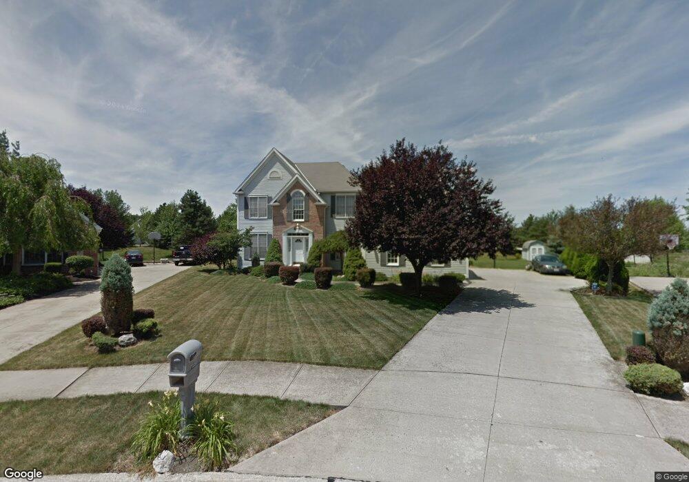
7312 Pondside Point Olmsted Falls, OH 44138
Estimated Value: $414,000 - $549,000
4
Beds
3
Baths
3,298
Sq Ft
$139/Sq Ft
Est. Value
About This Home
This home is located at 7312 Pondside Point, Olmsted Falls, OH 44138 and is currently estimated at $458,065, approximately $138 per square foot. 7312 Pondside Point is a home located in Cuyahoga County with nearby schools including Olmsted Falls Intermediate Building, Falls-Lenox Primary Elementary School, and Olmsted Falls Middle School.
Ownership History
Date
Name
Owned For
Owner Type
Purchase Details
Closed on
Aug 17, 1994
Sold by
Shore West Const Co
Bought by
Peugnet Ramsay P and Peugnet Rebecca Z
Current Estimated Value
Home Financials for this Owner
Home Financials are based on the most recent Mortgage that was taken out on this home.
Original Mortgage
$80,000
Interest Rate
8.73%
Mortgage Type
New Conventional
Purchase Details
Closed on
Jan 1, 1994
Bought by
Shorewest Const
Create a Home Valuation Report for This Property
The Home Valuation Report is an in-depth analysis detailing your home's value as well as a comparison with similar homes in the area
Home Values in the Area
Average Home Value in this Area
Purchase History
| Date | Buyer | Sale Price | Title Company |
|---|---|---|---|
| Peugnet Ramsay P | $289,629 | -- | |
| Shorewest Const | -- | -- |
Source: Public Records
Mortgage History
| Date | Status | Borrower | Loan Amount |
|---|---|---|---|
| Closed | Peugnet Ramsay P | $80,000 |
Source: Public Records
Tax History Compared to Growth
Tax History
| Year | Tax Paid | Tax Assessment Tax Assessment Total Assessment is a certain percentage of the fair market value that is determined by local assessors to be the total taxable value of land and additions on the property. | Land | Improvement |
|---|---|---|---|---|
| 2024 | $9,527 | $140,910 | $19,005 | $121,905 |
| 2023 | $9,515 | $116,130 | $15,750 | $100,380 |
| 2022 | $9,486 | $116,130 | $15,750 | $100,380 |
| 2021 | $9,399 | $116,130 | $15,750 | $100,380 |
| 2020 | $9,187 | $101,890 | $13,830 | $88,060 |
| 2019 | $8,301 | $291,100 | $39,500 | $251,600 |
| 2018 | $8,109 | $101,890 | $13,830 | $88,060 |
| 2017 | $8,292 | $99,020 | $13,410 | $85,610 |
| 2016 | $8,255 | $99,020 | $13,410 | $85,610 |
| 2015 | $8,296 | $99,020 | $13,410 | $85,610 |
| 2014 | $8,149 | $96,150 | $13,020 | $83,130 |
Source: Public Records
Map
Nearby Homes
- 7296 Chestnut Ct
- 7224 Pine Woods Way
- 7087 Mackenzie Rd
- 7097 Stearns Rd
- 6926 Mackenzie Rd
- 27069 Oakwood Cir Unit 117W
- 27097 Oakwood Cir Unit 208Z
- 27202 Cook Rd Unit 95
- 27202 Cook Rd Unit 127
- 28130 Angela Dr
- 6979 Warrington Dr
- 29651 Westminster Dr
- 29 Carl Ln
- 6752 Cypress Dr
- 6706 Crestwood Ln
- 42 Periwinkle Dr
- 3 Fiddle Sticks
- 26788 Skyline Dr
- 6560 Mackenzie Rd
- 29880 Westminster Dr
- 7306 Pondside Point
- 7316 Pondside Point
- 7302 Pondside Point
- 7321 Pondside Point
- 7317 Mulberry Ct
- 7316 Mulberry Ct
- 7317 Pondside Point
- 7313 Pondside Point
- 27049 Laurel Ln
- 26991 Pondside Point
- 7305 Pondside Point
- 7319 Mulberry Ct
- 27053 Laurel Ln
- 7301 Pondside Point
- 7314 Mulberry Ct
- 26995 Pondside Point
- 26995 Pondside Point
- 27057 Laurel Ln
- 7321 Mulberry Ct
- 27048 Laurel Ln