
Seller's Agent in 2025
Laura Bogenschneider
New Chapter Real Estate
(708) 262-4436
13 in this area
99 Total Sales
Estimated Value: $452,000 - $470,000
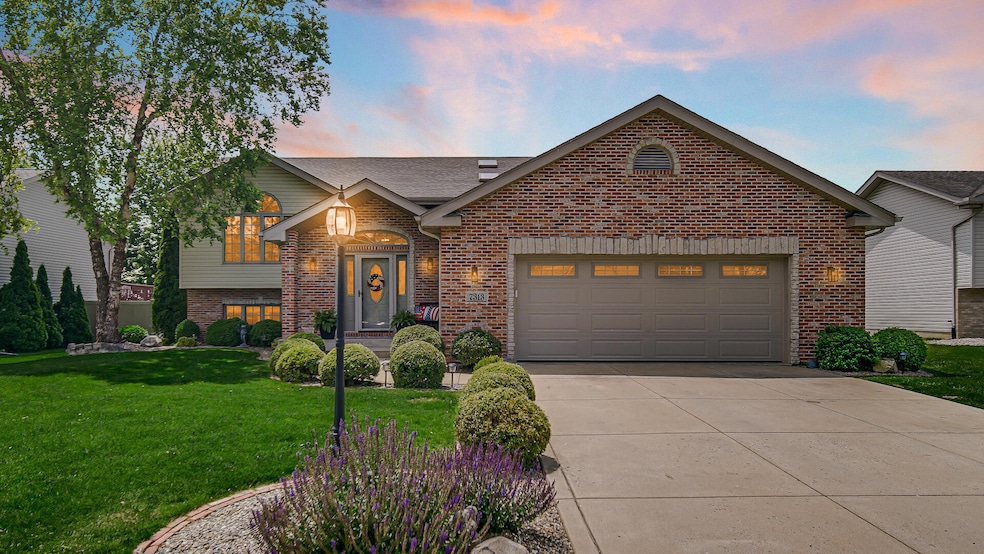
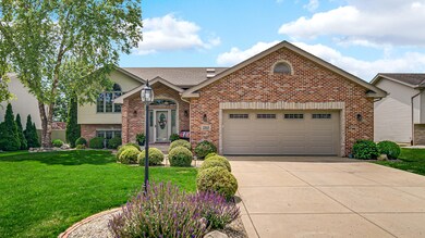
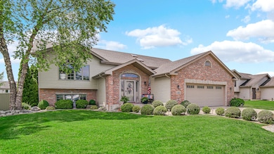
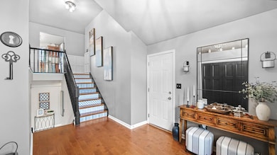
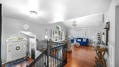
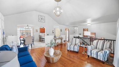
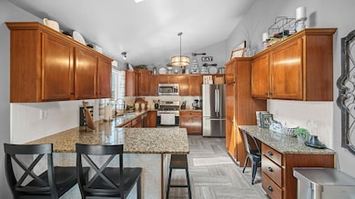
Welcome home! This high-end split level home has been proudly maintained! It is tastefully updated with a design style that blends modern conveniences with all the current design trends. It's like a Pinterest board in real life! With 6 true bedrooms including egress windows and closets & 3 bathrooms - there is plenty of space for everyone here. The upper level features engineered hardwood flooring. The kitchen has a functional layout with ample craftsman style cabinetry and granite counter tops. All kitchen appliances stay as well as the washer and dryer. The large primary bedroom features a tray ceiling and attached 3/4 bath. The secondary bedrooms are all generous sizes. The lower level family room has a beautiful stone-front gas fireplace and plenty of space for seating. The backyard is an entertainers dream - deck, pool, fenced in, fire pit area, and landscaped! The roof is only a year old! This gem is turn-key. Schedule your viewing to see it today!
Last Agent to Sell the Property
New Chapter Real Estate License #RB17001859 Listed on: 06/18/2025
| Date | Buyer | Sale Price | Title Company |
|---|---|---|---|
| Eaton Erin E | -- | None Listed On Document | |
| Moore Michael A | -- | Ticor Title Insurance Co |
| Date | Status | Borrower | Loan Amount |
|---|---|---|---|
| Open | Eaton Erin E | $432,250 | |
| Previous Owner | Moore Michael A | $155,200 |
| Date | Event | Price | List to Sale | Price per Sq Ft |
|---|---|---|---|---|
| 08/08/2025 08/08/25 | Sold | $455,000 | -5.2% | $160 / Sq Ft |
| 06/22/2025 06/22/25 | Pending | -- | -- | -- |
| 06/18/2025 06/18/25 | For Sale | $479,900 | -- | $169 / Sq Ft |
| Year | Tax Paid | Tax Assessment Tax Assessment Total Assessment is a certain percentage of the fair market value that is determined by local assessors to be the total taxable value of land and additions on the property. | Land | Improvement |
|---|---|---|---|---|
| 2024 | $6,889 | $357,500 | $70,000 | $287,500 |
| 2023 | $3,256 | $340,700 | $70,000 | $270,700 |
| 2022 | $3,256 | $322,400 | $70,000 | $252,400 |
| 2021 | $2,977 | $303,700 | $70,000 | $233,700 |
| 2020 | $2,843 | $286,300 | $54,600 | $231,700 |
| 2019 | $2,697 | $255,300 | $54,600 | $200,700 |
| 2018 | $2,779 | $254,600 | $54,600 | $200,000 |
| 2017 | $2,651 | $251,800 | $54,600 | $197,200 |
| 2016 | $2,350 | $230,000 | $54,600 | $175,400 |
| 2014 | $2,379 | $241,400 | $54,600 | $186,800 |
| 2013 | $2,478 | $245,600 | $54,600 | $191,000 |
Seller's Agent in 2025
Laura Bogenschneider
New Chapter Real Estate
(708) 262-4436
13 in this area
99 Total Sales
R
Seller Co-Listing Agent in 2025
Ryan Bogenschneider
New Chapter Real Estate
(708) 546-8089
7 in this area
56 Total Sales
Buyer's Agent in 2025
Carmen Ware
@ Properties
(219) 712-0444
1 in this area
27 Total Sales
Source: Northwest Indiana Association of REALTORS®
MLS Number: 822838
APN: 45-11-26-377-012.000-035
Disclaimer: Certain information contained herein is derived from information provided by parties other than Homes.com. All information provided is deemed reliable, but is not guaranteed to be accurate and should be independently verified.
![]() Copyright 2025 MuItiple Listing Service of the Northwest Indiana Realtors Association Multiple Listing Service (NIRA MLS). All rights reserved. IDX information is provided exclusively for personal, non-commercial use, and may not be used for any purpose other than to identify prospective properties consumers may be interested in purchasing. Information is deemed reliable but not guaranteed.
Copyright 2025 MuItiple Listing Service of the Northwest Indiana Realtors Association Multiple Listing Service (NIRA MLS). All rights reserved. IDX information is provided exclusively for personal, non-commercial use, and may not be used for any purpose other than to identify prospective properties consumers may be interested in purchasing. Information is deemed reliable but not guaranteed.