7314 Kershaw Rd Central Point, OR 97502
Estimated payment $1,488/month
About This Lot
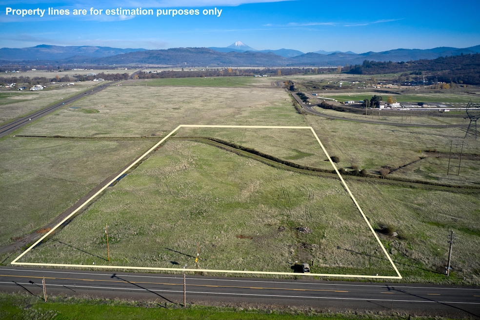
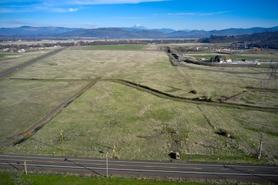
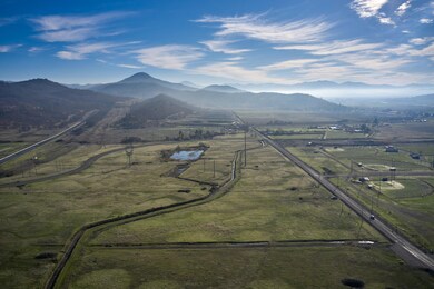
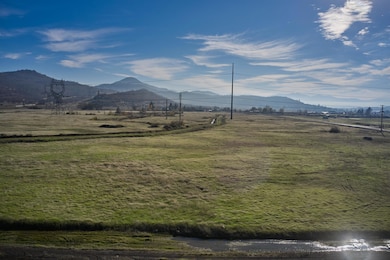
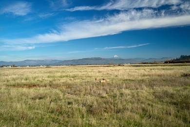
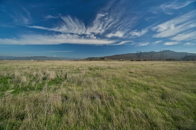
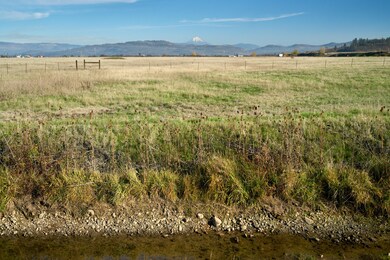
7.62 +/- acres with excellent access and near the intersection of Highway 140 and Kershaw Rd. OSR Zoning and comprised of two tax lots. Property is located in close proximity to Hwy 140, Hwy 62 and the Jackson County Sports Park. The property adjoins the Sports Park and is across the street from the Upper Rogue Baseball Fields. The well has an estimated production of 25-30 gpm and power is on- site with the availability of 3 phase. The property is level and the OSR zoning offers a variety of potential uses.
Property Details
Property Type
- Land
Est. Annual Taxes
- $1,062
Lot Details
- 7.62 Acre Lot
- Additional Parcels
- Property is zoned OSR, OSR
Utilities
- Well
Community Details
- No Home Owners Association
Listing and Financial Details
- Tax Lot 700 & 600
- Assessor Parcel Number 10262089
Map
Home Values in the Area
Average Home Value in this Area
Tax History
| Year | Tax Paid | Tax Assessment Tax Assessment Total Assessment is a certain percentage of the fair market value that is determined by local assessors to be the total taxable value of land and additions on the property. | Land | Improvement |
|---|---|---|---|---|
| 2025 | $519 | $58,440 | $58,440 | -- |
| 2024 | $519 | $56,740 | $56,740 | -- |
| 2023 | $501 | $55,090 | $55,090 | $0 |
| 2022 | $488 | $55,090 | $55,090 | $0 |
| 2021 | $474 | $53,490 | $53,490 | $0 |
| 2020 | $528 | $51,940 | $51,940 | $0 |
| 2019 | $524 | $48,970 | $48,970 | $0 |
| 2018 | $513 | $47,550 | $47,550 | $0 |
| 2017 | $502 | $47,550 | $47,550 | $0 |
| 2016 | $489 | $44,830 | $44,830 | $0 |
| 2015 | $467 | $44,830 | $44,830 | $0 |
| 2014 | $453 | $42,270 | $42,270 | $0 |
Property History
| Date | Event | Price | List to Sale | Price per Sq Ft | Prior Sale |
|---|---|---|---|---|---|
| 11/25/2025 11/25/25 | For Sale | $265,000 | +15.2% | -- | |
| 10/16/2020 10/16/20 | Sold | $230,000 | -4.2% | -- | View Prior Sale |
| 10/02/2020 10/02/20 | Pending | -- | -- | -- | |
| 08/14/2020 08/14/20 | For Sale | $240,000 | -- | -- |
Purchase History
| Date | Type | Sale Price | Title Company |
|---|---|---|---|
| Deed | $193,475 | None Listed On Document | |
| Deed | $193,475 | None Listed On Document | |
| Bargain Sale Deed | $24,000 | -- | |
| Bargain Sale Deed | $24,000 | -- |
Source: Oregon Datashare
MLS Number: 220212354
APN: 10262089
Disclaimer: Certain information contained herein is derived from information provided by parties other than Homes.com. All information provided is deemed reliable, but is not guaranteed to be accurate and should be independently verified.
![]() © 2025 Oregon Datashare (KCAR | MLSCO | SOMLS). All rights reserved. The data relating to real estate for sale on this web site comes in part from the Internet Data Exchange Program of the Oregon Datashare. Real estate listings held by IDX Brokerage firms other than Ten-X are marked with the Internet Data Exchange logo or the Internet Data Exchange thumbnail logo and detailed information about them includes the name of the listing Brokers. Information provided is for consumers' personal, non-commercial use and may not be used for any purpose other than to identify prospective properties the viewer may be interested in purchasing. The consumer will not copy, retransmit nor redistribute any of the content from this website. Information provided is deemed reliable, but not guaranteed.
© 2025 Oregon Datashare (KCAR | MLSCO | SOMLS). All rights reserved. The data relating to real estate for sale on this web site comes in part from the Internet Data Exchange Program of the Oregon Datashare. Real estate listings held by IDX Brokerage firms other than Ten-X are marked with the Internet Data Exchange logo or the Internet Data Exchange thumbnail logo and detailed information about them includes the name of the listing Brokers. Information provided is for consumers' personal, non-commercial use and may not be used for any purpose other than to identify prospective properties the viewer may be interested in purchasing. The consumer will not copy, retransmit nor redistribute any of the content from this website. Information provided is deemed reliable, but not guaranteed.
- 6915 Kershaw Rd
- 4423 Avenue E
- 3775 Agate Meadows Ct
- 3732 Agate Meadows Ct
- 3765 Nicholas Way
- 7540 Rocio Dr
- 3885 Avenue C
- 7843 Cadence Ln
- 7501 28th St
- 7894 Laura Ln
- 3601 Avenue C Unit SPC 30
- 3501 Avenue C Unit SPC 35
- 7865 Houston Loop
- 7875 Houston Loop
- 7727 Wilson Way
- 7858 Phaedra Ln
- 7837 Phaedra Ln
- 7870 Phaedra Ln
- 7880 Phaedra Ln
- 3432 Sonny Way
- 396 Patricia Ln
- 1125 Annalise St
- 2190 Poplar Dr
- 1801 Poplar Dr
- 645 Royal Ave
- 700 N Haskell St
- 237 E McAndrews Rd
- 1116 Niantic St Unit 3
- 518 N Riverside Ave
- 520 N Bartlett St
- 121 S Holly St
- 406 W Main St
- 2532 Juanipero Way
- 230 Laurel St
- 309 Laurel St
- 536 Hamilton St Unit 536
- 534 Hamilton St Unit 534
- 353 Dalton St
- 2642 W Main St
- 835 Overcup St
