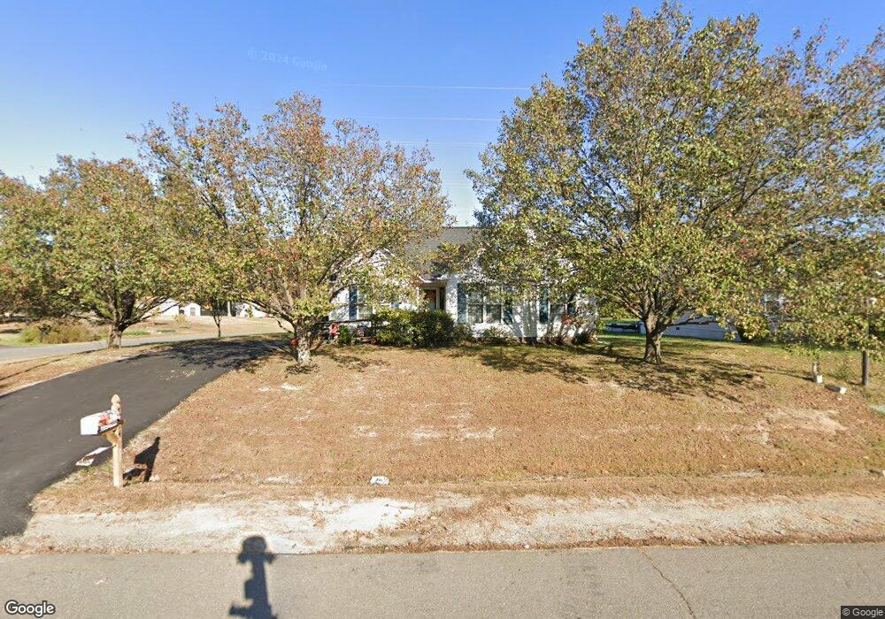
7314 N Katie Dr Fredericksburg, VA 22407
Estimated Value: $371,000 - $383,000
3
Beds
2
Baths
1,223
Sq Ft
$309/Sq Ft
Est. Value
About This Home
This home is located at 7314 N Katie Dr, Fredericksburg, VA 22407 and is currently estimated at $378,251, approximately $309 per square foot. 7314 N Katie Dr is a home located in Spotsylvania County with nearby schools including Wilderness Elementary School, Freedom Middle School, and Riverbend High School.
Ownership History
Date
Name
Owned For
Owner Type
Purchase Details
Closed on
May 25, 2001
Sold by
Kegley Andrew T
Bought by
Kiple Sharon B
Current Estimated Value
Home Financials for this Owner
Home Financials are based on the most recent Mortgage that was taken out on this home.
Original Mortgage
$117,967
Outstanding Balance
$44,114
Interest Rate
7.05%
Mortgage Type
Purchase Money Mortgage
Estimated Equity
$334,137
Create a Home Valuation Report for This Property
The Home Valuation Report is an in-depth analysis detailing your home's value as well as a comparison with similar homes in the area
Home Values in the Area
Average Home Value in this Area
Purchase History
| Date | Buyer | Sale Price | Title Company |
|---|---|---|---|
| Kiple Sharon B | $118,900 | -- |
Source: Public Records
Mortgage History
| Date | Status | Borrower | Loan Amount |
|---|---|---|---|
| Open | Kiple Sharon B | $117,967 |
Source: Public Records
Tax History Compared to Growth
Tax History
| Year | Tax Paid | Tax Assessment Tax Assessment Total Assessment is a certain percentage of the fair market value that is determined by local assessors to be the total taxable value of land and additions on the property. | Land | Improvement |
|---|---|---|---|---|
| 2025 | $1,860 | $253,300 | $125,000 | $128,300 |
| 2024 | $1,860 | $253,300 | $125,000 | $128,300 |
| 2023 | $1,706 | $221,100 | $110,000 | $111,100 |
| 2022 | $1,631 | $221,100 | $110,000 | $111,100 |
| 2021 | $1,579 | $195,100 | $90,000 | $105,100 |
| 2020 | $1,579 | $195,100 | $90,000 | $105,100 |
| 2019 | $1,597 | $188,500 | $85,000 | $103,500 |
| 2018 | $1,570 | $188,500 | $85,000 | $103,500 |
| 2017 | $1,417 | $166,700 | $70,000 | $96,700 |
| 2016 | $1,417 | $166,700 | $70,000 | $96,700 |
| 2015 | -- | $149,800 | $55,000 | $94,800 |
| 2014 | -- | $149,800 | $55,000 | $94,800 |
Source: Public Records
Map
Nearby Homes
- 7117 Pullen Dr
- 7105 Pullen Dr
- 11604 Hampstead Dr
- 7500 Harvest Ln
- 11612 Kenton Dr
- 11514 Woodland View Dr
- 8039 Chancellor Rd
- Richmond Plan at Thornburn Estates
- Spencer Plan at Thornburn Estates
- Tyler Plan at Thornburn Estates
- Colson Plan at Thornburn Estates
- Lafayette Plan at Thornburn Estates
- Rosslyn Plan at Thornburn Estates
- Washington Plan at Thornburn Estates
- Sydney Plan at Thornburn Estates
- 7614 Regency Glen Dr
- 11798 Wales Dr
- Hampshire II Plan at Linwood Landing
- Hadley II Plan at Linwood Landing
- Jamestown III Plan at Linwood Landing
- 7316 N Katie Dr
- 7400 N Katie Dr
- 11701 Mcginty Dr
- 11628 Brian Dr
- 7402 N Katie Dr
- 7313 N Katie Dr
- 11704 Mcginty Dr
- 11703 Mcginty Dr
- 7310 N Katie Dr
- 7401 N Katie Dr
- 7402 Laura Ln
- 11626 Brian Dr
- 11705 Mcginty Dr
- 7308 N Katie Dr
- 7404 N Katie Dr
- 7404 Laura Ln
- 7403 N Katie Dr
- 11627 Brian Dr
- 7309 N Katie Dr
- 11707 Mcginty Dr