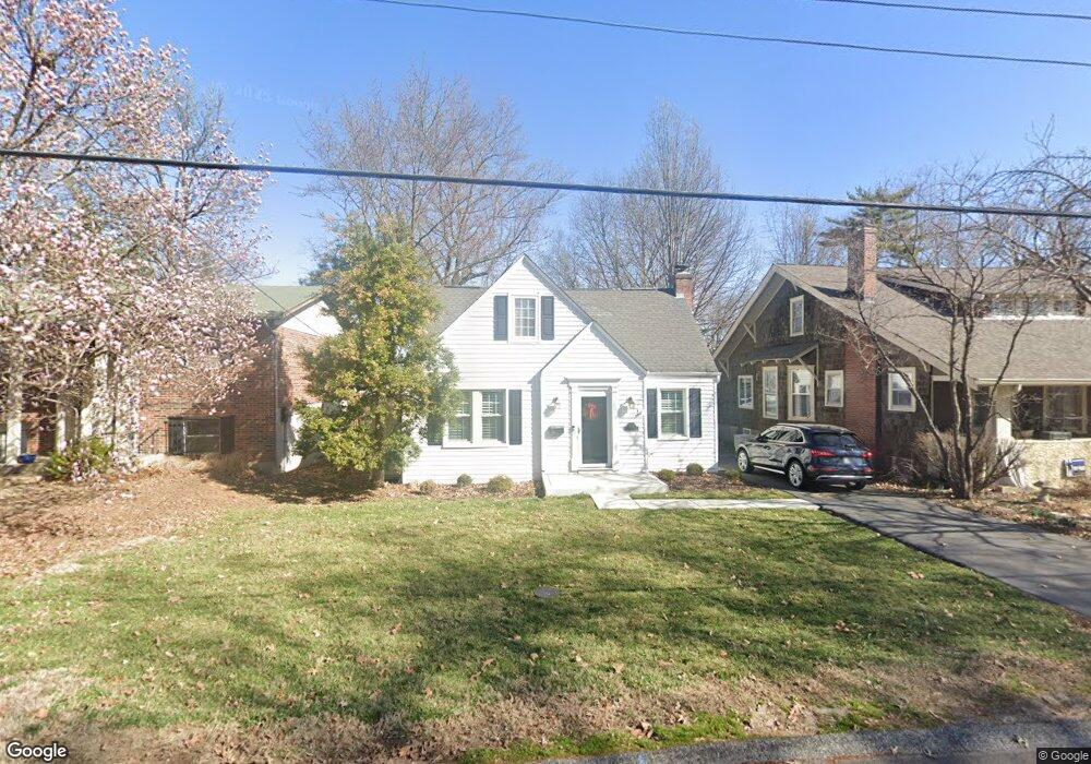
7319 Sutherland Ave Saint Louis, MO 63119
Estimated Value: $370,000 - $441,000
3
Beds
2
Baths
1,587
Sq Ft
$247/Sq Ft
Est. Value
About This Home
This home is located at 7319 Sutherland Ave, Saint Louis, MO 63119 and is currently estimated at $392,778, approximately $247 per square foot. 7319 Sutherland Ave is a home located in St. Louis County with nearby schools including Avery Elementary School, Hixson Middle School, and Webster Groves High School.
Ownership History
Date
Name
Owned For
Owner Type
Purchase Details
Closed on
Oct 1, 2013
Sold by
Blue Dog Llc
Bought by
Rompf David L and Rompf Cori E
Current Estimated Value
Home Financials for this Owner
Home Financials are based on the most recent Mortgage that was taken out on this home.
Original Mortgage
$180,000
Outstanding Balance
$135,884
Interest Rate
4.62%
Mortgage Type
New Conventional
Estimated Equity
$256,894
Purchase Details
Closed on
May 24, 2013
Sold by
Montroy Cecelia F
Bought by
Blue Dog Llc
Create a Home Valuation Report for This Property
The Home Valuation Report is an in-depth analysis detailing your home's value as well as a comparison with similar homes in the area
Home Values in the Area
Average Home Value in this Area
Purchase History
| Date | Buyer | Sale Price | Title Company |
|---|---|---|---|
| Rompf David L | $225,000 | Investors Title Co Clayton | |
| Blue Dog Llc | -- | Integrity Land Title Co Inc |
Source: Public Records
Mortgage History
| Date | Status | Borrower | Loan Amount |
|---|---|---|---|
| Open | Rompf David L | $180,000 |
Source: Public Records
Tax History
| Year | Tax Paid | Tax Assessment Tax Assessment Total Assessment is a certain percentage of the fair market value that is determined by local assessors to be the total taxable value of land and additions on the property. | Land | Improvement |
|---|---|---|---|---|
| 2025 | $4,841 | $63,070 | $30,500 | $32,570 |
| 2024 | $4,841 | $67,490 | $15,240 | $52,250 |
| 2023 | $4,817 | $67,490 | $15,240 | $52,250 |
| 2022 | $4,526 | $58,960 | $15,240 | $43,720 |
| 2021 | $4,140 | $58,960 | $15,240 | $43,720 |
| 2020 | $4,114 | $53,150 | $15,240 | $37,910 |
| 2019 | $4,272 | $53,150 | $15,240 | $37,910 |
| 2018 | $3,775 | $42,240 | $12,560 | $29,680 |
| 2016 | $4,011 | $42,580 | $10,660 | $31,920 |
Source: Public Records
Map
Nearby Homes
- 7324 Weil Ave
- 7081 Winona Ave
- 7740 Arlington Ave
- 1088 Key West Ave
- 7114 Drury Ln
- 3723 Commonwealth Ave
- 25 Saint Charles Place
- 7800 Murdoch Ave
- 6968 Lansdowne Ave
- 6962 Sutherland Ave
- 3718 Oxford Blvd
- 6973 Winona Ave
- 1052 Kuhlman Ln
- 3558 Wabash Ave
- 1048 Kuhlman Ln
- 7056 Oleatha Ave
- 6927-6931 Sutherland Ave
- 4313 Jamieson Ave
- 3947 Jamieson Ave
- 7826 Grove Ave
- 7317 Sutherland Ave
- 7321 Sutherland Ave
- 7315 Sutherland Ave
- 7318 Melbourne Ave
- 7325 Sutherland Ave
- 7316 Melbourne Ave
- 7322 Melbourne Ave
- 7313 Sutherland Ave
- 7324 Melbourne Ave
- 7314 Melbourne Ave
- 7320 Sutherland Ave
- 7326 Melbourne Ave
- 7316 Sutherland Ave
- 7324 Sutherland Ave
- 7314 Sutherland Ave
- 7312 Melbourne Ave
- 7312 Melbourne Ave Unit 12
- 7309 Sutherland Ave
- 7329 Sutherland Ave
- 7312 Sutherland Ave
Your Personal Tour Guide
Ask me questions while you tour the home.