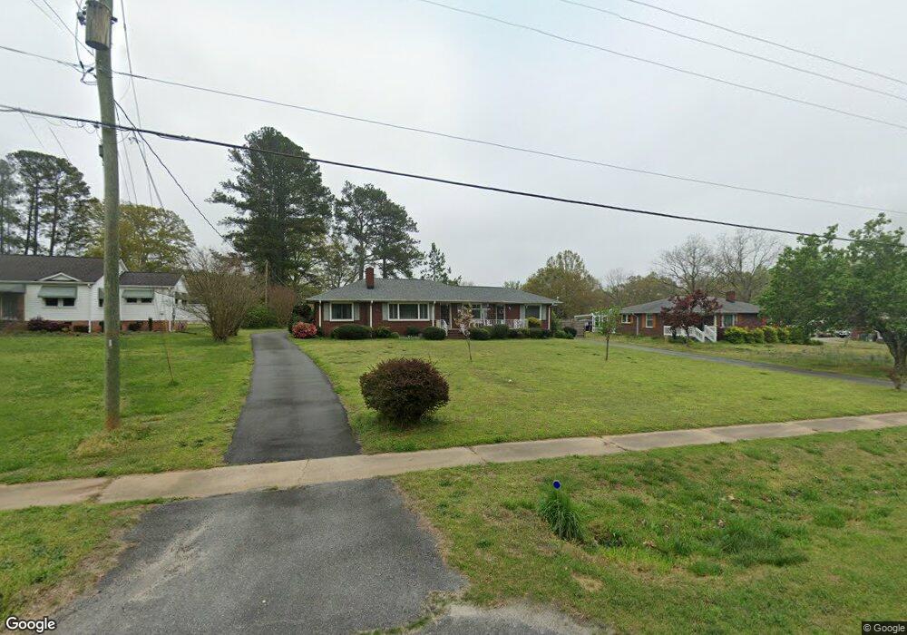
732 Anderson St Belton, SC 29627
Estimated Value: $187,437 - $278,000
2
Beds
--
Bath
1,554
Sq Ft
$144/Sq Ft
Est. Value
About This Home
This home is located at 732 Anderson St, Belton, SC 29627 and is currently estimated at $224,359, approximately $144 per square foot. 732 Anderson St is a home located in Anderson County with nearby schools including Belton Honea Path High School and Trinity Christian Education School.
Ownership History
Date
Name
Owned For
Owner Type
Purchase Details
Closed on
Jun 23, 2021
Sold by
Jennings Kristi T and Wood Bridget T
Bought by
Forsyth Lorraine K
Current Estimated Value
Home Financials for this Owner
Home Financials are based on the most recent Mortgage that was taken out on this home.
Original Mortgage
$50,000
Outstanding Balance
$45,269
Interest Rate
2.9%
Mortgage Type
New Conventional
Estimated Equity
$179,090
Purchase Details
Closed on
Mar 18, 2009
Sold by
Timms Lida S
Bought by
Jennings Kristi T and Wood Bridget T
Create a Home Valuation Report for This Property
The Home Valuation Report is an in-depth analysis detailing your home's value as well as a comparison with similar homes in the area
Home Values in the Area
Average Home Value in this Area
Purchase History
| Date | Buyer | Sale Price | Title Company |
|---|---|---|---|
| Forsyth Lorraine K | $113,000 | None Available | |
| Jennings Kristi T | -- | -- |
Source: Public Records
Mortgage History
| Date | Status | Borrower | Loan Amount |
|---|---|---|---|
| Open | Forsyth Lorraine K | $50,000 |
Source: Public Records
Tax History Compared to Growth
Tax History
| Year | Tax Paid | Tax Assessment Tax Assessment Total Assessment is a certain percentage of the fair market value that is determined by local assessors to be the total taxable value of land and additions on the property. | Land | Improvement |
|---|---|---|---|---|
| 2024 | $1,652 | $6,490 | $560 | $5,930 |
| 2023 | $1,652 | $6,490 | $560 | $5,930 |
| 2022 | $4,537 | $9,730 | $840 | $8,890 |
| 2021 | $499 | $4,390 | $320 | $4,070 |
| 2020 | $499 | $4,390 | $320 | $4,070 |
| 2019 | $495 | $4,390 | $320 | $4,070 |
| 2018 | $493 | $4,390 | $320 | $4,070 |
| 2017 | -- | $4,390 | $320 | $4,070 |
| 2016 | $392 | $4,510 | $480 | $4,030 |
| 2015 | $409 | $4,510 | $480 | $4,030 |
| 2014 | $412 | $4,510 | $480 | $4,030 |
Source: Public Records
Map
Nearby Homes
- 109 Brookside Cir
- 522 Forest Ln
- 302 Forest Ln
- 305 Forest Ln
- 405 Blue Ridge Ave
- 167 Murdock Rd
- 402 Woodland Cir
- 400 Woodland Cir
- 398 Woodland Cir
- 206 Brown St
- 103 Haynie Pkwy
- 502 Forest Ln
- 316 Harris Ave
- 301 Blue Ridge Ave
- 101 Poplar Ave
- 00 Murdock Rd
- 304 Cherry St
- 111 Church St
- 0 Sam Dr
- Lot C Sam Dr