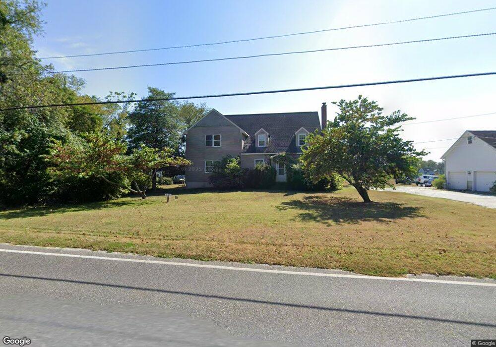
732 Jonathan Hoffman Rd Cape May, NJ 08204
Estimated Value: $944,000 - $1,367,000
--
Bed
--
Bath
2,470
Sq Ft
$465/Sq Ft
Est. Value
About This Home
This home is located at 732 Jonathan Hoffman Rd, Cape May, NJ 08204 and is currently estimated at $1,147,644, approximately $464 per square foot. 732 Jonathan Hoffman Rd is a home located in Cape May County with nearby schools including Carl T. Mitnick School, David C. Douglass Veterans Memorial School, and Maud Abrams School.
Ownership History
Date
Name
Owned For
Owner Type
Purchase Details
Closed on
May 22, 1990
Sold by
Cresse Alfred S
Bought by
Johnston Edward J
Current Estimated Value
Purchase Details
Closed on
May 30, 1989
Sold by
Cresse B Decd Alfred Cresse Exc
Bought by
Johnston Edward
Purchase Details
Closed on
Mar 8, 1989
Sold by
Creese Alfred
Bought by
The Estate Of Beatrice Cresse
Create a Home Valuation Report for This Property
The Home Valuation Report is an in-depth analysis detailing your home's value as well as a comparison with similar homes in the area
Home Values in the Area
Average Home Value in this Area
Purchase History
| Date | Buyer | Sale Price | Title Company |
|---|---|---|---|
| Johnston Edward J | -- | -- | |
| Johnston Edward J | -- | -- | |
| Johnston Edward | $150,000 | -- | |
| The Estate Of Beatrice Cresse | -- | -- |
Source: Public Records
Tax History Compared to Growth
Tax History
| Year | Tax Paid | Tax Assessment Tax Assessment Total Assessment is a certain percentage of the fair market value that is determined by local assessors to be the total taxable value of land and additions on the property. | Land | Improvement |
|---|---|---|---|---|
| 2025 | $10,941 | $539,500 | $332,800 | $206,700 |
| 2024 | $10,941 | $539,500 | $332,800 | $206,700 |
| 2023 | $10,785 | $539,500 | $332,800 | $206,700 |
| 2022 | $10,456 | $539,500 | $332,800 | $206,700 |
| 2021 | $10,079 | $539,500 | $332,800 | $206,700 |
| 2020 | $9,981 | $539,500 | $332,800 | $206,700 |
| 2019 | $9,733 | $539,500 | $332,800 | $206,700 |
| 2018 | $9,501 | $539,500 | $332,800 | $206,700 |
| 2017 | $9,511 | $539,500 | $332,800 | $206,700 |
| 2016 | $9,366 | $539,500 | $332,800 | $206,700 |
| 2015 | $9,064 | $539,500 | $332,800 | $206,700 |
| 2014 | $8,767 | $539,500 | $332,800 | $206,700 |
Source: Public Records
Map
Nearby Homes
- 1023 Shunpike Rd
- 1024 Shunpike Rd
- 1031 Seashore Rd
- 313 Nantucket Dr
- 1036 Seashore Rd
- 3941 Bayshore Rd
- 753 Route 9 Unit U
- 424 Portsmouth Rd
- 808 Westfield Ave
- 818 Shunpike Rd
- 1062 Seashore Rd
- 3911 Bayshore Rd
- 1083 Seashore Rd
- 668 Crawford Rd
- 104 11th Ave
- 120 Victoria Dr
- 712 Gorham Ave
- 59 Westwood Dr
- 54 Heron Way
- 709 U S 9
- 730 Jonathan Hoffman Rd
- 747 Jonathan Hoffman Rd
- 743 Jonathan Hoffman Rd
- 749 Jonathan Hoffman Rd
- 741 Jonathan Hoffman Rd
- 741 Jonathan Hoffman Rd Unit Corner Eldredge Aven
- 753 Jonathan Hoffman Rd
- 739 Jonathan Hoffman Rd
- 728 Jonathan Hoffman Rd
- 737 Jonathan Hoffman Rd
- 755 Jonathan Hoffman Rd
- 744 Reeves Ave
- 746 Reeves Ave
- 925 Eldredge Ave
- 733 Jonathan Hoffman Rd
- 934 Seashore Rd
- 926 Eldredge Ave
- 731 Jonathan Hoffman Rd
- 726 Jonathan Hoffman Rd
- 932 Seashore Rd