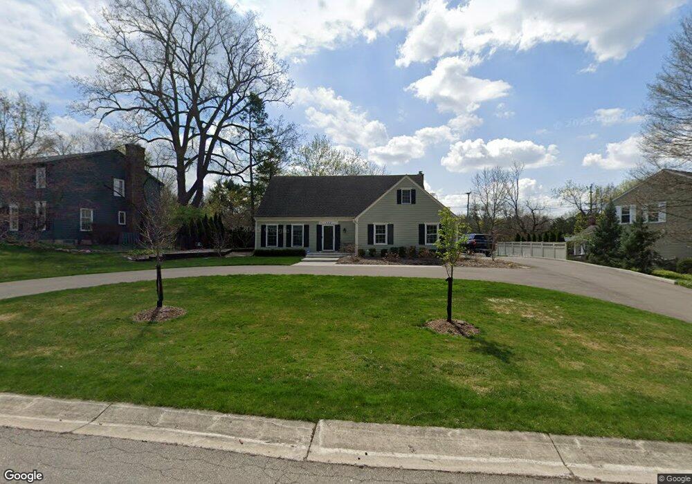
732 Kensington Ln Unit Bldg-Unit Bloomfield Hills, MI 48304
Estimated Value: $687,000 - $767,000
4
Beds
3
Baths
2,139
Sq Ft
$337/Sq Ft
Est. Value
About This Home
This home is located at 732 Kensington Ln Unit Bldg-Unit, Bloomfield Hills, MI 48304 and is currently estimated at $720,947, approximately $337 per square foot. 732 Kensington Ln Unit Bldg-Unit is a home located in Oakland County with nearby schools including Harlan Elementary School, Ernest W. Seaholm High School, and Roeper City and Country Upper.
Ownership History
Date
Name
Owned For
Owner Type
Purchase Details
Closed on
Jun 1, 2018
Sold by
Doyle Matthew D and Doyle Erin T
Bought by
Stevens Joseph and Stephens Kali
Current Estimated Value
Purchase Details
Closed on
May 10, 2017
Sold by
Onderko John R and Onderko Joanne E
Bought by
Doyle Matthew D and Doyle Erin T
Home Financials for this Owner
Home Financials are based on the most recent Mortgage that was taken out on this home.
Original Mortgage
$356,250
Interest Rate
4.14%
Mortgage Type
Purchase Money Mortgage
Purchase Details
Closed on
Apr 17, 2012
Sold by
Onderko John R and Onderko Deborah A
Bought by
Onderko John R and Onderko Joanne E
Home Financials for this Owner
Home Financials are based on the most recent Mortgage that was taken out on this home.
Original Mortgage
$232,450
Interest Rate
4%
Mortgage Type
New Conventional
Create a Home Valuation Report for This Property
The Home Valuation Report is an in-depth analysis detailing your home's value as well as a comparison with similar homes in the area
Home Values in the Area
Average Home Value in this Area
Purchase History
| Date | Buyer | Sale Price | Title Company |
|---|---|---|---|
| Stevens Joseph | $440,000 | None Available | |
| Doyle Matthew D | $375,000 | Title Source Inc | |
| Onderko John R | -- | Title Connect Llc |
Source: Public Records
Mortgage History
| Date | Status | Borrower | Loan Amount |
|---|---|---|---|
| Previous Owner | Doyle Matthew D | $356,250 | |
| Previous Owner | Onderko John R | $232,450 |
Source: Public Records
Tax History Compared to Growth
Tax History
| Year | Tax Paid | Tax Assessment Tax Assessment Total Assessment is a certain percentage of the fair market value that is determined by local assessors to be the total taxable value of land and additions on the property. | Land | Improvement |
|---|---|---|---|---|
| 2024 | $4,929 | $288,500 | $0 | $0 |
| 2023 | $4,730 | $252,930 | $0 | $0 |
| 2022 | $8,220 | $228,490 | $0 | $0 |
| 2021 | $8,284 | $208,140 | $0 | $0 |
| 2020 | $4,695 | $212,080 | $0 | $0 |
| 2019 | $8,791 | $219,700 | $0 | $0 |
| 2018 | $9,058 | $222,740 | $0 | $0 |
| 2017 | $6,159 | $216,870 | $0 | $0 |
| 2016 | $6,192 | $205,350 | $0 | $0 |
| 2015 | -- | $189,220 | $0 | $0 |
| 2014 | -- | $187,710 | $0 | $0 |
| 2011 | -- | $135,130 | $0 | $0 |
Source: Public Records
Map
Nearby Homes
- 1333 N Adams Rd
- 1330 Oxford Rd
- 680 Shepardbush St
- 654 Shepardbush St
- 000 N Adams Rd
- 928 Poppleton St
- 5554 Pine Brooke Ct
- 0000 Brookdale Rd
- 1225 Derby Rd Unit 1
- 850 N Adams Rd
- 2991 Lanergan Dr
- 3014 Caswell Dr
- 2840 Bolingbroke Dr
- 878 Brooklawn Dr
- 3036 Newport Ct
- 1180 Manchester Rd
- 4731 Haddington Dr
- 1111 N Old Woodward Ave Unit 4
- 1111 N Old Woodward Ave Unit 26
- 1115 N Old Woodward #76 Ave
- 732 Kensington Ln
- 748 Kensington Ln
- 710 Kensington Ln
- 721 Ivy Ln
- 00 Kensington
- 737 Kensington Ln
- 725 Kensington Ln
- 749 Kensington Ln
- 741 Ivy Ln
- 709 Kensington Ln
- 778 Kensington Ln
- 5395 Hickory Bend
- 730 Ivy Ln
- 5381 Hickory Bend
- 790 Kensington Ln
- 787 Ivy Ln
- 799 Kensington Ln
- 780 Ivy Ln
- 5311 Hickory Bend
- 5369 Hickory Bend