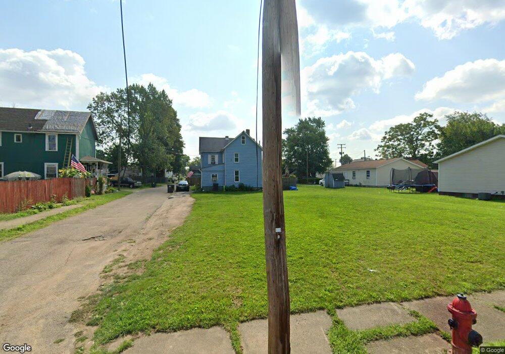
732 Union Ave SW Canton, OH 44707
Southwest Association of Neighbors NeighborhoodEstimated Value: $26,041 - $361,000
2
Beds
1
Bath
850
Sq Ft
$152/Sq Ft
Est. Value
About This Home
This home is located at 732 Union Ave SW, Canton, OH 44707 and is currently estimated at $129,260, approximately $152 per square foot. 732 Union Ave SW is a home located in Stark County with nearby schools including Early Learning Center @ Schreiber, Cedar Elementary School, and Clarendon Intermediate School.
Ownership History
Date
Name
Owned For
Owner Type
Purchase Details
Closed on
Aug 28, 2023
Sold by
Stark County Land Reutilization Corporat
Bought by
Williams Janee M
Current Estimated Value
Purchase Details
Closed on
Aug 14, 2018
Sold by
Stark County Land Reutilization Corporat
Bought by
Stark Country Regional Planning Commissi
Purchase Details
Closed on
Jul 21, 2017
Sold by
Moore Jessie J
Bought by
Stark County Land Reutilization Corp
Purchase Details
Closed on
Dec 11, 2000
Sold by
Pritchard and Pauline
Bought by
Moore Jessie J and Moore Linda M
Create a Home Valuation Report for This Property
The Home Valuation Report is an in-depth analysis detailing your home's value as well as a comparison with similar homes in the area
Home Values in the Area
Average Home Value in this Area
Purchase History
| Date | Buyer | Sale Price | Title Company |
|---|---|---|---|
| Williams Janee M | -- | None Listed On Document | |
| Stark Country Regional Planning Commissi | -- | None Available | |
| Stark County Land Reutilization Corp | -- | None Available | |
| Moore Jessie J | $12,000 | -- |
Source: Public Records
Tax History Compared to Growth
Tax History
| Year | Tax Paid | Tax Assessment Tax Assessment Total Assessment is a certain percentage of the fair market value that is determined by local assessors to be the total taxable value of land and additions on the property. | Land | Improvement |
|---|---|---|---|---|
| 2025 | -- | $810 | $810 | -- |
| 2024 | -- | $810 | $810 | -- |
| 2023 | $0 | $460 | $460 | $0 |
| 2022 | $504 | $460 | $460 | $0 |
| 2021 | $504 | $460 | $460 | $0 |
| 2020 | -- | $420 | $420 | $0 |
| 2019 | $54 | $1,580 | $840 | $740 |
| 2018 | $829 | $1,580 | $840 | $740 |
| 2017 | $0 | $1,440 | $810 | $630 |
| 2016 | $3,948 | $1,440 | $810 | $630 |
| 2015 | $102 | $1,440 | $810 | $630 |
| 2014 | $599 | $1,370 | $770 | $600 |
| 2013 | $50 | $1,370 | $770 | $600 |
Source: Public Records
Map
Nearby Homes
- 1016 Clinton Ave SW
- 1017 Clinton Ave SW
- 719 Prospect Ave SW
- 817 Prospect Ave SW
- 1111 2nd St NW
- 1024 3rd St NW
- 1015 4th St NW
- 646 Dueber Ave SW
- 413 Newton Ave NW
- 1033 Monnot Place NW
- 916 6th St NW
- 1334 Margaret Ave SW
- 1356 Margaret Ave SW
- 633 Park Ave SW
- 202 Lincoln Ave NW
- 1215 Dueber Ave SW
- 1219 Dueber Ave SW
- 631 Greenfield Ave SW
- 1021 Greenfield Ave SW
- 722 High Ave NW
- 734 Union Ave SW
- 904 Saylor Place SW
- 735 Union Ave SW
- 740 Union Ave SW
- 907 Saylor Place SW
- 724 Union Ave SW
- 731 Union Ave SW
- 905 8th St SW
- 739 Union Ave SW
- 722 Union Ave SW
- 908 Raynolds Place SW
- 1007 Saylor Place SW
- 745 Union Ave SW
- 725 Union Ave SW
- 900 Raynolds Place SW
- 723 Union Ave SW
- 1011 8th St SW
- 720 Union Ave SW
- 1011 Saylor Place SW
- 806 Union Ave SW
