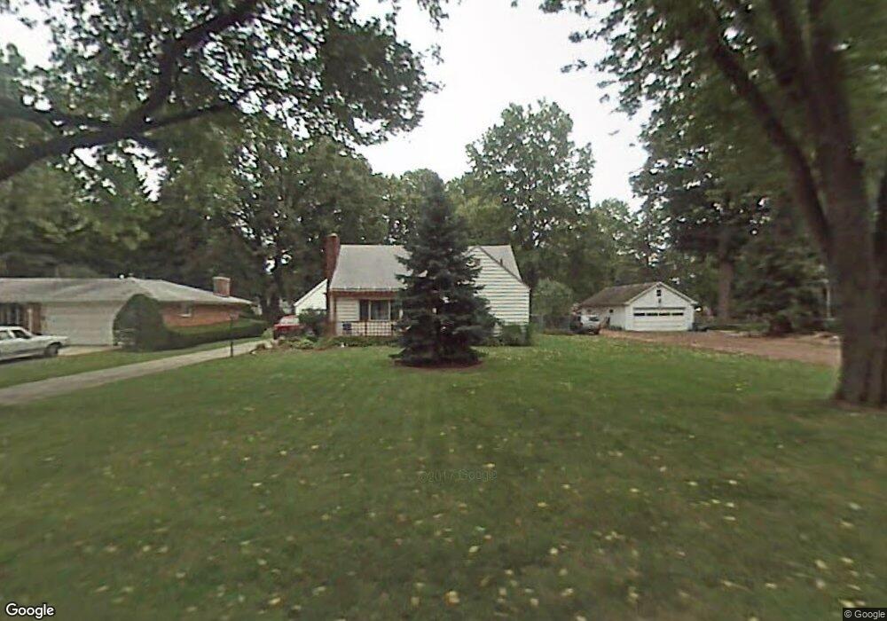
732 Vanderbilt Rd Toledo, OH 43615
Reynolds Corners NeighborhoodEstimated Value: $114,438 - $159,000
3
Beds
1
Bath
918
Sq Ft
$139/Sq Ft
Est. Value
About This Home
This home is located at 732 Vanderbilt Rd, Toledo, OH 43615 and is currently estimated at $127,860, approximately $139 per square foot. 732 Vanderbilt Rd is a home located in Lucas County with nearby schools including McTigue Elementary School, Rogers High School, and Horizon Science Academy-Springfield.
Ownership History
Date
Name
Owned For
Owner Type
Purchase Details
Closed on
Apr 14, 2020
Sold by
Sauber Grant Thomas
Bought by
Mccarty Shawn and Mccann Shawn C
Current Estimated Value
Home Financials for this Owner
Home Financials are based on the most recent Mortgage that was taken out on this home.
Original Mortgage
$21,954
Interest Rate
3.2%
Mortgage Type
New Conventional
Purchase Details
Closed on
Dec 14, 2017
Sold by
Wells Fargo Bank Na
Bought by
Sauber Grant Thomas
Purchase Details
Closed on
Jul 6, 2017
Sold by
Laforge Robin L and Laforge Robin Laureta
Bought by
Wells Fargo Band Na
Purchase Details
Closed on
Jun 14, 2017
Sold by
Lagorge Robin L and Lagorge Robin Laureta
Bought by
Wells Fargo Bank Na
Purchase Details
Closed on
Apr 24, 2006
Sold by
Ursell Steve J and Ursell Cindy M
Bought by
Bradner Robin L
Home Financials for this Owner
Home Financials are based on the most recent Mortgage that was taken out on this home.
Original Mortgage
$93,532
Interest Rate
6.42%
Mortgage Type
FHA
Purchase Details
Closed on
Nov 14, 2003
Sold by
Wright Clark J and Wright Lucinda E
Bought by
Ursell Steve J and Ursell Cindy M
Home Financials for this Owner
Home Financials are based on the most recent Mortgage that was taken out on this home.
Original Mortgage
$88,580
Interest Rate
5.87%
Mortgage Type
Purchase Money Mortgage
Purchase Details
Closed on
Sep 5, 2003
Sold by
Wright Clark J and Wright Sharon A
Bought by
Wright Clark J and Wright Lucinda E
Home Financials for this Owner
Home Financials are based on the most recent Mortgage that was taken out on this home.
Original Mortgage
$41,000
Interest Rate
6.18%
Mortgage Type
Purchase Money Mortgage
Purchase Details
Closed on
May 17, 1993
Sold by
Ellithorpe Robert E Jr Et
Purchase Details
Closed on
Jun 7, 1988
Sold by
Ames Beulah E
Create a Home Valuation Report for This Property
The Home Valuation Report is an in-depth analysis detailing your home's value as well as a comparison with similar homes in the area
Home Values in the Area
Average Home Value in this Area
Purchase History
| Date | Buyer | Sale Price | Title Company |
|---|---|---|---|
| Mccarty Shawn | $70,000 | None Available | |
| Sauber Grant Thomas | $37,500 | Boston National Title | |
| Wells Fargo Band Na | $23,334 | None Available | |
| Wells Fargo Bank Na | $23,334 | None Available | |
| Bradner Robin L | $95,000 | Louisville Title Agency For | |
| Ursell Steve J | $88,600 | Mta | |
| Wright Clark J | -- | First Capital Title | |
| -- | $50,000 | -- | |
| -- | $44,000 | -- |
Source: Public Records
Mortgage History
| Date | Status | Borrower | Loan Amount |
|---|---|---|---|
| Closed | Mccarty Shawn | $21,954 | |
| Previous Owner | Bradner Robin L | $93,532 | |
| Previous Owner | Ursell Steve J | $88,580 | |
| Previous Owner | Wright Clark J | $41,000 |
Source: Public Records
Tax History
| Year | Tax Paid | Tax Assessment Tax Assessment Total Assessment is a certain percentage of the fair market value that is determined by local assessors to be the total taxable value of land and additions on the property. | Land | Improvement |
|---|---|---|---|---|
| 2025 | $1,270 | $30,100 | $8,400 | $21,700 |
| 2024 | $3,510 | $30,100 | $8,400 | $21,700 |
| 2023 | $1,721 | $23,905 | $7,700 | $16,205 |
| 2022 | $1,700 | $23,905 | $7,700 | $16,205 |
| 2021 | $1,761 | $23,905 | $7,700 | $16,205 |
| 2020 | $1,768 | $20,825 | $7,875 | $12,950 |
| 2019 | $1,702 | $20,825 | $7,875 | $12,950 |
| 2018 | $1,719 | $20,825 | $7,875 | $12,950 |
| 2017 | $1,680 | $20,370 | $7,700 | $12,670 |
| 2016 | $1,701 | $58,200 | $22,000 | $36,200 |
| 2015 | $1,725 | $58,200 | $22,000 | $36,200 |
| 2014 | $1,282 | $20,370 | $7,700 | $12,670 |
| 2013 | $1,282 | $20,370 | $7,700 | $12,670 |
Source: Public Records
Map
Nearby Homes
- 1207 Vanderbilt Rd
- 605 Koch Dr
- 914 Sawyer Rd
- 419 N Holland Sylvania Rd
- 280 Dulton Dr
- 5845 Cook Dr
- 1137 Bedford Woods Dr
- 5665 Camberley Dr
- 630 Saturn Dr
- 1911 N Holland Sylvania Rd
- 1966 Devinci Dr
- 1950 Devinci Dr Unit A203
- 6324 Bapst Ave
- 2004 Oakside Rd
- 2015 Oakside Rd
- 2010 Oakside Rd
- 5057 Brandon Rd
- 5331 Fleet Rd
- 1809 Birdie Dr
- 5041 Ancil Rd
- 740 Vanderbilt Rd
- 720 Vanderbilt Rd
- 804 Vanderbilt Rd
- 808 Vanderbilt Rd
- 729 Vanderbilt Rd
- 725 Vanderbilt Rd
- 706 Vanderbilt Rd
- 5736 Fryer Ave
- 735 Eton Rd
- 719 Vanderbilt Rd
- 725 Eton Rd
- 824 Vanderbilt Rd
- 5726 Fryer Ave
- 739 Vanderbilt Rd
- 805 Vanderbilt Rd
- 803 Eton Rd
- 807 Eton Rd
- 828 Vanderbilt Rd
- 819 Eton Rd
- 5814 Fryer Ave
Your Personal Tour Guide
Ask me questions while you tour the home.