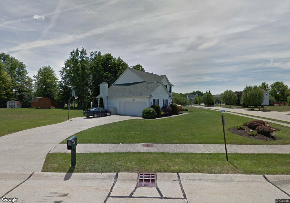
7323 Mulberry Ct Olmsted Falls, OH 44138
Estimated Value: $396,185 - $466,000
4
Beds
3
Baths
2,560
Sq Ft
$170/Sq Ft
Est. Value
About This Home
This home is located at 7323 Mulberry Ct, Olmsted Falls, OH 44138 and is currently estimated at $434,046, approximately $169 per square foot. 7323 Mulberry Ct is a home located in Cuyahoga County with nearby schools including Olmsted Falls Intermediate Building, Falls-Lenox Primary Elementary School, and Olmsted Falls Middle School.
Ownership History
Date
Name
Owned For
Owner Type
Purchase Details
Closed on
Aug 30, 2002
Sold by
Diffenbacher Brian R and Diffenbacher Vanessa
Bought by
Schmucki James A and Schmucki Margaret M
Current Estimated Value
Home Financials for this Owner
Home Financials are based on the most recent Mortgage that was taken out on this home.
Original Mortgage
$222,228
Interest Rate
6.56%
Create a Home Valuation Report for This Property
The Home Valuation Report is an in-depth analysis detailing your home's value as well as a comparison with similar homes in the area
Home Values in the Area
Average Home Value in this Area
Purchase History
| Date | Buyer | Sale Price | Title Company |
|---|---|---|---|
| Schmucki James A | -- | American Title & Trust |
Source: Public Records
Mortgage History
| Date | Status | Borrower | Loan Amount |
|---|---|---|---|
| Previous Owner | Schmucki James A | $222,228 |
Source: Public Records
Tax History Compared to Growth
Tax History
| Year | Tax Paid | Tax Assessment Tax Assessment Total Assessment is a certain percentage of the fair market value that is determined by local assessors to be the total taxable value of land and additions on the property. | Land | Improvement |
|---|---|---|---|---|
| 2024 | $9,187 | $122,325 | $24,360 | $97,965 |
| 2023 | $9,166 | $97,790 | $20,440 | $77,350 |
| 2022 | $8,266 | $89,740 | $20,440 | $69,300 |
| 2021 | $8,192 | $89,740 | $20,440 | $69,300 |
| 2020 | $8,097 | $78,720 | $17,920 | $60,800 |
| 2019 | $7,347 | $224,900 | $51,200 | $173,700 |
| 2018 | $7,100 | $78,720 | $17,920 | $60,800 |
| 2017 | $7,197 | $74,700 | $17,400 | $57,300 |
| 2016 | $7,141 | $74,420 | $17,400 | $57,020 |
| 2015 | $7,069 | $74,420 | $17,400 | $57,020 |
| 2014 | $7,069 | $72,250 | $16,910 | $55,340 |
Source: Public Records
Map
Nearby Homes
- 7296 Chestnut Ct
- 7224 Pine Woods Way
- 7087 Mackenzie Rd
- 7097 Stearns Rd
- 6926 Mackenzie Rd
- 27069 Oakwood Cir Unit 117W
- 27097 Oakwood Cir Unit 208Z
- 27202 Cook Rd Unit 95
- 27202 Cook Rd Unit 127
- 29 Carl Ln
- 8706 Stearns Rd
- 29651 Westminster Dr
- 6979 Warrington Dr
- 26788 Skyline Dr
- 28130 Angela Dr
- 6752 Cypress Dr
- 52 Periwinkle Dr
- 29880 Westminster Dr
- 6706 Crestwood Ln
- 42 Periwinkle Dr
- 27064 Valeside Ln
- 7321 Mulberry Ct
- 27060 Valeside Ln
- 7312 Mulberry Ct
- 27056 Valeside Ln
- 7318 Valeside Ln
- 7319 Mulberry Ct
- 7322 Valeside Ln
- 7326 Valeside Ln
- 7314 Mulberry Ct
- 27052 Valeside Ln
- 7314 Valeside Ln
- 7317 Mulberry Ct
- 7316 Mulberry Ct
- 27048 Valeside Ln
- 7310 Valeside Ln
- 27073 Valeside Ln
- 27061 Valeside Ln
- 27057 Valeside Ln
- 27044 Valeside Ln