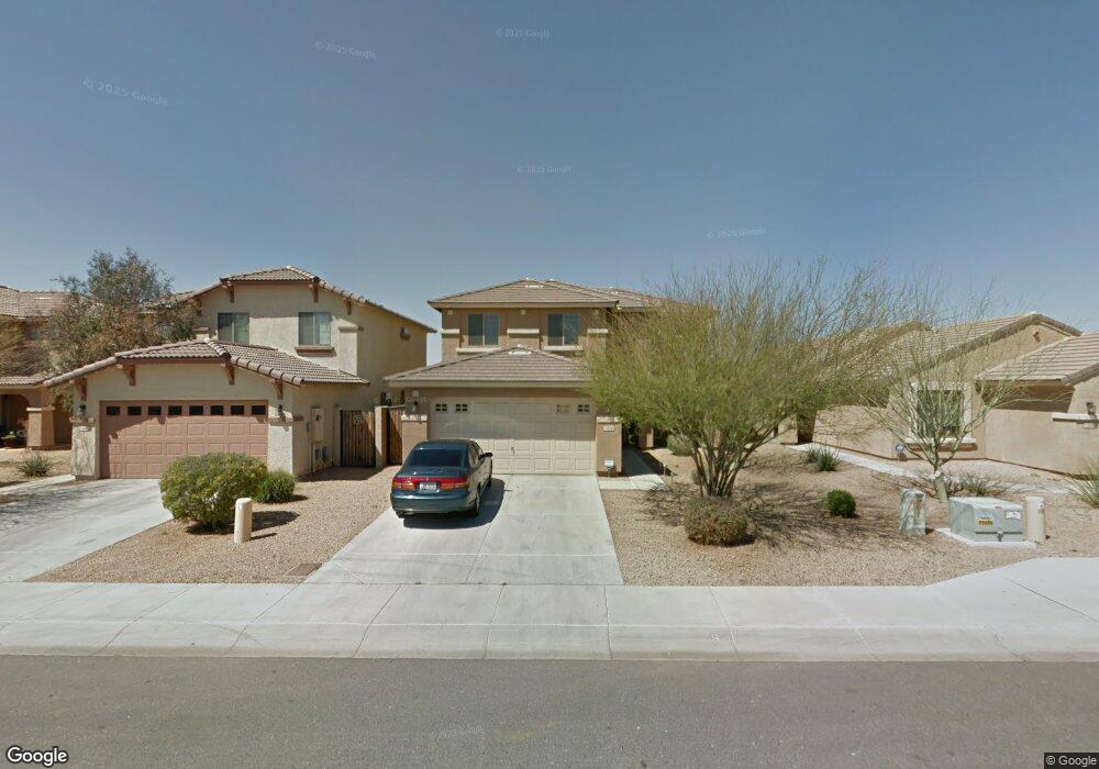
7328 W Ian Dr Laveen, AZ 85339
Laveen NeighborhoodEstimated Value: $349,580 - $422,000
--
Bed
3
Baths
1,905
Sq Ft
$209/Sq Ft
Est. Value
About This Home
This home is located at 7328 W Ian Dr, Laveen, AZ 85339 and is currently estimated at $398,395, approximately $209 per square foot. 7328 W Ian Dr is a home located in Maricopa County with nearby schools including Betty Fairfax High School, Phoenix Coding Academy, and Country Gardens Charter School.
Ownership History
Date
Name
Owned For
Owner Type
Purchase Details
Closed on
Aug 12, 2014
Sold by
Provident Residential Real Estate Fund L
Bought by
Sby 2014-1 Borrower Llc
Current Estimated Value
Purchase Details
Closed on
Aug 11, 2011
Sold by
Metropolitan West Valley Llc
Bought by
Provident Residential Real Estate Fund L
Purchase Details
Closed on
Aug 3, 2011
Sold by
Carr Chantele S
Bought by
Metropolitan West Valley Llc
Purchase Details
Closed on
Jul 24, 2006
Sold by
Tw Homes/Arizona Inc
Bought by
Carr Chantele S
Home Financials for this Owner
Home Financials are based on the most recent Mortgage that was taken out on this home.
Original Mortgage
$56,824
Interest Rate
6.76%
Mortgage Type
Stand Alone Second
Create a Home Valuation Report for This Property
The Home Valuation Report is an in-depth analysis detailing your home's value as well as a comparison with similar homes in the area
Home Values in the Area
Average Home Value in this Area
Purchase History
| Date | Buyer | Sale Price | Title Company |
|---|---|---|---|
| Sby 2014-1 Borrower Llc | -- | None Available | |
| Provident Residential Real Estate Fund L | -- | Great American Title Agency | |
| Metropolitan West Valley Llc | $80,300 | Accommodation | |
| Carr Chantele S | $284,116 | First American Title Ins Co | |
| Tw Homes/Arizona Inc | -- | First American Title Ins Co |
Source: Public Records
Mortgage History
| Date | Status | Borrower | Loan Amount |
|---|---|---|---|
| Previous Owner | Tw Homes/Arizona Inc | $56,824 | |
| Previous Owner | Carr Chantele S | $227,292 |
Source: Public Records
Tax History Compared to Growth
Tax History
| Year | Tax Paid | Tax Assessment Tax Assessment Total Assessment is a certain percentage of the fair market value that is determined by local assessors to be the total taxable value of land and additions on the property. | Land | Improvement |
|---|---|---|---|---|
| 2025 | $2,002 | $12,982 | -- | -- |
| 2024 | $1,966 | $12,363 | -- | -- |
| 2023 | $1,966 | $27,200 | $5,440 | $21,760 |
| 2022 | $1,910 | $20,370 | $4,070 | $16,300 |
| 2021 | $1,909 | $19,080 | $3,810 | $15,270 |
| 2020 | $1,861 | $17,180 | $3,430 | $13,750 |
| 2019 | $1,863 | $15,430 | $3,080 | $12,350 |
| 2018 | $1,779 | $13,620 | $2,720 | $10,900 |
| 2017 | $1,687 | $11,930 | $2,380 | $9,550 |
| 2016 | $1,606 | $11,870 | $2,370 | $9,500 |
| 2015 | $1,450 | $11,350 | $2,270 | $9,080 |
Source: Public Records
Map
Nearby Homes
- 7204 W Beverly Rd
- 7820 S 73rd Ln
- 7904 S 74th Ave
- 7337 W Valencia Dr
- 7709 S 72nd Dale
- 7428 W Fawn Dr
- 7241 W Donner Dr
- 7023 W Melody Dr
- 7592 W Darrow St
- 7205 W Ellis St
- 7037 W Sophie Ln
- 7417 W Park St
- 7572 W Darrow St
- 7521 76th Dr
- 7517 76th Dr
- 7517 S 76th Dr
- 7509 76th Dr
- 8420 S 69th Ln
- 7509 S 76th Dr
- 7505 76th Dr