Estimated Value: $315,000 - $359,000
4
Beds
2
Baths
1,069
Sq Ft
$314/Sq Ft
Est. Value
About This Home
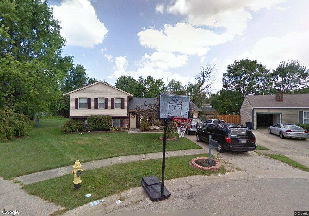
This home is located at 733 Anthony Ln, Mason, OH 45040 and is currently estimated at $335,895, approximately $314 per square foot. 733 Anthony Ln is a home located in Warren County with nearby schools including Mason Intermediate Elementary School, Mason Middle School, and William Mason High School.
Ownership History
Date
Name
Owned For
Owner Type
Purchase Details
Closed on
Aug 27, 1999
Sold by
Moraites Dean A
Bought by
Nalder Robert E and Nalder Jennifer L
Current Estimated Value
Home Financials for this Owner
Home Financials are based on the most recent Mortgage that was taken out on this home.
Original Mortgage
$117,239
Outstanding Balance
$31,099
Interest Rate
7.61%
Mortgage Type
FHA
Estimated Equity
$304,796
Purchase Details
Closed on
Jun 3, 1997
Sold by
Bruzina Dennis N
Bought by
Moriates Dean A and Moriates Michelle M
Home Financials for this Owner
Home Financials are based on the most recent Mortgage that was taken out on this home.
Original Mortgage
$105,400
Interest Rate
8.27%
Mortgage Type
FHA
Purchase Details
Closed on
Nov 6, 1992
Sold by
Hoffman Hoffman and Hoffman Robert D
Bought by
Bruzina Bruzina and Bruzina Dennis
Purchase Details
Closed on
Apr 5, 1990
Sold by
Wynne Wynne and Wynne David R
Bought by
Hoffman Hoffman and Hoffman Robert D
Purchase Details
Closed on
Mar 1, 1984
Sold by
Peter Peter and Peter Donald
Bought by
Wynne Wynne and Wynne David R
Purchase Details
Closed on
May 4, 1979
Sold by
Drudy Drudy and Drudy Robert E
Create a Home Valuation Report for This Property
The Home Valuation Report is an in-depth analysis detailing your home's value as well as a comparison with similar homes in the area
Home Values in the Area
Average Home Value in this Area
Purchase History
| Date | Buyer | Sale Price | Title Company |
|---|---|---|---|
| Nalder Robert E | $117,300 | -- | |
| Moriates Dean A | $106,900 | -- | |
| Bruzina Bruzina | $85,000 | -- | |
| Hoffman Hoffman | $80,900 | -- | |
| Wynne Wynne | $54,200 | -- | |
| -- | $49,900 | -- |
Source: Public Records
Mortgage History
| Date | Status | Borrower | Loan Amount |
|---|---|---|---|
| Open | Nalder Robert E | $117,239 | |
| Previous Owner | Moriates Dean A | $105,400 |
Source: Public Records
Tax History
| Year | Tax Paid | Tax Assessment Tax Assessment Total Assessment is a certain percentage of the fair market value that is determined by local assessors to be the total taxable value of land and additions on the property. | Land | Improvement |
|---|---|---|---|---|
| 2025 | $3,288 | $80,980 | $24,500 | $56,480 |
| 2024 | $3,288 | $80,980 | $24,500 | $56,480 |
| 2023 | $2,923 | $60,812 | $10,762 | $50,050 |
| 2022 | $2,885 | $60,813 | $10,763 | $50,050 |
| 2021 | $2,733 | $60,813 | $10,763 | $50,050 |
| 2020 | $2,592 | $49,441 | $8,750 | $40,691 |
| 2019 | $2,383 | $49,441 | $8,750 | $40,691 |
| 2018 | $2,391 | $49,441 | $8,750 | $40,691 |
| 2017 | $2,209 | $42,658 | $8,274 | $34,384 |
| 2016 | $2,276 | $42,658 | $8,274 | $34,384 |
| 2015 | $2,280 | $42,658 | $8,274 | $34,384 |
| 2014 | $2,285 | $39,870 | $7,730 | $32,130 |
| 2013 | $2,290 | $45,120 | $8,750 | $36,370 |
Source: Public Records
Map
Nearby Homes
- 792 Majken Place
- 6300 Amber Ct
- 1475 St Lawrence Dr
- 6411 Coverage Ct
- 6404 Coverage Ct
- 6394 Coverage Ct
- 6382 Coverage Ct
- 6378 Coverage Ct
- 6364 Coverage Ct
- 6354 Coverage Ct
- 6379 Coverage Ct
- 6375 Coverage Ct
- 6358 Coverage Ct
- 6403 Nicholas Way
- 6393 Nicholas Way
- 6179 Nicholas Way
- 6175 Nicholas Way
- 6171 Nicholas Way
- 6361 Coverage Ct
- 6342 Coverage Ct
- 729 Anthony Ln
- 737 Anthony Ln
- 608 Jeffery Ct
- 604 Jeffery Ct
- 1381 Fishhawk Ct
- 1379 Fishhawk Ct
- 1383 Fishhawk Ct
- 1296 Laura Ln
- 734 Anthony Ln
- 600 Jeffery Ct
- 610 Jeffery Ct
- 1377 Fishhawk Ct
- 738 Anthony Ln
- 1385 Fishhawk Ct
- 742 Anthony Ln
- 1375 Fishhawk Ct
- 746 Anthony Ln
- 1374 Fishhawk Ct
- 1376 Fishhawk Ct
- 609 Jeffery Ct
Your Personal Tour Guide
Ask me questions while you tour the home.