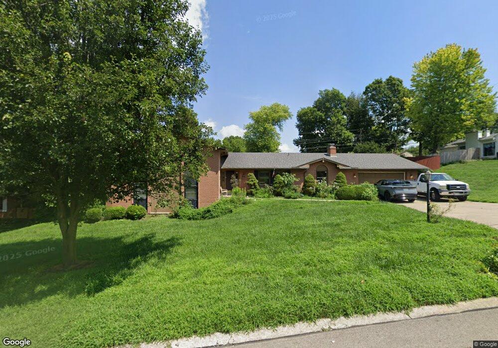
733 Barth Ln Dayton, OH 45429
Estimated Value: $426,161 - $505,000
5
Beds
3
Baths
3,036
Sq Ft
$151/Sq Ft
Est. Value
About This Home
This home is located at 733 Barth Ln, Dayton, OH 45429 and is currently estimated at $459,040, approximately $151 per square foot. 733 Barth Ln is a home located in Montgomery County with nearby schools including Southdale Elementary School, Van Buren Middle School, and Kettering Fairmont High School.
Ownership History
Date
Name
Owned For
Owner Type
Purchase Details
Closed on
Jul 5, 2024
Sold by
Petrina Llc
Bought by
Robert L Zavakos Trust and Zavakos
Current Estimated Value
Purchase Details
Closed on
Jun 18, 2014
Sold by
Strang James M and Strang Rebecca Erb
Bought by
Petrina Llc
Purchase Details
Closed on
Aug 30, 2006
Sold by
Blair Robert A and Rodriguez Blair Wilma A
Bought by
Strang James M and Strang Rebecca Erb
Purchase Details
Closed on
Jan 31, 1996
Sold by
Alfaro Margaret Glennon
Bought by
Blair Robert A and Rodriguez Blair Wilma A
Create a Home Valuation Report for This Property
The Home Valuation Report is an in-depth analysis detailing your home's value as well as a comparison with similar homes in the area
Home Values in the Area
Average Home Value in this Area
Purchase History
| Date | Buyer | Sale Price | Title Company |
|---|---|---|---|
| Robert L Zavakos Trust | -- | None Listed On Document | |
| Petrina Llc | $190,000 | None Available | |
| Strang James M | $242,000 | None Available | |
| Blair Robert A | -- | Midland Title Security Inc |
Source: Public Records
Tax History Compared to Growth
Tax History
| Year | Tax Paid | Tax Assessment Tax Assessment Total Assessment is a certain percentage of the fair market value that is determined by local assessors to be the total taxable value of land and additions on the property. | Land | Improvement |
|---|---|---|---|---|
| 2024 | $5,902 | $93,340 | $21,920 | $71,420 |
| 2023 | $5,902 | $93,340 | $21,920 | $71,420 |
| 2022 | $7,024 | $87,940 | $20,680 | $67,260 |
| 2021 | $6,505 | $87,940 | $20,680 | $67,260 |
| 2020 | $6,525 | $87,940 | $20,680 | $67,260 |
| 2019 | $7,319 | $87,270 | $20,680 | $66,590 |
| 2018 | $7,359 | $87,270 | $20,680 | $66,590 |
| 2017 | $6,792 | $87,270 | $20,680 | $66,590 |
| 2016 | $7,384 | $91,400 | $20,680 | $70,720 |
| 2015 | $7,052 | $91,400 | $20,680 | $70,720 |
| 2014 | $7,052 | $91,400 | $20,680 | $70,720 |
| 2012 | -- | $78,510 | $24,480 | $54,030 |
Source: Public Records
Map
Nearby Homes
- 4400 Royal Ridge Way
- 3993 Applewood Ln
- 516 Pauley Woods Cir
- 298 Marchester Dr
- 3720 Ridgeleigh Rd Unit D
- 4301 Tait Rd
- 1905 Tait Circle Rd
- 3464 Southern Blvd
- 4458 Moraine Ridge Ln
- 1524 Hillwood Dr
- 209 Westhaven Dr
- 3325 Ridgeway Rd
- 3915 Utica Dr
- 1955 Kresswood Cir
- 1125 Laurelwood Rd
- 5048 Oak Manor Ct
- 1673 W Stroop Rd
- 1692 Hillwood Dr
- 5303 Split Rail
- 1314 Ridgeview Ave
- 4231 Brookdale Dr
- 749 Barth Ln
- 716 Schrubb Dr
- 732 Schrubb Dr
- 4203 Brookdale Dr
- 736 Barth Ln
- 700 Barth Ln
- 748 Barth Ln
- 4230 Brookdale Dr
- 765 Barth Ln
- 748 Schrubb Dr
- 4202 Brookdale Dr
- 766 Barth Ln
- 755 Stanbridge Dr
- 717 Schrubb Dr
- 739 Stanbridge Dr
- 4171 Brookdale Dr
- 4209 Barth Ln
- 773 Stanbridge Dr
- 4209 Schrubb Dr