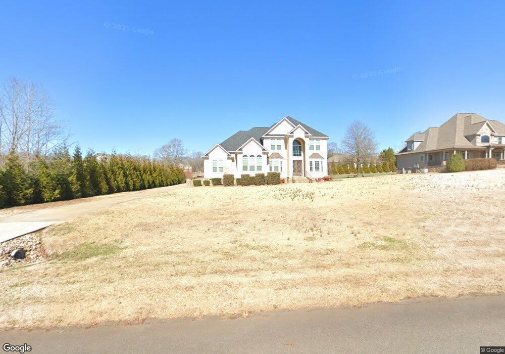
733 Belfast Ct Rock Hill, SC 29730
Estimated Value: $657,000 - $845,109
--
Bed
--
Bath
4,327
Sq Ft
$177/Sq Ft
Est. Value
About This Home
This home is located at 733 Belfast Ct, Rock Hill, SC 29730 and is currently estimated at $767,277, approximately $177 per square foot. 733 Belfast Ct is a home located in York County with nearby schools including Lesslie Elementary School, Castle Heights Middle School, and Rock Hill High School.
Ownership History
Date
Name
Owned For
Owner Type
Purchase Details
Closed on
Jan 2, 2020
Sold by
Vongsay Eddy
Bought by
Vongsay Bopreang An
Current Estimated Value
Purchase Details
Closed on
Mar 17, 2016
Sold by
Burris Kevin D
Bought by
Vongsay Eddy
Purchase Details
Closed on
Feb 25, 2015
Sold by
Kuzinski Robert and Kuzinski Frances
Bought by
Burris Kevin D
Purchase Details
Closed on
Mar 30, 2012
Sold by
Synovus Bank
Bought by
Kuzinski Robert and Kuzinski Frances
Purchase Details
Closed on
Apr 13, 2011
Sold by
Tullamore Llc
Bought by
The National Bank Of South Carolina
Create a Home Valuation Report for This Property
The Home Valuation Report is an in-depth analysis detailing your home's value as well as a comparison with similar homes in the area
Home Values in the Area
Average Home Value in this Area
Purchase History
| Date | Buyer | Sale Price | Title Company |
|---|---|---|---|
| Vongsay Bopreang An | -- | None Available | |
| Vongsay Eddy | $40,000 | None Available | |
| Burris Kevin D | $30,000 | -- | |
| Kuzinski Robert | $1,800 | -- | |
| The National Bank Of South Carolina | $1,271,000 | -- |
Source: Public Records
Tax History Compared to Growth
Tax History
| Year | Tax Paid | Tax Assessment Tax Assessment Total Assessment is a certain percentage of the fair market value that is determined by local assessors to be the total taxable value of land and additions on the property. | Land | Improvement |
|---|---|---|---|---|
| 2024 | $3,455 | $24,610 | $1,257 | $23,353 |
| 2023 | $3,544 | $24,610 | $1,257 | $23,353 |
| 2022 | $3,556 | $24,610 | $1,257 | $23,353 |
| 2021 | -- | $24,610 | $1,257 | $23,353 |
| 2020 | $3,544 | $24,610 | $0 | $0 |
| 2019 | $3,231 | $21,400 | $0 | $0 |
| 2018 | $10,888 | $32,100 | $0 | $0 |
| 2017 | $682 | $32,100 | $0 | $0 |
| 2016 | $660 | $2,100 | $0 | $0 |
| 2014 | $201 | $2,100 | $2,100 | $0 |
| 2013 | $201 | $2,100 | $2,100 | $0 |
Source: Public Records
Map
Nearby Homes
- 508 Bridgestone Ln
- 172 Neely Store Rd
- 3339 Lesslie Hwy Unit 2
- 356 Emma Wood Ln
- 1903 Manning Place
- 2003 Capel Ct
- 281 Schoolside Dr
- 111 Emily Crest Ln
- 3943 Walker Rd
- 3943 Walker Rd Unit LOT ONLY
- 3943 Walker Road (Land Only)
- 611 Pondway Downs
- 1580 Anderson Rd S
- 161 Billy Claude Cir
- 2999 Starnes Dr
- 141 Edenvale Rd
- 3886 Lesslie Hwy
- 1009 Rainbow Cir
- 623 Neelys Creek Rd
- 1034 Neely Store Rd
- 745 Belfast Ct Unit Lot11
- 721 Belfast Ct
- 709 Belfast Ct
- 757 Belfast Ct
- 757 Belfast Ct Unit 10
- 618 Carollbrook Dr
- 720 Belfast Ct
- 732 Belfast Ct
- 744 Belfast Ct
- 630 Carollbrook Dr
- 630 Carollbrook Dr Unit 18
- 576 Carollbrook Dr
- 13 Belfast Rd
- 708 Belfast Ct
- 769 Belfast Ct
- 14 Belfast Rd
- 756 Belfast Ct
- 642 Carollbrook Dr
- 606 Carollbrook Dr
- 545 Carollbrook Dr