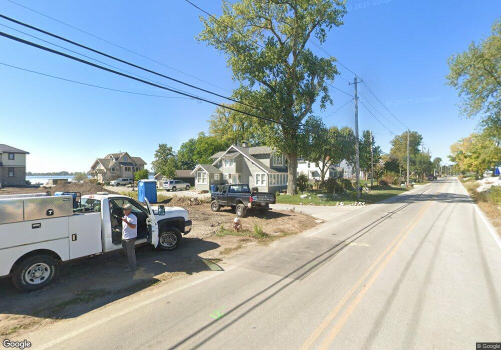
733 Cedar Point Rd Sandusky, OH 44870
Estimated Value: $480,102 - $790,000
3
Beds
3
Baths
1,421
Sq Ft
$454/Sq Ft
Est. Value
About This Home
This home is located at 733 Cedar Point Rd, Sandusky, OH 44870 and is currently estimated at $645,034, approximately $453 per square foot. 733 Cedar Point Rd is a home located in Erie County with nearby schools including Sandusky High School.
Ownership History
Date
Name
Owned For
Owner Type
Purchase Details
Closed on
Jul 25, 2025
Sold by
Robert M Critchfield Declaration Of Trus and Critchfield Robert M
Bought by
Robert M Critchfield Declaration Of Trust and Critchfield
Current Estimated Value
Purchase Details
Closed on
Apr 4, 2019
Sold by
Critchfield Robert M
Bought by
Critchfield Robert M Trustee
Home Financials for this Owner
Home Financials are based on the most recent Mortgage that was taken out on this home.
Interest Rate
4.08%
Purchase Details
Closed on
Jan 31, 2018
Sold by
Ritter Mary Jane
Bought by
Critchfield Robert M
Home Financials for this Owner
Home Financials are based on the most recent Mortgage that was taken out on this home.
Interest Rate
4.15%
Create a Home Valuation Report for This Property
The Home Valuation Report is an in-depth analysis detailing your home's value as well as a comparison with similar homes in the area
Purchase History
| Date | Buyer | Sale Price | Title Company |
|---|---|---|---|
| Robert M Critchfield Declaration Of Trust | -- | Hartung Title | |
| Critchfield Robert M Trustee | -- | -- | |
| Critchfield Robert M | $290,000 | -- |
Source: Public Records
Mortgage History
| Date | Status | Borrower | Loan Amount |
|---|---|---|---|
| Previous Owner | Critchfield Robert M | -- | |
| Previous Owner | Critchfield Robert M | -- |
Source: Public Records
Tax History
| Year | Tax Paid | Tax Assessment Tax Assessment Total Assessment is a certain percentage of the fair market value that is determined by local assessors to be the total taxable value of land and additions on the property. | Land | Improvement |
|---|---|---|---|---|
| 2024 | $6,170 | $158,185 | $81,217 | $76,968 |
| 2023 | $6,230 | $119,115 | $64,498 | $54,617 |
| 2022 | $4,723 | $93,173 | $64,498 | $28,675 |
| 2021 | $4,767 | $93,180 | $64,500 | $28,680 |
| 2020 | $5,019 | $90,160 | $64,500 | $25,660 |
| 2019 | $4,842 | $84,610 | $64,500 | $20,110 |
| 2018 | $4,806 | $94,690 | $84,390 | $10,300 |
| 2017 | $5,420 | $105,350 | $84,260 | $21,090 |
| 2016 | $5,417 | $105,350 | $84,260 | $21,090 |
| 2015 | $4,889 | $105,350 | $84,260 | $21,090 |
| 2014 | $4,775 | $103,660 | $84,260 | $19,400 |
| 2013 | $4,726 | $103,660 | $84,260 | $19,400 |
Source: Public Records
Map
Nearby Homes
- 939 Cedar Point Rd
- 139 Cedar Point Rd
- 1640 Cleveland Rd W
- 2821 Park Ln
- 2811 Peterson Ln
- 2815 E Perkins Ave
- 2501 E Perkins Ave
- 1999 E Oldgate Rd
- 2906 E Perkins Ave
- 3050 E Perkins Ave
- 1711 Willow Dr
- 81 Marina Point Dr
- 89 Marina Point Dr
- 57 Marina Point Dr
- 49 Marina Point Dr
- 32 Marina Point Dr
- 1708 Dietrick St
- 3037 Lauras Ln
- 3135 Lauras Ln
- 3132 Lauras Ln
- 739 Cedar Point Rd
- 727 Cedar Point Rd
- 739 Cedar Point
- 801 Cedar Point Rd
- 805 Cedar Point Rd
- V/L Cedar Point Rd
- 807 Cedar Point Rd
- 717 Cedar Point Rd
- 721 Cedar Point Rd
- 811 Cedar Point Rd
- 811 Cedar Point Dr
- 715 Cedar Point Rd
- 813 Cedar Point Rd
- 711 Cedar Point Rd
- 817 Cedar Point Rd
- 709 Cedar Point Rd
- 819 Cedar Point Rd
- 705 Cedar Point Rd
- 823 Cedar Point Rd
- 703 Cedar Point Rd
Your Personal Tour Guide
Ask me questions while you tour the home.
