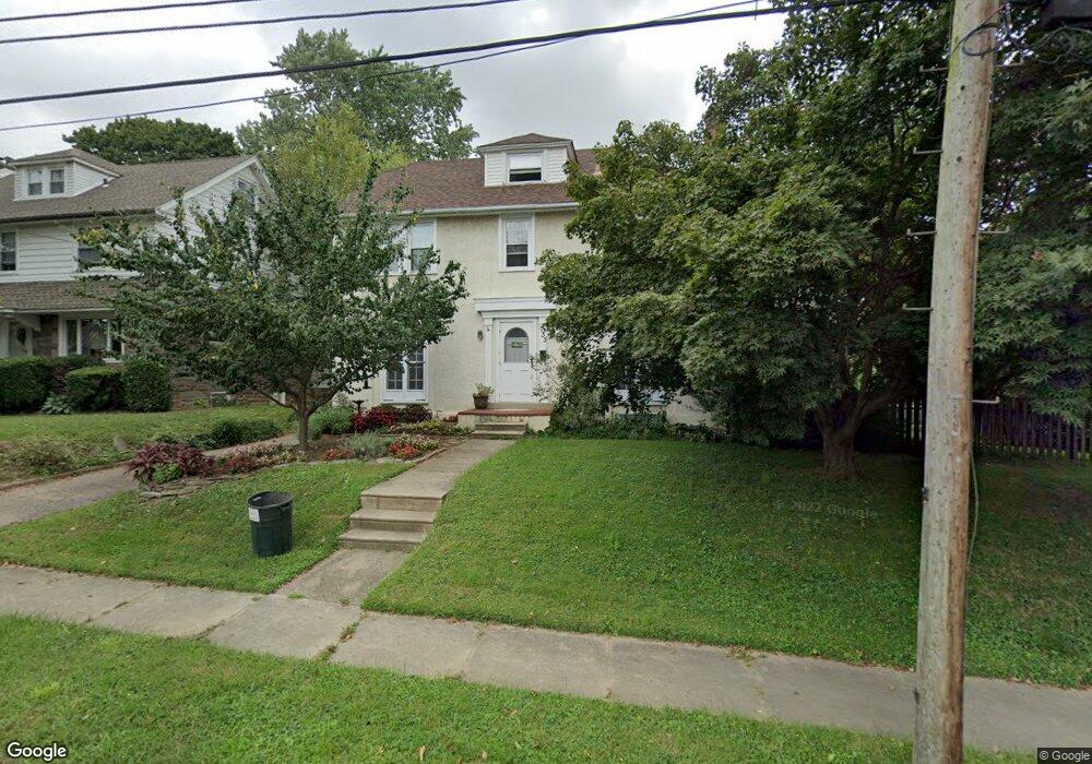
733 Foss Ave Drexel Hill, PA 19026
Estimated Value: $362,000 - $444,000
4
Beds
2
Baths
1,742
Sq Ft
$226/Sq Ft
Est. Value
About This Home
This home is located at 733 Foss Ave, Drexel Hill, PA 19026 and is currently estimated at $394,071, approximately $226 per square foot. 733 Foss Ave is a home located in Delaware County with nearby schools including Hillcrest El School, Drexel Hill Middle School, and Upper Darby High School.
Ownership History
Date
Name
Owned For
Owner Type
Purchase Details
Closed on
Oct 7, 2009
Sold by
Pieretti Timi L and Pieretti Christopher D
Bought by
Pieretti Timi L and Pieretti Christopher D
Current Estimated Value
Purchase Details
Closed on
Jul 28, 2006
Sold by
Felker Ezra H and Felker Diana
Bought by
Shambaugh Timi and Pieretti Christopher D
Home Financials for this Owner
Home Financials are based on the most recent Mortgage that was taken out on this home.
Original Mortgage
$218,480
Outstanding Balance
$130,744
Interest Rate
6.7%
Mortgage Type
Purchase Money Mortgage
Estimated Equity
$263,327
Purchase Details
Closed on
Oct 31, 2000
Sold by
Kollmar Harry J and Kollmar Susan A
Bought by
Felker Ezra H and Felker Diana
Home Financials for this Owner
Home Financials are based on the most recent Mortgage that was taken out on this home.
Original Mortgage
$161,500
Interest Rate
7.83%
Create a Home Valuation Report for This Property
The Home Valuation Report is an in-depth analysis detailing your home's value as well as a comparison with similar homes in the area
Home Values in the Area
Average Home Value in this Area
Purchase History
| Date | Buyer | Sale Price | Title Company |
|---|---|---|---|
| Pieretti Timi L | -- | Accommodation | |
| Shambaugh Timi | $273,100 | First American Title Ins Co | |
| Felker Ezra H | $170,000 | T A Title Insurance Company |
Source: Public Records
Mortgage History
| Date | Status | Borrower | Loan Amount |
|---|---|---|---|
| Open | Shambaugh Timi | $218,480 | |
| Previous Owner | Felker Ezra H | $161,500 |
Source: Public Records
Tax History Compared to Growth
Tax History
| Year | Tax Paid | Tax Assessment Tax Assessment Total Assessment is a certain percentage of the fair market value that is determined by local assessors to be the total taxable value of land and additions on the property. | Land | Improvement |
|---|---|---|---|---|
| 2025 | $7,798 | $184,380 | $49,020 | $135,360 |
| 2024 | $7,798 | $184,380 | $49,020 | $135,360 |
| 2023 | $7,724 | $184,380 | $49,020 | $135,360 |
| 2022 | $7,517 | $184,380 | $49,020 | $135,360 |
| 2021 | $10,135 | $184,380 | $49,020 | $135,360 |
| 2020 | $8,752 | $135,300 | $39,470 | $95,830 |
| 2019 | $8,598 | $135,300 | $39,470 | $95,830 |
| 2018 | $8,499 | $135,300 | $0 | $0 |
| 2017 | $8,278 | $135,300 | $0 | $0 |
| 2016 | $743 | $135,300 | $0 | $0 |
| 2015 | $758 | $135,300 | $0 | $0 |
| 2014 | $743 | $135,300 | $0 | $0 |
Source: Public Records
Map
Nearby Homes
- 801 Penn Ave
- 3765 Highland Ave
- 3700 School Ln
- 542 Shadeland Ave
- 831 Concord Ave
- 930 Ormond Ave
- 1004 Turner Ave
- 506 Burmont Rd
- 3634 Rosemont Ave
- 3810 Huey Ave
- 474 Kenwood Rd
- 827 Hampshire Rd
- 804 Gainsboro Rd
- 2548 Irvington Rd
- 3804 Rosemont Ave
- 4123 School Ln
- 924 Fairfax Rd
- 3811 Berry Ave
- 1025 Shadeland Ave
- 455 Irvington Rd