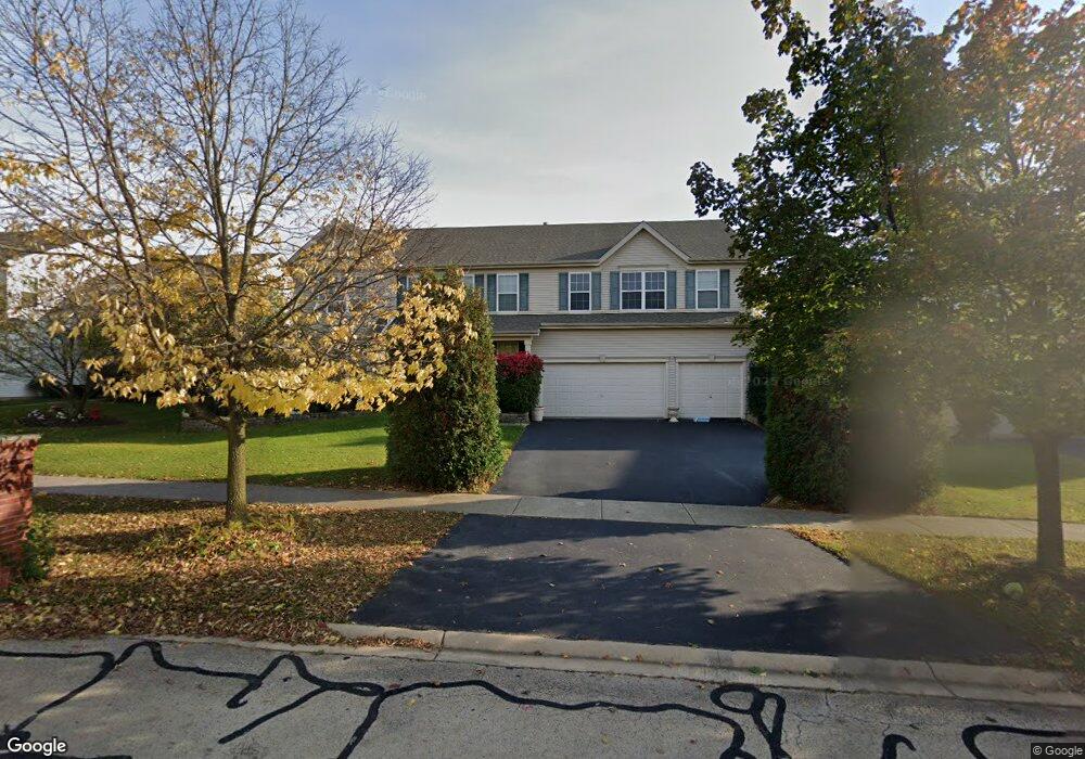
733 Lindsey Ln Unit 2A Bolingbrook, IL 60440
DuPage NeighborhoodEstimated Value: $611,718 - $623,000
4
Beds
3
Baths
3,888
Sq Ft
$159/Sq Ft
Est. Value
About This Home
This home is located at 733 Lindsey Ln Unit 2A, Bolingbrook, IL 60440 and is currently estimated at $617,930, approximately $158 per square foot. 733 Lindsey Ln Unit 2A is a home located in Will County with nearby schools including Jamie Mcgee Elementary School, Jane Addams Middle School, and Bolingbrook High School.
Ownership History
Date
Name
Owned For
Owner Type
Purchase Details
Closed on
May 25, 2004
Sold by
Realen Homes Lp
Bought by
Yang Li Hui and Yang Jing
Current Estimated Value
Home Financials for this Owner
Home Financials are based on the most recent Mortgage that was taken out on this home.
Original Mortgage
$270,000
Outstanding Balance
$131,557
Interest Rate
6.06%
Mortgage Type
Purchase Money Mortgage
Estimated Equity
$486,373
Create a Home Valuation Report for This Property
The Home Valuation Report is an in-depth analysis detailing your home's value as well as a comparison with similar homes in the area
Home Values in the Area
Average Home Value in this Area
Purchase History
| Date | Buyer | Sale Price | Title Company |
|---|---|---|---|
| Yang Li Hui | $366,500 | Chicago Title Insurance Co |
Source: Public Records
Mortgage History
| Date | Status | Borrower | Loan Amount |
|---|---|---|---|
| Open | Yang Li Hui | $270,000 |
Source: Public Records
Tax History Compared to Growth
Tax History
| Year | Tax Paid | Tax Assessment Tax Assessment Total Assessment is a certain percentage of the fair market value that is determined by local assessors to be the total taxable value of land and additions on the property. | Land | Improvement |
|---|---|---|---|---|
| 2024 | $16,682 | $188,625 | $49,229 | $139,396 |
| 2023 | $16,682 | $169,719 | $44,295 | $125,424 |
| 2022 | $14,531 | $153,010 | $39,934 | $113,076 |
| 2021 | $13,799 | $143,067 | $37,339 | $105,728 |
| 2020 | $13,388 | $138,362 | $36,111 | $102,251 |
| 2019 | $12,977 | $131,773 | $34,391 | $97,382 |
| 2018 | $12,476 | $126,122 | $32,916 | $93,206 |
| 2017 | $11,901 | $119,547 | $31,200 | $88,347 |
| 2016 | $11,577 | $113,800 | $29,700 | $84,100 |
| 2015 | $10,554 | $109,200 | $28,500 | $80,700 |
| 2014 | $10,554 | $101,100 | $26,400 | $74,700 |
| 2013 | $10,554 | $96,200 | $25,100 | $71,100 |
Source: Public Records
Map
Nearby Homes
- VACANT W Boughton Rd
- 591 Barclay Dr Unit 2A
- 315 Clarendon Ln Unit 1
- 267 Clarendon Ln Unit 1
- 284 Berkeley Dr Unit 1
- 329 Redwing Dr
- 353 Foster Way Unit 2
- 650 Sundance Dr
- 261 Bryant Way
- 621 Sundance Dr
- 316 Pueblo Dr
- 206 Christine Way Unit 2
- 11 Penny Ct
- 228 Elkhorn Ct Unit B
- 157 N Orchard Dr
- 234 Dakota Ct Unit C
- 2308 Fleetwood Ct
- 25 W 500 Royce Rd
- 1031 Bothwell Cir
- 112 S Orchard Dr
- 729 Lindsey Ln
- 737 Lindsey Ln
- 725 Lindsey Ln Unit 2A
- 741 Lindsey Ln
- 728 Lindsey Ln Unit 2A
- 724 Lindsey Ln Unit 2A
- 732 Lindsey Ln
- 721 Lindsey Ln
- 745 Lindsey Ln
- 736 Lindsey Ln Unit 2A
- 720 Lindsey Ln
- 7 Arbury Ct
- 740 Lindsey Ln
- 716 Lindsey Ln Unit 2A
- 717 Lindsey Ln Unit 2A
- 556 Barclay Dr
- 749 Lindsey Ln
- 552 Barclay Dr Unit 2A
- 560 Barclay Dr Unit 2A
- 8 Arbury Ct