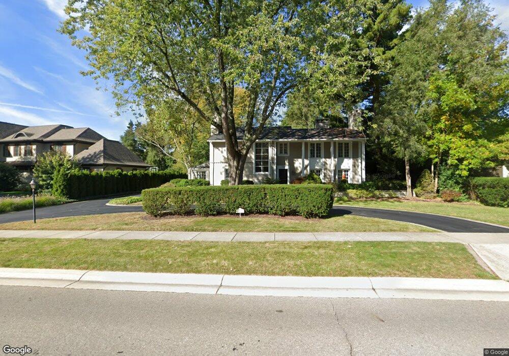
733 N Cranbrook Rd Bloomfield Hills, MI 48301
Estimated Value: $1,029,327 - $1,543,000
4
Beds
3
Baths
3,038
Sq Ft
$404/Sq Ft
Est. Value
About This Home
This home is located at 733 N Cranbrook Rd, Bloomfield Hills, MI 48301 and is currently estimated at $1,227,582, approximately $404 per square foot. 733 N Cranbrook Rd is a home located in Oakland County with nearby schools including Quarton Elementary, Derby Middle School, and Ernest W. Seaholm High School.
Ownership History
Date
Name
Owned For
Owner Type
Purchase Details
Closed on
Jan 18, 2005
Sold by
Dodge N P and National Equity Inc
Bought by
Elliott Thomas P and Elliott Mary Grace S
Current Estimated Value
Purchase Details
Closed on
Sep 13, 2004
Sold by
Conaty James R and Conaty Janet K
Bought by
Dodge N P and National Equity Inc
Create a Home Valuation Report for This Property
The Home Valuation Report is an in-depth analysis detailing your home's value as well as a comparison with similar homes in the area
Home Values in the Area
Average Home Value in this Area
Purchase History
| Date | Buyer | Sale Price | Title Company |
|---|---|---|---|
| Elliott Thomas P | -- | Metropolitan | |
| Dodge N P | $810,000 | -- |
Source: Public Records
Tax History Compared to Growth
Tax History
| Year | Tax Paid | Tax Assessment Tax Assessment Total Assessment is a certain percentage of the fair market value that is determined by local assessors to be the total taxable value of land and additions on the property. | Land | Improvement |
|---|---|---|---|---|
| 2024 | $7,571 | $491,180 | $0 | $0 |
| 2023 | $7,266 | $436,490 | $0 | $0 |
| 2022 | $12,810 | $398,160 | $0 | $0 |
| 2021 | $12,917 | $417,340 | $0 | $0 |
| 2020 | $6,979 | $410,720 | $0 | $0 |
| 2019 | $12,877 | $405,850 | $0 | $0 |
| 2018 | $12,740 | $389,080 | $0 | $0 |
| 2017 | $12,740 | $365,970 | $0 | $0 |
| 2016 | $12,813 | $340,930 | $0 | $0 |
| 2015 | -- | $327,920 | $0 | $0 |
| 2014 | -- | $313,070 | $0 | $0 |
| 2011 | -- | $277,850 | $0 | $0 |
Source: Public Records
Map
Nearby Homes
- 1019 N Cranbrook Rd
- 2579 Amberly Rd
- 956 Westwood Dr
- 1882 Melbourne St
- 345 Kimberly St
- 1120 Lyonhurst St
- 1834 Fairview St
- 1260 Lyonhurst St
- 120 Westchester Way
- 586 Fairfax St
- 397 S Cranbrook Rd
- 394 S Glenhurst Dr
- 1056 Pilgrim Ave
- 100 Overhill Rd
- 421 S Williamsbury Rd
- 222 Arlington St
- 3320 Morningview Terrace
- 520 Pleasant St
- 375 Dunston Rd
- 695 Westchester Way
- 819 N Cranbrook Rd
- 768 Yarmouth Rd
- 655 N Cranbrook Rd
- 734 Yarmouth Rd
- 852 Yarmouth Rd
- 873 N Cranbrook Rd
- 611 N Cranbrook Rd
- 736 N Cranbrook Rd
- 700 Yarmouth Rd
- 770 N Cranbrook Rd
- 770 N Cranbrook Rd
- 880 Yarmouth Rd
- 652 Yarmouth Rd
- 830 N Cranbrook Rd
- 880 N Cranbrook Rd
- 684 N Cranbrook Rd Unit Bldg-Unit
- 684 N Cranbrook Rd
- 583 N Cranbrook Rd
- 656 N Cranbrook Rd
- 735 Yarmouth Rd