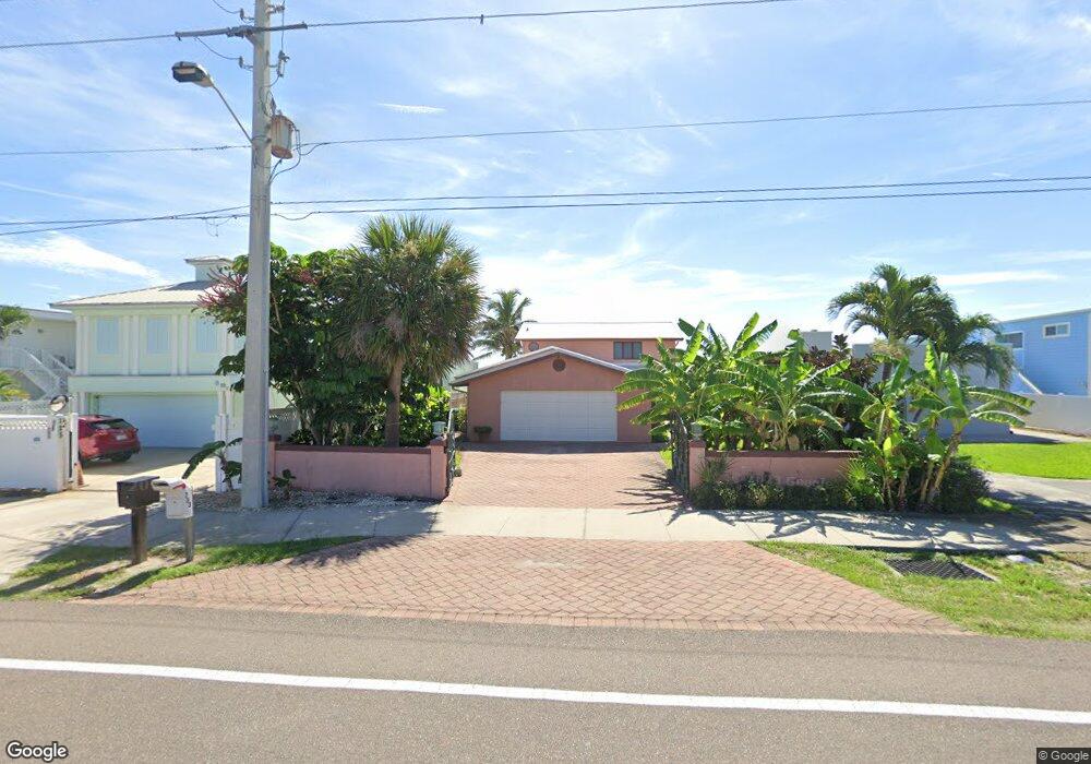
733 S Atlantic Ave Cocoa Beach, FL 32931
Estimated Value: $1,053,000 - $2,657,000
3
Beds
2
Baths
2,735
Sq Ft
$663/Sq Ft
Est. Value
About This Home
This home is located at 733 S Atlantic Ave, Cocoa Beach, FL 32931 and is currently estimated at $1,812,192, approximately $662 per square foot. 733 S Atlantic Ave is a home located in Brevard County with nearby schools including Theodore Roosevelt Elementary School, Cocoa Beach Junior/Senior High School, and Cocoa Beach Christian School.
Ownership History
Date
Name
Owned For
Owner Type
Purchase Details
Closed on
Mar 10, 2017
Sold by
Paul F Wood
Bought by
Wittekind Melinda
Current Estimated Value
Home Financials for this Owner
Home Financials are based on the most recent Mortgage that was taken out on this home.
Original Mortgage
$215,000
Outstanding Balance
$178,487
Interest Rate
4.21%
Estimated Equity
$1,633,705
Purchase Details
Closed on
Oct 18, 1993
Sold by
Collins Curtis W
Bought by
Millsap Melind Lou
Create a Home Valuation Report for This Property
The Home Valuation Report is an in-depth analysis detailing your home's value as well as a comparison with similar homes in the area
Home Values in the Area
Average Home Value in this Area
Purchase History
| Date | Buyer | Sale Price | Title Company |
|---|---|---|---|
| Wittekind Melinda | -- | -- | |
| Millsap Melind Lou | $33,500 | -- |
Source: Public Records
Mortgage History
| Date | Status | Borrower | Loan Amount |
|---|---|---|---|
| Open | Wittekind Melinda | $215,000 | |
| Closed | Wittekind Melinda | -- |
Source: Public Records
Tax History Compared to Growth
Tax History
| Year | Tax Paid | Tax Assessment Tax Assessment Total Assessment is a certain percentage of the fair market value that is determined by local assessors to be the total taxable value of land and additions on the property. | Land | Improvement |
|---|---|---|---|---|
| 2025 | $4,462 | $321,650 | -- | -- |
| 2024 | $4,373 | $312,590 | -- | -- |
| 2023 | $4,373 | $303,490 | $0 | $0 |
| 2022 | $4,059 | $294,660 | $0 | $0 |
| 2021 | $4,053 | $286,080 | $0 | $0 |
| 2020 | $4,021 | $282,140 | $0 | $0 |
| 2019 | $3,998 | $275,800 | $0 | $0 |
| 2018 | $3,981 | $270,660 | $0 | $0 |
| 2017 | $4,008 | $265,100 | $0 | $0 |
| 2016 | $3,998 | $546,250 | $546,250 | $0 |
| 2015 | $3,992 | $546,250 | $546,250 | $0 |
| 2014 | $4,007 | $498,750 | $498,750 | $0 |
Source: Public Records
Map
Nearby Homes
- 701 S Orlando Ave
- 637 S Orlando Ave
- 801 S Brevard Ave Unit G
- 640 S Brevard Ave Unit 1234
- 760 S Brevard Ave Unit 219
- 760 S Brevard Ave Unit 321
- 933 S Atlantic Ave
- 921 S Orlando Ave
- 550 S Brevard Ave Unit 523
- 931 S Orlando Ave
- 660 S Brevard Ave Unit 1515
- 320 S Brevard Ave
- 315 S Brevard Ave
- 630 S Brevard Ave Unit 1132
- 530 S Brevard Ave Unit 315
- 530 S Brevard Ave Unit 322
- 1000 S Orlando Ave
- 540 S Brevard Ave Unit 412
- 580 S Brevard Ave Unit 817
- 1030 S Orlando Ave
- 741 S Atlantic Ave
- 725 S Atlantic Ave
- 717 S Atlantic Ave
- 747 S Atlantic Ave
- 755 S Atlantic Ave
- 709 S Atlantic Ave
- 718 S Atlantic Ave Unit 104
- 738 S Atlantic Ave Unit 804
- 738 S Atlantic Ave Unit 802
- 718 S Atlantic Ave Unit 403
- 718 S Atlantic Ave Unit 201
- 718 S Atlantic Ave Unit 304
- 718 S Atlantic Ave Unit 401
- 718 S Atlantic Ave Unit 301
- 738 S Atlantic Ave Unit 805
- 724 S Atlantic Ave Unit 505
- 718 S Atlantic Ave Unit 101
- 724 S Atlantic Ave Unit 508
- 718 S Atlantic Ave Unit 203
- 718 S Atlantic Ave Unit 904