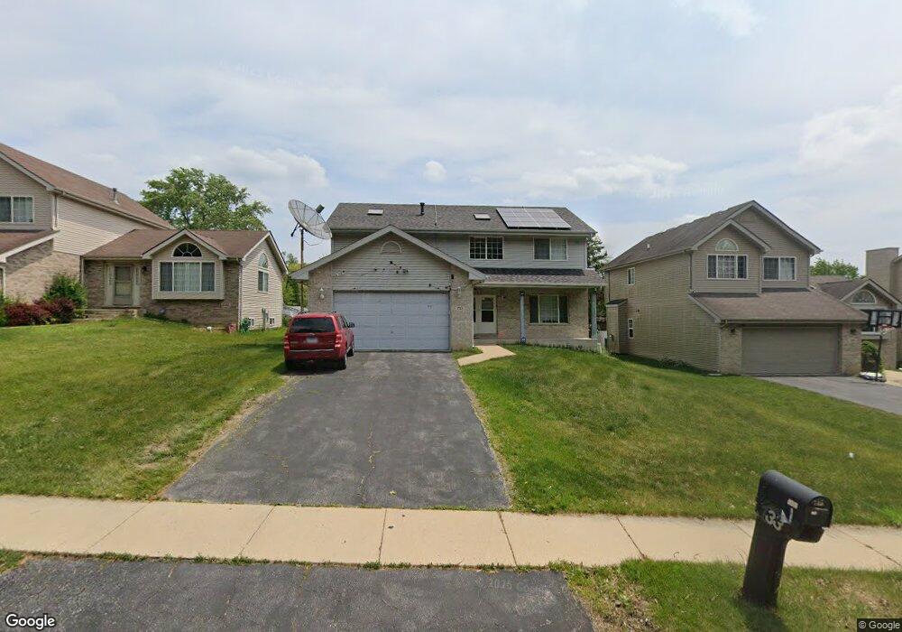
733 Wright Rd University Park, IL 60484
Estimated Value: $210,944 - $338,000
Studio
1
Bath
2,311
Sq Ft
$121/Sq Ft
Est. Value
About This Home
This home is located at 733 Wright Rd, University Park, IL 60484 and is currently estimated at $278,736, approximately $120 per square foot. 733 Wright Rd is a home located in Will County with nearby schools including Crete Elementary School, Crete-Monee Middle School, and Crete-Monee High School.
Ownership History
Date
Name
Owned For
Owner Type
Purchase Details
Closed on
Aug 1, 2002
Sold by
Fifth Third Bank
Bought by
Crane Christopher P
Current Estimated Value
Home Financials for this Owner
Home Financials are based on the most recent Mortgage that was taken out on this home.
Original Mortgage
$124,410
Interest Rate
6.64%
Create a Home Valuation Report for This Property
The Home Valuation Report is an in-depth analysis detailing your home's value as well as a comparison with similar homes in the area
Home Values in the Area
Average Home Value in this Area
Purchase History
| Date | Buyer | Sale Price | Title Company |
|---|---|---|---|
| Crane Christopher P | $173,500 | Chicago Title Insurance Co |
Source: Public Records
Mortgage History
| Date | Status | Borrower | Loan Amount |
|---|---|---|---|
| Closed | Crane Christopher P | $124,410 |
Source: Public Records
Tax History
| Year | Tax Paid | Tax Assessment Tax Assessment Total Assessment is a certain percentage of the fair market value that is determined by local assessors to be the total taxable value of land and additions on the property. | Land | Improvement |
|---|---|---|---|---|
| 2024 | $8,287 | $82,023 | $10,910 | $71,113 |
| 2023 | $8,287 | $70,709 | $9,405 | $61,304 |
| 2022 | $7,216 | $62,200 | $8,273 | $53,927 |
| 2021 | $6,867 | $57,562 | $7,523 | $50,039 |
| 2020 | $6,806 | $55,696 | $7,279 | $48,417 |
| 2019 | $6,781 | $52,818 | $6,903 | $45,915 |
| 2018 | $6,398 | $51,188 | $6,750 | $44,438 |
| 2017 | $6,541 | $49,668 | $6,539 | $43,129 |
| 2016 | $6,178 | $47,458 | $6,302 | $41,156 |
| 2015 | $6,540 | $44,566 | $5,831 | $38,735 |
| 2014 | $6,540 | $45,172 | $5,826 | $39,346 |
| 2013 | $6,540 | $47,300 | $6,100 | $41,200 |
Source: Public Records
Map
Nearby Homes
- 703 Circle Dr
- 735 Union Dr
- 807 Blackhawk Dr
- 807 Union Dr
- 655 Sullivan Ln
- 820 Sandra Dr Unit 2C
- 903 Blackhawk Dr
- 608 Sullivan Ln
- 882 White Oak Ln Unit 3
- 505 Barbara Ct
- 24625 S Western Ave
- 607 Sullivan Ln
- 918 Cordoba Ct
- 1015 Sierra Ct
- 401 Pebble Beach Grove Cir
- 754 Mission Dr
- 740 Mission St
- 523 Nathan Rd
- 2337 Valley View Ln
- 1031 Blackhawk Dr
- 731 Wright Rd
- 735 Wright Rd
- 737 Wright Rd
- 732 Blackhawk Dr
- 618 Sandra Dr
- 728 Blackhawk Dr
- 727 Wright Rd
- 730 Blackhawk Dr
- 734 Blackhawk Dr
- 726 Blackhawk Dr
- 725 Wright Rd
- 724 Blackhawk Dr
- 733 Blackhawk Dr
- 723 Wright Rd
- 722 Blackhawk Dr
- 617 Sandra Dr
- 735 Blackhawk Dr
- 737 Blackhawk Dr
- 731 Blackhawk Dr
- 800 Blackhawk Dr
Your Personal Tour Guide
Ask me questions while you tour the home.