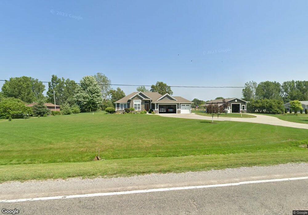
7330 Hospital Rd Freeland, MI 48623
Estimated Value: $405,000 - $547,374
3
Beds
4
Baths
1,890
Sq Ft
$260/Sq Ft
Est. Value
About This Home
This home is located at 7330 Hospital Rd, Freeland, MI 48623 and is currently estimated at $492,344, approximately $260 per square foot. 7330 Hospital Rd is a home with nearby schools including Freeland Learning Center, Freeland Elementary School, and Freeland Middle/High School.
Ownership History
Date
Name
Owned For
Owner Type
Purchase Details
Closed on
Dec 1, 2015
Sold by
Hamlin Carolyn and Hamlin Michael E
Bought by
Wills Cynthia J and Wills Danny E
Current Estimated Value
Home Financials for this Owner
Home Financials are based on the most recent Mortgage that was taken out on this home.
Interest Rate
3.95%
Purchase Details
Closed on
Jun 4, 2015
Sold by
Meylan Lori
Bought by
Ross Gary A and Ross Diane C
Purchase Details
Closed on
May 10, 2007
Sold by
Hamlin Eugene W
Bought by
Meylan Lori
Create a Home Valuation Report for This Property
The Home Valuation Report is an in-depth analysis detailing your home's value as well as a comparison with similar homes in the area
Home Values in the Area
Average Home Value in this Area
Purchase History
| Date | Buyer | Sale Price | Title Company |
|---|---|---|---|
| Wills Cynthia J | $97,000 | -- | |
| Ross Gary A | $38,000 | -- | |
| Meylan Lori | -- | -- |
Source: Public Records
Mortgage History
| Date | Status | Borrower | Loan Amount |
|---|---|---|---|
| Closed | Wills Cynthia J | -- | |
| Closed | Wills Cynthia J | -- |
Source: Public Records
Tax History Compared to Growth
Tax History
| Year | Tax Paid | Tax Assessment Tax Assessment Total Assessment is a certain percentage of the fair market value that is determined by local assessors to be the total taxable value of land and additions on the property. | Land | Improvement |
|---|---|---|---|---|
| 2025 | $5,375 | $257,000 | $0 | $0 |
| 2024 | $1,829 | $249,000 | $0 | $0 |
| 2023 | $1,742 | $224,400 | $0 | $0 |
| 2022 | $4,576 | $213,500 | $0 | $0 |
| 2021 | $4,147 | $153,500 | $0 | $0 |
| 2020 | $4,064 | $150,700 | $0 | $0 |
| 2019 | $3,942 | $147,500 | $0 | $0 |
| 2018 | $1,519 | $138,500 | $0 | $0 |
| 2017 | $3,634 | $140,600 | $0 | $0 |
| 2016 | $603 | $18,300 | $0 | $0 |
| 2014 | -- | $19,900 | $0 | $0 |
| 2013 | -- | $19,900 | $0 | $0 |
Source: Public Records
Map
Nearby Homes
- 6641 Pierce Rd
- 6790 Hospital Rd
- 7474 Kochville Rd
- 9325 Hospital Rd
- Parcel B 2 56 Acres N Center Rd Unit Parcel B
- Parcel C 2 56 Acres N Center Rd Unit Parcel C
- Parcel D 2 64 Acres N Center Rd Unit Parcel D
- 5874 Diamond Meadows Ln
- TBD Garfield Rd
- M-47 & Tittabawassee Rd
- 5430 Tittabawassee Rd
- 0000 Pierce Rd
- 5120 Midland Rd
- 4374 Island Dr W
- 6816 Spring Meadow Ct
- 1040 Wheelock St
- 9100 Brook Hollow Ln
- 9160 Brook Hollow Ln
- 4400 Tittabawassee Rd
- 10123 Hawk Dr
- 7280 Hospital Rd
- 7401 Hospital Rd
- 7353 Hospital Rd
- 7379 Hospital Rd
- 7264 Hospital Rd
- 7264 Hospital Rd
- 7313 Hospital Rd
- 7360 Hospital Rd
- 7263 Hospital Rd
- 7244 Hospital Rd
- 7470 Hospital Rd
- 7225 Hospital Rd
- 7166 Hospital Rd
- 7515 Hospital Rd
- 7514 Hospital Rd
- 7165 Hospital Rd
- 7165 Hospital Rd
- 7534 Hospital Rd
- 7161 Hospital Rd
- 7545 Hospital Rd