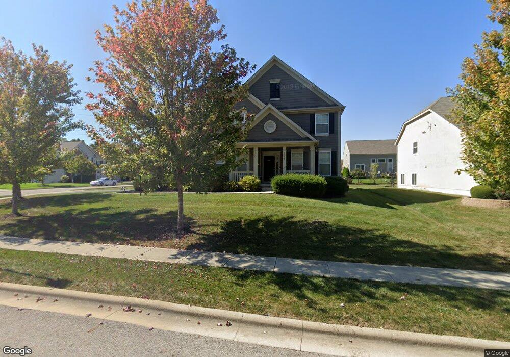
7332 Winfield Dr Unit 7099 Lewis Center, OH 43035
Orange NeighborhoodEstimated Value: $671,776 - $746,000
4
Beds
4
Baths
4,095
Sq Ft
$172/Sq Ft
Est. Value
About This Home
This home is located at 7332 Winfield Dr Unit 7099, Lewis Center, OH 43035 and is currently estimated at $703,694, approximately $171 per square foot. 7332 Winfield Dr Unit 7099 is a home located in Delaware County with nearby schools including Freedom Trail Elementary School, Olentangy Orange Middle School, and Orange High School.
Ownership History
Date
Name
Owned For
Owner Type
Purchase Details
Closed on
Aug 6, 2020
Sold by
Sukhramani Sumit and Sukhramani Pooja
Bought by
Cox Nathan Ryan and Cox Sara Patrice
Current Estimated Value
Home Financials for this Owner
Home Financials are based on the most recent Mortgage that was taken out on this home.
Original Mortgage
$433,800
Outstanding Balance
$384,811
Interest Rate
3%
Mortgage Type
New Conventional
Estimated Equity
$318,883
Purchase Details
Closed on
Oct 6, 2011
Sold by
M/I Homes Of Central Ohio Llc
Bought by
Sukhramani Sumit and Sukhramani Pooja
Home Financials for this Owner
Home Financials are based on the most recent Mortgage that was taken out on this home.
Original Mortgage
$349,320
Interest Rate
4.22%
Mortgage Type
New Conventional
Create a Home Valuation Report for This Property
The Home Valuation Report is an in-depth analysis detailing your home's value as well as a comparison with similar homes in the area
Home Values in the Area
Average Home Value in this Area
Purchase History
| Date | Buyer | Sale Price | Title Company |
|---|---|---|---|
| Cox Nathan Ryan | $482,000 | Advantage Title | |
| Sukhramani Sumit | $362,500 | Attorney |
Source: Public Records
Mortgage History
| Date | Status | Borrower | Loan Amount |
|---|---|---|---|
| Open | Cox Nathan Ryan | $433,800 | |
| Closed | Sukhramani Sumit | $349,320 |
Source: Public Records
Tax History Compared to Growth
Tax History
| Year | Tax Paid | Tax Assessment Tax Assessment Total Assessment is a certain percentage of the fair market value that is determined by local assessors to be the total taxable value of land and additions on the property. | Land | Improvement |
|---|---|---|---|---|
| 2024 | $11,369 | $204,930 | $31,500 | $173,430 |
| 2023 | $11,410 | $204,930 | $31,500 | $173,430 |
| 2022 | $10,467 | $152,810 | $24,500 | $128,310 |
| 2021 | $10,526 | $152,810 | $24,500 | $128,310 |
| 2020 | $10,575 | $152,810 | $24,500 | $128,310 |
| 2019 | $9,214 | $138,040 | $24,500 | $113,540 |
| 2018 | $9,255 | $138,040 | $24,500 | $113,540 |
| 2017 | $8,634 | $124,330 | $22,090 | $102,240 |
| 2016 | $8,881 | $124,330 | $22,090 | $102,240 |
| 2015 | $8,108 | $124,330 | $22,090 | $102,240 |
| 2014 | $8,223 | $124,330 | $22,090 | $102,240 |
| 2013 | $8,149 | $120,410 | $22,090 | $98,320 |
Source: Public Records
Map
Nearby Homes
- 3679 Birkland Cir
- 7631 Pleasant Colony Ct
- 3313 Glen Oaks Ct
- 2715 Tucker Trail
- 3902 Rivers Run Dr
- 2383 Bold Venture Dr
- 3138 E Powell Rd
- 1627 Bristol Commons Place
- 2216 Reeves Ave
- 2165 Ben Brush Place
- 7697 Bale Kenyon Rd
- 1746 E Powell Rd
- 3670 E Powell Rd
- 4515 McAlister Park Dr
- 4527 McAlister Park Dr
- 1923 Myrtle St
- 1955 Royal Oak Dr
- 6964 Saint Ninians St
- 0 E Orange Rd Unit lot 1
- 0 E Orange Rd
- 7332 Winfield Dr
- 7292 Winfield Dr
- 7374 Winfield Dr
- 7278 Winfield Dr
- 7388 Winfield Dr
- 7329 Winfield Dr
- 7307 Winfield Dr
- 7289 Winfield Dr
- 7343 Winfield Dr
- 7400 Winfield Dr
- 7315 Winfield Dr
- 7321 Winfield Dr
- 7260 Winfield Dr
- 7260 Winfield Dr Unit 7096
- 7273 Winfield Dr
- 7371 Winfield Dr
- 7371 Winfield Dr Unit 7086
- 7383 Winfield Dr
- 7383 Winfield Dr Unit 7085
- 7259 Winfield Dr