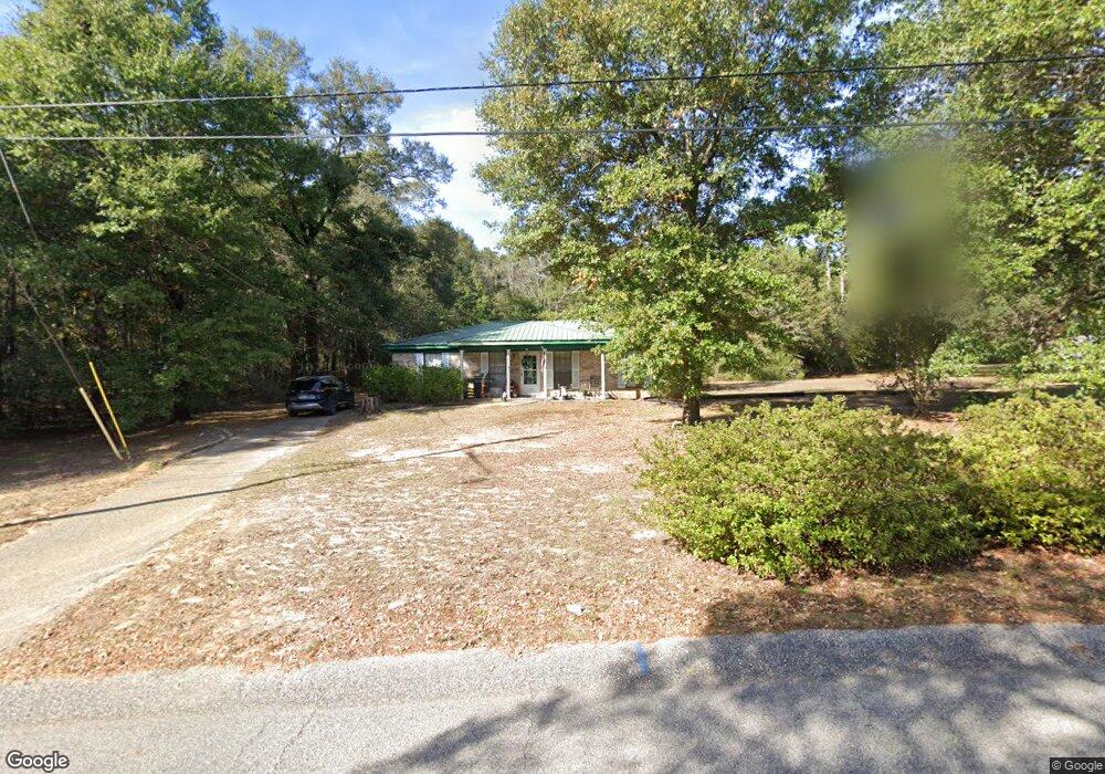
7333 Spaceview Dr Saraland, AL 36571
Outer Saraland NeighborhoodEstimated Value: $200,579 - $256,000
3
Beds
2
Baths
1,272
Sq Ft
$173/Sq Ft
Est. Value
About This Home
This home is located at 7333 Spaceview Dr, Saraland, AL 36571 and is currently estimated at $220,395, approximately $173 per square foot. 7333 Spaceview Dr is a home located in Mobile County with nearby schools including Saraland Elementary School, Nelson Leon Adams Middle School/Saraland Middle School, and Saraland High School.
Ownership History
Date
Name
Owned For
Owner Type
Purchase Details
Closed on
Jan 14, 1999
Sold by
Crosby Richard L and Crosby Betty L
Bought by
Williams Harold R and Williams Patricia N
Current Estimated Value
Home Financials for this Owner
Home Financials are based on the most recent Mortgage that was taken out on this home.
Original Mortgage
$72,188
Outstanding Balance
$16,686
Interest Rate
6.72%
Mortgage Type
FHA
Estimated Equity
$203,709
Create a Home Valuation Report for This Property
The Home Valuation Report is an in-depth analysis detailing your home's value as well as a comparison with similar homes in the area
Home Values in the Area
Average Home Value in this Area
Purchase History
| Date | Buyer | Sale Price | Title Company |
|---|---|---|---|
| Williams Harold R | -- | -- |
Source: Public Records
Mortgage History
| Date | Status | Borrower | Loan Amount |
|---|---|---|---|
| Open | Williams Harold R | $72,188 |
Source: Public Records
Tax History Compared to Growth
Tax History
| Year | Tax Paid | Tax Assessment Tax Assessment Total Assessment is a certain percentage of the fair market value that is determined by local assessors to be the total taxable value of land and additions on the property. | Land | Improvement |
|---|---|---|---|---|
| 2024 | $704 | $13,010 | $3,200 | $9,810 |
| 2023 | $673 | $12,420 | $3,520 | $8,900 |
| 2022 | $630 | $11,710 | $3,200 | $8,510 |
| 2021 | $680 | $12,550 | $4,250 | $8,300 |
| 2020 | $692 | $12,750 | $4,250 | $8,500 |
| 2019 | $647 | $11,980 | $4,250 | $7,730 |
| 2018 | $564 | $10,600 | $0 | $0 |
| 2017 | $579 | $10,860 | $0 | $0 |
| 2016 | $588 | $11,000 | $0 | $0 |
| 2013 | $505 | $10,920 | $0 | $0 |
Source: Public Records
Map
Nearby Homes
- 7420 Pake Rd
- 7366 Fir Dr
- 4514 Hickory Ln
- 7012 Kali Oka Rd
- 4567 Pine Ave
- 4571 Spruce Ave
- 7135 Cedar Dr Unit 1B
- 11301 Kali Oka Rd
- 0 Lafitte Rd Unit 7142258
- 6799 T M Brett Blvd
- 0 Charleston Ct Unit 7478152
- 0 Charleston Ct Unit 6 369803
- 0 Styles Dr Unit 7635647
- 0 Styles Dr Unit 7635747
- 0 Styles Dr Unit 7635768
- 0 Styles Dr Unit 7635851
- 6776 T M Brett Blvd Unit 31
- 6786 T M Brett Blvd Unit 14
- 6778 T M Brett Blvd Unit 30
- 6798 T M Brett Blvd Unit 2
- 7345 Spaceview Dr
- 0 Spaceview Dr
- 7325 Spaceview Dr
- 7354 Spaceview Dr
- 7360 Spaceview Dr
- 7361 Spaceview Dr
- 7315 Spaceview Dr
- 7344 Spaceview Dr
- 7426 Pake Rd
- 7315 Grissom Dr
- 7368 Spaceview Dr
- 7362 Kali Oka Rd
- 4330 Orbit Ave
- 7375 Spaceview Dr
- 7427 Pake Rd
- 7431 Pake Rd
- 7305 Grissom Dr
- 4288 Shepard Dr S
- 4344 Orbit Ave
- 7382 Spaceview Dr