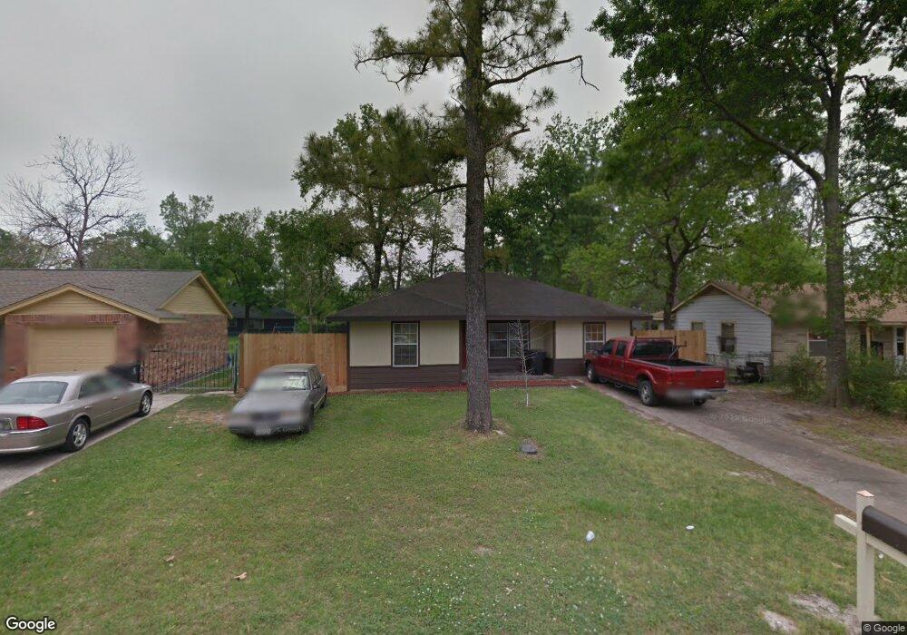
7334 Caddo Rd Houston, TX 77016
East Little York NeighborhoodEstimated Value: $156,000 - $181,000
3
Beds
1
Bath
1,305
Sq Ft
$129/Sq Ft
Est. Value
About This Home
This home is located at 7334 Caddo Rd, Houston, TX 77016 and is currently estimated at $167,977, approximately $128 per square foot. 7334 Caddo Rd is a home located in Harris County with nearby schools including Shadydale Elementary School, Forest Brook Middle, and North Forest High School.
Ownership History
Date
Name
Owned For
Owner Type
Purchase Details
Closed on
Dec 14, 2010
Sold by
Fannie Mae
Bought by
Perez Maria Celia
Current Estimated Value
Purchase Details
Closed on
Oct 5, 2010
Sold by
Lafear George P and La Fear Alison
Bought by
Federal National Mortgage Association
Purchase Details
Closed on
Jan 24, 2005
Sold by
Wealthmark Inc
Bought by
Lafear George P
Home Financials for this Owner
Home Financials are based on the most recent Mortgage that was taken out on this home.
Original Mortgage
$68,556
Interest Rate
5.87%
Mortgage Type
Purchase Money Mortgage
Purchase Details
Closed on
May 28, 2004
Sold by
Ontrack Partners Inc
Bought by
Wealthmark Inc
Home Financials for this Owner
Home Financials are based on the most recent Mortgage that was taken out on this home.
Original Mortgage
$61,000
Interest Rate
6.32%
Mortgage Type
Purchase Money Mortgage
Purchase Details
Closed on
Mar 21, 2003
Sold by
Partners Enterprise
Bought by
Wealthmark Inc and Ontrack Partners Inc
Home Financials for this Owner
Home Financials are based on the most recent Mortgage that was taken out on this home.
Original Mortgage
$50,000
Interest Rate
5.71%
Mortgage Type
Purchase Money Mortgage
Purchase Details
Closed on
Aug 7, 2001
Sold by
Howard Chistene and Howard Chester
Bought by
Partners Enterprise
Create a Home Valuation Report for This Property
The Home Valuation Report is an in-depth analysis detailing your home's value as well as a comparison with similar homes in the area
Home Values in the Area
Average Home Value in this Area
Purchase History
| Date | Buyer | Sale Price | Title Company |
|---|---|---|---|
| Perez Maria Celia | -- | Old Republic National Title | |
| Federal National Mortgage Association | $56,616 | None Available | |
| Lafear George P | -- | South Land Title Of Montgome | |
| Wealthmark Inc | -- | South Land Title Montgomerer | |
| Wealthmark Inc | -- | Stewart Title | |
| Partners Enterprise | $20,100 | -- |
Source: Public Records
Mortgage History
| Date | Status | Borrower | Loan Amount |
|---|---|---|---|
| Previous Owner | Lafear George P | $68,556 | |
| Previous Owner | Wealthmark Inc | $61,000 | |
| Previous Owner | Wealthmark Inc | $50,000 |
Source: Public Records
Tax History Compared to Growth
Tax History
| Year | Tax Paid | Tax Assessment Tax Assessment Total Assessment is a certain percentage of the fair market value that is determined by local assessors to be the total taxable value of land and additions on the property. | Land | Improvement |
|---|---|---|---|---|
| 2025 | $3,103 | $155,139 | $52,548 | $102,591 |
| 2024 | $3,103 | $148,294 | $52,548 | $95,746 |
| 2023 | $3,103 | $160,440 | $43,488 | $116,952 |
| 2022 | $2,889 | $131,203 | $36,240 | $94,963 |
| 2021 | $2,646 | $113,514 | $27,180 | $86,334 |
| 2020 | $2,160 | $89,213 | $18,845 | $70,368 |
| 2019 | $2,050 | $80,998 | $12,394 | $68,604 |
| 2018 | $1,615 | $63,805 | $12,394 | $51,411 |
| 2017 | $1,613 | $63,805 | $12,394 | $51,411 |
| 2016 | $1,613 | $63,805 | $12,394 | $51,411 |
| 2015 | $1,003 | $48,004 | $12,394 | $35,610 |
| 2014 | $1,003 | $39,035 | $12,394 | $26,641 |
Source: Public Records
Map
Nearby Homes
- 0 Bretshire Dr Unit 83088734
- 0 Bretshire Dr Unit 61965426
- 7338 Bigwood St
- 7242 Bretshire Dr
- 7314 Sterlingshire St
- 7218 Bretshire Dr
- 0 Wileyvale Rd Unit 37533417
- 0 Laura Koppe Rd Unit 64066450
- 0 Lockwood Unit 97801497
- 0 Wileyvale Rd Unit 98938709
- 7305 Yoe St
- 7252 Parker Rd
- 7220 Parker Rd
- 7306 Parker Rd
- 7402 Yoe St
- 10106 Cheeves Dr
- 7234 Boggess Rd
- 9702 Crofton St
- 10101 Rebel Rd
- 7603 Caddo Rd
- 7338 Caddo Rd
- 7330 Caddo Rd
- 0 Bretshire Dr Unit 10375406
- 0 Plaag St Unit 20714754
- 0 Lynnfield Ave Unit 63515809
- 0 Bretshire Dr Unit 58874974
- 0 Plaag St Unit 2170054
- 0 Bretshire Dr Unit 832270
- 0 Bretshire Dr Unit 3543291
- 0 Lynnfield Ave Unit 29498512
- 0 Sayers St Unit 74853729
- 0 Plaag St Unit 51200074
- 0 Bretshire Dr Unit 65702307
- 0 Lynnfield Ave Unit 74099293
- 0 Bretshire Dr Unit 5553612
- 0 Plaag St Unit 48021274
- 0 NE Pembrook Unit 46237656
- 0 Westbrook Unit 44421368
- 0 Bretshire Dr Unit 71001436
- 0 Plaag St Unit 35361864