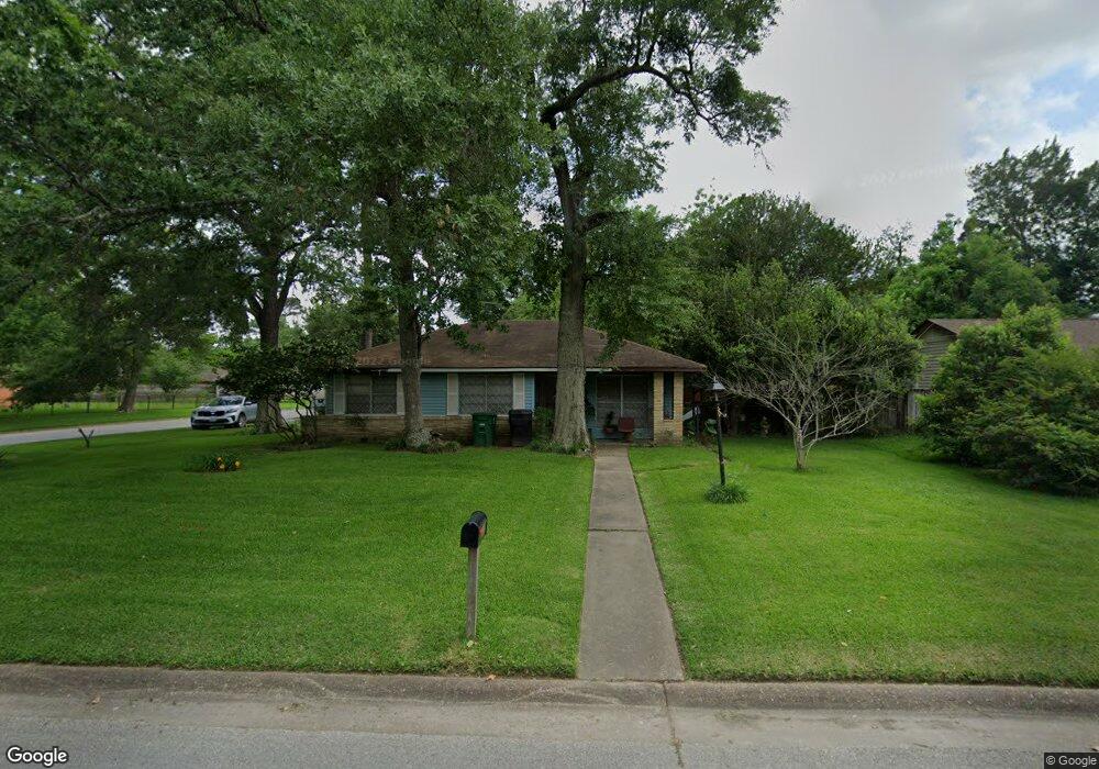
7334 Saunders Rd Houston, TX 77016
East Little York NeighborhoodEstimated Value: $163,000 - $167,000
3
Beds
2
Baths
1,083
Sq Ft
$152/Sq Ft
Est. Value
About This Home
This home is located at 7334 Saunders Rd, Houston, TX 77016 and is currently estimated at $164,383, approximately $151 per square foot. 7334 Saunders Rd is a home located in Harris County with nearby schools including Shadydale Elementary School, Forest Brook Middle, and North Forest High School.
Ownership History
Date
Name
Owned For
Owner Type
Purchase Details
Closed on
Jan 23, 2009
Sold by
Us Bank National Association
Bought by
Bravo Noelia
Current Estimated Value
Purchase Details
Closed on
Sep 2, 2008
Sold by
Burton Stanley
Bought by
Us Bank Na and Bank Of America Na Abfc 2006-He1
Purchase Details
Closed on
Aug 25, 2006
Sold by
Burton Shirley
Bought by
Burton Stanley
Home Financials for this Owner
Home Financials are based on the most recent Mortgage that was taken out on this home.
Original Mortgage
$55,500
Interest Rate
6.79%
Mortgage Type
Purchase Money Mortgage
Create a Home Valuation Report for This Property
The Home Valuation Report is an in-depth analysis detailing your home's value as well as a comparison with similar homes in the area
Home Values in the Area
Average Home Value in this Area
Purchase History
| Date | Buyer | Sale Price | Title Company |
|---|---|---|---|
| Bravo Noelia | -- | Charter Title Company | |
| Us Bank National Association | -- | Charter Title Company | |
| Us Bank Na | $25,380 | None Available | |
| Burton Stanley | -- | None Available |
Source: Public Records
Mortgage History
| Date | Status | Borrower | Loan Amount |
|---|---|---|---|
| Previous Owner | Burton Stanley | $55,500 |
Source: Public Records
Tax History Compared to Growth
Tax History
| Year | Tax Paid | Tax Assessment Tax Assessment Total Assessment is a certain percentage of the fair market value that is determined by local assessors to be the total taxable value of land and additions on the property. | Land | Improvement |
|---|---|---|---|---|
| 2025 | $2,745 | $136,629 | $54,946 | $81,683 |
| 2024 | $2,745 | $131,182 | $54,946 | $76,236 |
| 2023 | $2,745 | $140,659 | $45,473 | $95,186 |
| 2022 | $2,509 | $113,928 | $37,894 | $76,034 |
| 2021 | $2,310 | $99,126 | $28,421 | $70,705 |
| 2020 | $2,120 | $87,545 | $19,705 | $67,840 |
| 2019 | $2,037 | $80,507 | $12,960 | $67,547 |
| 2018 | $1,613 | $63,753 | $12,960 | $50,793 |
| 2017 | $1,612 | $63,753 | $12,960 | $50,793 |
| 2016 | $1,612 | $63,753 | $12,960 | $50,793 |
| 2015 | $548 | $23,441 | $12,960 | $10,481 |
| 2014 | $548 | $21,336 | $12,960 | $8,376 |
Source: Public Records
Map
Nearby Homes
- 10313 Blades St
- 7449 Gleason Rd
- 7818 Laurel Gem Dr
- 7827 Laurel Gem Dr
- 7823 Laurel Gem Dr
- 7821 Laurel Gem Dr
- 7812 Laurel Gem Dr
- 7830 Laurel Gem Dr
- 7824 Laurel Gem Dr
- 7819 Laurel Gem Dr
- 7815 Laurel Gem Dr
- 7226 Gore Dr
- 7451 Langley Rd
- 10317 Kelburn Dr
- 7210 Colton St
- 10430 Royal Oaks Dr
- 000 Rebel Rd
- 10206 Cheeves Dr
- 7234 Boggess Rd
- 10526 Hollyglen Dr
- 7330 Saunders Rd
- 7326 Saunders Rd
- 7333 Gleason Rd
- 7402 Saunders Rd
- 7329 Gleason Rd
- 10505 Lera St
- 7325 Gleason Rd
- 7401 Gleason Rd
- 7322 Saunders Rd
- 7406 Saunders Rd
- 7339 Orlando St
- 7405 Saunders Rd
- 7321 Gleason Rd
- 7405 Gleason Rd
- 10509 Lera St
- 7410 Saunders Rd
- 7409 Saunders Rd
- 7317 Gleason Rd
- 7335 Orlando St
- 7409 Gleason Rd