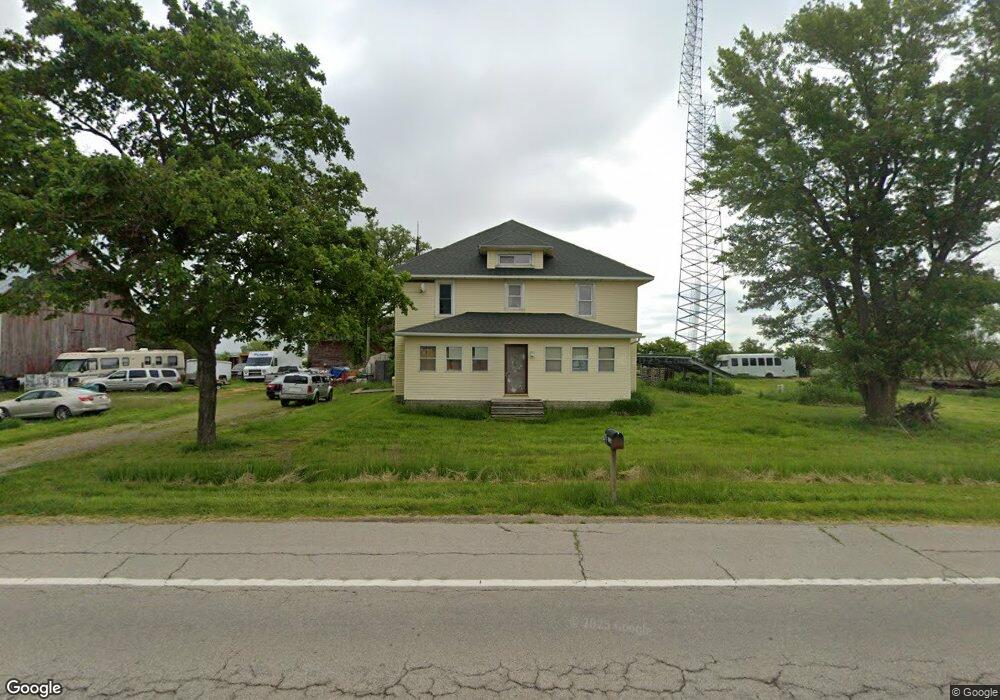
7334 Us Route 127 Paulding, OH 45879
Estimated Value: $174,257 - $254,000
5
Beds
2
Baths
3,136
Sq Ft
$68/Sq Ft
Est. Value
About This Home
This home is located at 7334 Us Route 127, Paulding, OH 45879 and is currently estimated at $214,314, approximately $68 per square foot. 7334 Us Route 127 is a home located in Paulding County with nearby schools including Wayne Trace High School.
Ownership History
Date
Name
Owned For
Owner Type
Purchase Details
Closed on
Oct 17, 2008
Sold by
Federal Home Loan Mortgage Corporation
Bought by
Lewis Dennis L
Current Estimated Value
Home Financials for this Owner
Home Financials are based on the most recent Mortgage that was taken out on this home.
Original Mortgage
$76,800
Outstanding Balance
$49,879
Interest Rate
5.95%
Mortgage Type
New Conventional
Estimated Equity
$164,435
Purchase Details
Closed on
Jul 31, 2008
Sold by
Thomas Anne M and Chase Home Finance Llc
Bought by
Federal Home Loan Mortgage Corporation
Purchase Details
Closed on
Jul 11, 2003
Sold by
Bennett Bernadette E
Bought by
Lewis Dennis L
Purchase Details
Closed on
Jun 17, 2002
Sold by
Bennett Bernadette E
Bought by
Lewis Dennis L
Purchase Details
Closed on
Aug 13, 1999
Bought by
Lewis Dennis L
Create a Home Valuation Report for This Property
The Home Valuation Report is an in-depth analysis detailing your home's value as well as a comparison with similar homes in the area
Home Values in the Area
Average Home Value in this Area
Purchase History
| Date | Buyer | Sale Price | Title Company |
|---|---|---|---|
| Lewis Dennis L | -- | None Available | |
| Federal Home Loan Mortgage Corporation | $60,000 | None Available | |
| Lewis Dennis L | $127,600 | -- | |
| Lewis Dennis L | -- | -- | |
| Lewis Dennis L | $55,000 | -- |
Source: Public Records
Mortgage History
| Date | Status | Borrower | Loan Amount |
|---|---|---|---|
| Open | Lewis Dennis L | $76,800 |
Source: Public Records
Tax History Compared to Growth
Tax History
| Year | Tax Paid | Tax Assessment Tax Assessment Total Assessment is a certain percentage of the fair market value that is determined by local assessors to be the total taxable value of land and additions on the property. | Land | Improvement |
|---|---|---|---|---|
| 2024 | $1,461 | $42,460 | $9,910 | $32,550 |
| 2023 | $1,461 | $42,460 | $9,910 | $32,550 |
| 2022 | $1,391 | $42,460 | $9,910 | $32,550 |
| 2021 | $1,252 | $33,360 | $9,910 | $23,450 |
| 2020 | $1,294 | $33,360 | $9,910 | $23,450 |
| 2019 | $1,300 | $32,240 | $9,910 | $22,330 |
| 2018 | $1,155 | $32,240 | $9,910 | $22,330 |
| 2017 | $1,156 | $32,240 | $9,910 | $22,330 |
| 2016 | $1,123 | $32,240 | $9,910 | $22,330 |
| 2015 | $1,051 | $30,800 | $9,310 | $21,490 |
| 2014 | $1,064 | $30,800 | $9,310 | $21,490 |
| 2013 | $1,157 | $30,800 | $9,310 | $21,490 |
Source: Public Records
Map
Nearby Homes
- 12783 Road 82
- 225 2nd St
- 14255 Road 126
- 14830 Road 126
- 750 E Perry St
- 301 S Williams St
- 300 S Williams St
- 720 W Wayne St
- 717 W Harrison St
- 720 W Perry St
- 614 W Jackson St
- 215 N Dewitt St
- 606 Lincoln Ave
- 0 Road 111
- 418 E Baldwin St
- 320 E Baldwin Ave
- 616 N Dix St
- 752 N Dix St
- 0000 Ohio 111
- 1045 Emerald Rd
- 7477 Us Route 127
- 7742 Us Route 127
- 6894 Us Route 127
- 12783 Road 82 Unit 10
- 12783 Road 82 Unit 8
- 12783 Road 82 Unit 1
- 12783 Road 82
- 13368 Road 82
- 780 Third
- 325 Second
- 7776 Us Route 127
- 2 Alexander St
- 1 Alexander St
- 0 Alexander St
- 285 2nd St
- 440 1st St
- 12815 Tr 92
- 0 St Rt 127 Unit 5031441
- 0 St Rt 127 Unit 5086649