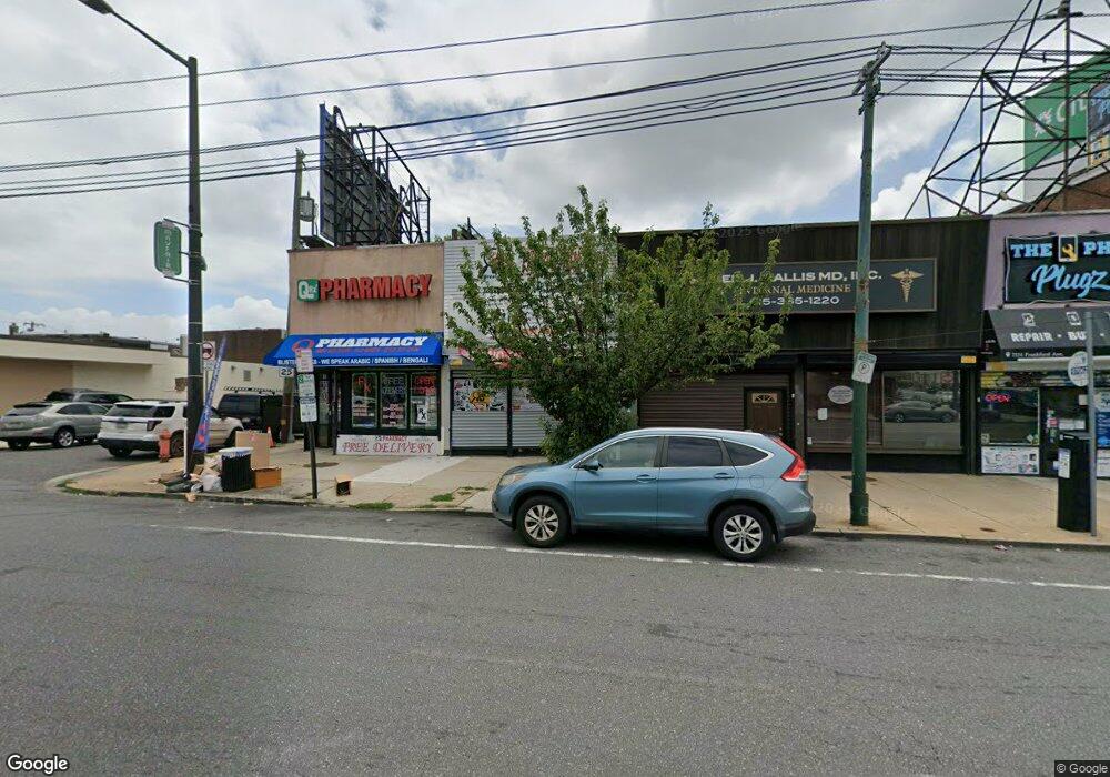
7337 Frankford Ave Philadelphia, PA 19136
Holmesburg NeighborhoodEstimated Value: $280,018
--
Bed
--
Bath
1,296
Sq Ft
$216/Sq Ft
Est. Value
About This Home
This home is located at 7337 Frankford Ave, Philadelphia, PA 19136 and is currently estimated at $280,018, approximately $216 per square foot. 7337 Frankford Ave is a home located in Philadelphia County with nearby schools including Edwin Forrest Elementary School, Lincoln High School, and Meehan Austin Middle School.
Ownership History
Date
Name
Owned For
Owner Type
Purchase Details
Closed on
Dec 28, 2017
Sold by
Baker Gail
Bought by
Cottman Ne Llc
Current Estimated Value
Home Financials for this Owner
Home Financials are based on the most recent Mortgage that was taken out on this home.
Original Mortgage
$105,000
Interest Rate
3.99%
Mortgage Type
Commercial
Purchase Details
Closed on
Mar 28, 2001
Sold by
S & L Enterprises
Bought by
Malitas Fotios and Malitas Alexandra
Home Financials for this Owner
Home Financials are based on the most recent Mortgage that was taken out on this home.
Original Mortgage
$80,000
Interest Rate
7.05%
Mortgage Type
Commercial
Create a Home Valuation Report for This Property
The Home Valuation Report is an in-depth analysis detailing your home's value as well as a comparison with similar homes in the area
Home Values in the Area
Average Home Value in this Area
Purchase History
| Date | Buyer | Sale Price | Title Company |
|---|---|---|---|
| Cottman Ne Llc | $162,000 | Nova Abstract Llc | |
| Malitas Fotios | $100,000 | -- |
Source: Public Records
Mortgage History
| Date | Status | Borrower | Loan Amount |
|---|---|---|---|
| Previous Owner | Cottman Ne Llc | $105,000 | |
| Previous Owner | Malitas Fotios | $80,000 |
Source: Public Records
Tax History Compared to Growth
Tax History
| Year | Tax Paid | Tax Assessment Tax Assessment Total Assessment is a certain percentage of the fair market value that is determined by local assessors to be the total taxable value of land and additions on the property. | Land | Improvement |
|---|---|---|---|---|
| 2025 | $2,496 | $204,500 | $40,900 | $163,600 |
| 2024 | $2,496 | $204,500 | $40,900 | $163,600 |
| 2023 | $2,496 | $178,300 | $35,667 | $142,633 |
| 2022 | $2,284 | $178,300 | $35,667 | $142,633 |
| 2021 | $2,284 | $0 | $0 | $0 |
| 2020 | $2,284 | $0 | $0 | $0 |
| 2019 | $2,268 | $0 | $0 | $0 |
| 2018 | $2,434 | $0 | $0 | $0 |
| 2017 | $1,971 | $0 | $0 | $0 |
| 2016 | $1,971 | $0 | $0 | $0 |
| 2015 | $1,887 | $0 | $0 | $0 |
| 2014 | -- | $140,800 | $25,000 | $115,800 |
| 2012 | -- | $43,840 | $19,626 | $24,214 |
Source: Public Records
Map
Nearby Homes
- 4021 Aldine St
- 4046 Aldine St
- 4057 Teesdale St
- 4056 Teesdale St
- 3550 Tudor St
- 4011 Bleigh Ave
- 4207 Bleigh Ave
- 4233 Cottman Ave
- 4016 Vista St
- 4224 Cottman Ave
- 4032 Vista St
- 3448 Tudor St
- 3532 Englewood St
- 7232 Walker St
- 3448 Ryan Ave
- 3522 Englewood St
- 4329 Teesdale St
- 3547 Shelmire Ave
- 4232 Shelmire Ave
- 3413 Tudor St
- 7339 Frankford Ave
- 7331 Frankford Ave
- 4010 Aldine St
- 4012 Aldine St
- 7341 Frankford Ave
- 4014 Aldine St
- 4013 Teesdale St
- 4016 Aldine St
- 4016 Aldine St Unit 1
- 4015 Teesdale St
- 4017 Teesdale St
- 4018 Aldine St
- 4019 Teesdale St
- 4020 Aldine St
- 4021 Teesdale St
- 4013 Aldine St
- 4022 Aldine St
- 4015 Aldine St
- 4023 Teesdale St
- 4017 Aldine St