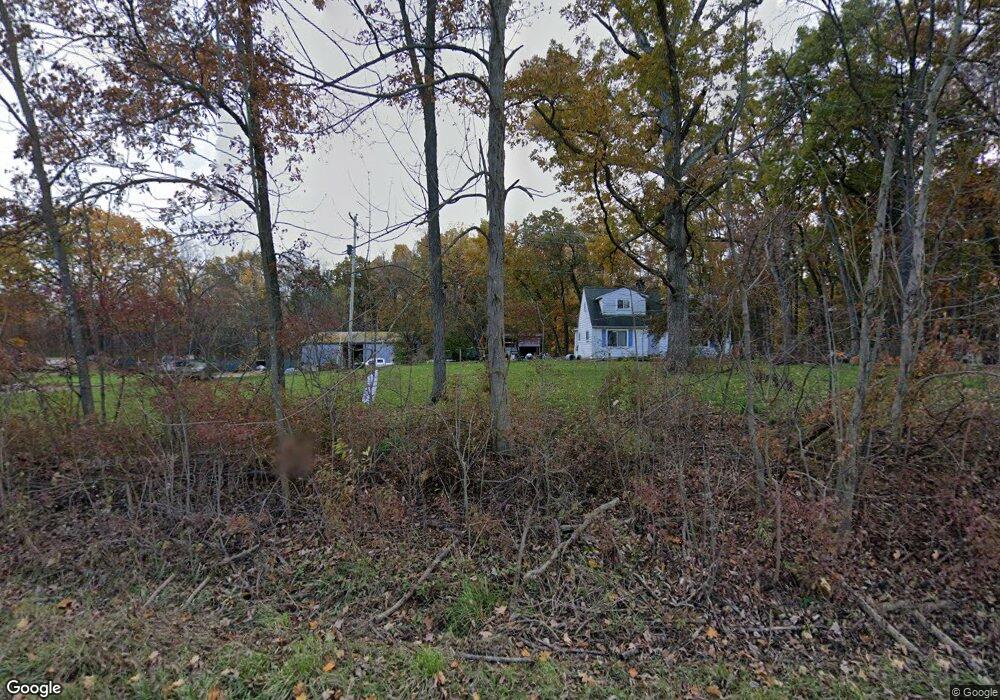
7339 W Rolston Rd Linden, MI 48451
Estimated Value: $221,000 - $403,185
3
Beds
2
Baths
1,666
Sq Ft
$198/Sq Ft
Est. Value
About This Home
This home is located at 7339 W Rolston Rd, Linden, MI 48451 and is currently estimated at $329,046, approximately $197 per square foot. 7339 W Rolston Rd is a home located in Genesee County with nearby schools including Central Elementary School and Linden High School.
Ownership History
Date
Name
Owned For
Owner Type
Purchase Details
Closed on
Oct 4, 2021
Sold by
Bedell Ii Timothy P and Bedell Jill M
Bought by
Bedell Ii Family Trust
Current Estimated Value
Purchase Details
Closed on
Oct 28, 2019
Sold by
Bedell Timothy P and Bedell Dolores D
Bought by
Bedell Timothy P and Bedell Jimm M
Home Financials for this Owner
Home Financials are based on the most recent Mortgage that was taken out on this home.
Original Mortgage
$115,000
Interest Rate
3.6%
Mortgage Type
New Conventional
Purchase Details
Closed on
Aug 15, 2013
Sold by
Bedell Timothy P and Bedell Dolores B
Bought by
Bedell Timothy P and Bedell Jill M
Purchase Details
Closed on
Apr 30, 2013
Sold by
Bedell Dolores D and Beatrice M Chupek Living Trust
Bought by
Bedell Dolores D
Purchase Details
Closed on
Jun 4, 2007
Sold by
Chupek Beatrice M and Chupek John T
Bought by
Chupek Beatrice M and Beatrice M Chupek Living Trust
Create a Home Valuation Report for This Property
The Home Valuation Report is an in-depth analysis detailing your home's value as well as a comparison with similar homes in the area
Home Values in the Area
Average Home Value in this Area
Purchase History
| Date | Buyer | Sale Price | Title Company |
|---|---|---|---|
| Bedell Ii Family Trust | -- | None Listed On Document | |
| Bedell Timothy P | $142,500 | Cislo Title Co | |
| Bedell Timothy P | -- | None Available | |
| Bedell Timothy P | -- | None Available | |
| Bedell Dolores D | -- | None Available | |
| Chupek Beatrice M | -- | None Available |
Source: Public Records
Mortgage History
| Date | Status | Borrower | Loan Amount |
|---|---|---|---|
| Previous Owner | Bedell Timothy P | $115,000 |
Source: Public Records
Tax History Compared to Growth
Tax History
| Year | Tax Paid | Tax Assessment Tax Assessment Total Assessment is a certain percentage of the fair market value that is determined by local assessors to be the total taxable value of land and additions on the property. | Land | Improvement |
|---|---|---|---|---|
| 2025 | $3,449 | $187,300 | $0 | $0 |
| 2024 | $1,475 | $148,600 | $0 | $0 |
| 2023 | $1,408 | $150,100 | $0 | $0 |
| 2022 | $3,164 | $135,400 | $0 | $0 |
| 2021 | $3,126 | $125,000 | $0 | $0 |
| 2020 | $1,249 | $118,700 | $0 | $0 |
| 2019 | $1,254 | $110,600 | $0 | $0 |
| 2018 | $2,908 | $92,600 | $0 | $0 |
| 2017 | $2,785 | $92,600 | $0 | $0 |
| 2016 | $2,818 | $90,500 | $0 | $0 |
| 2015 | $2,212 | $80,300 | $0 | $0 |
| 2014 | $1,162 | $72,600 | $0 | $0 |
Source: Public Records
Map
Nearby Homes
- Parcel E Hogan Rd
- 13065 White Oaks Unit 17
- 1590 W Rolston Rd
- 5290 Spring Meadows Way
- 15082 Meadow Ln
- 437 Sweet Briar Ridge Unit 70
- 12715 Ivy Ln
- 12711 Ivy Ln
- 321 Rustic Trail Unit 92
- 6342 Restwood Dr
- 13158 Stony Brook Pass
- 13150 Westwinds Dr
- 13180 Westwinds Dr
- 13204 Westwinds Dr
- 13168 Westwinds Dr
- 13186 Westwinds Dr
- 13138 Westwinds Dr
- 13144 Westwinds Dr
- 13102 Westwinds Dr
- 13096 Westwinds Dr
- 7391 W Rolston Rd
- 7279 W Rolston Rd
- 7279 W Rolston Rd
- 7393 W Rolston Rd
- 7245 W Rolston Rd
- 7425 W Rolston Rd
- 7425 W Rolston Rd
- 7234 W Rolston Rd
- 7310 W Rolston Rd
- 7143 W Rolston Rd
- 7440 W Rolston Rd
- 7468 W Rolston Rd
- 8021 W Rolston Rd
- 7500 W Rolston Rd
- 7067 W Rolston Rd
- 7156 W Rolston Rd
- 8122 W Rolston Rd
- 6581 W Rolston Rd
- 6575 W Rolston Rd
- 8178 W Rolston Rd