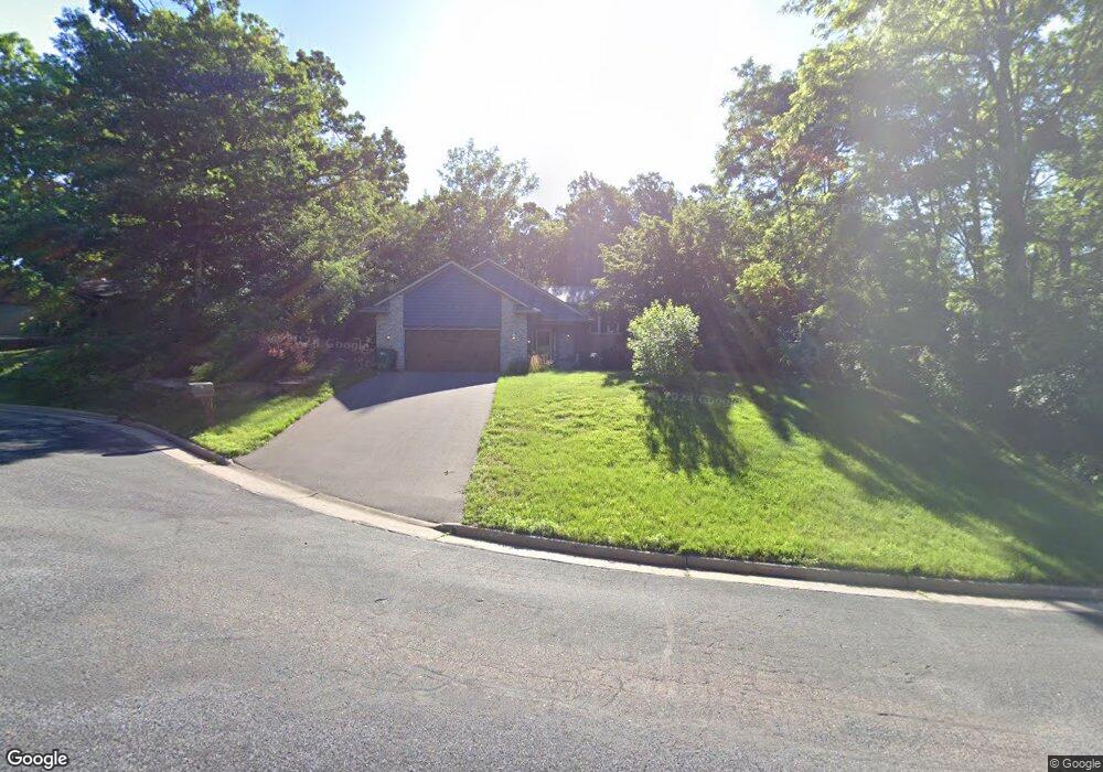
734 Deer Path Rd Hudson, WI 54016
Estimated Value: $406,725 - $495,000
Studio
--
Bath
--
Sq Ft
16,858
Sq Ft Lot
About This Home
This home is located at 734 Deer Path Rd, Hudson, WI 54016 and is currently estimated at $442,431. 734 Deer Path Rd is a home located in St. Croix County with nearby schools including North Hudson Elementary School, Hudson Middle School, and Hudson High School.
Ownership History
Date
Name
Owned For
Owner Type
Purchase Details
Closed on
Jul 25, 2007
Sold by
Riege Christine L and Ferron Christine L
Bought by
Schrack Michael and Schrack Lisa
Current Estimated Value
Home Financials for this Owner
Home Financials are based on the most recent Mortgage that was taken out on this home.
Original Mortgage
$80,000
Interest Rate
6.79%
Mortgage Type
New Conventional
Create a Home Valuation Report for This Property
The Home Valuation Report is an in-depth analysis detailing your home's value as well as a comparison with similar homes in the area
Home Values in the Area
Average Home Value in this Area
Purchase History
| Date | Buyer | Sale Price | Title Company |
|---|---|---|---|
| Schrack Michael | $262,500 | River Valley Abstract & Titl |
Source: Public Records
Mortgage History
| Date | Status | Borrower | Loan Amount |
|---|---|---|---|
| Closed | Schrack Michael | $80,000 |
Source: Public Records
Tax History
| Year | Tax Paid | Tax Assessment Tax Assessment Total Assessment is a certain percentage of the fair market value that is determined by local assessors to be the total taxable value of land and additions on the property. | Land | Improvement |
|---|---|---|---|---|
| 2025 | $4,462 | $330,000 | $71,900 | $258,100 |
| 2024 | $42 | $330,000 | $71,900 | $258,100 |
| 2023 | $4,006 | $330,000 | $71,900 | $258,100 |
| 2022 | $4,040 | $330,000 | $71,900 | $258,100 |
| 2021 | $3,992 | $204,600 | $58,000 | $146,600 |
| 2020 | $3,839 | $204,600 | $58,000 | $146,600 |
| 2019 | $3,589 | $204,600 | $58,000 | $146,600 |
| 2018 | $3,587 | $204,600 | $58,000 | $146,600 |
| 2017 | $3,451 | $204,600 | $58,000 | $146,600 |
| 2016 | $3,451 | $204,600 | $58,000 | $146,600 |
| 2015 | $3,182 | $204,600 | $58,000 | $146,600 |
| 2014 | $3,154 | $204,600 | $58,000 | $146,600 |
| 2013 | $3,471 | $226,700 | $74,300 | $152,400 |
Source: Public Records
Map
Nearby Homes
- 1110 Partridge Ln
- 1029 Sommers St N
- 1031 Sommers St N
- 1102 Sommers St N
- 602 Prairie Dr N
- 1143 Sommers St N
- 641 8th St N
- 612 4th St N Unit 15
- 811 Fox Tree Ln N
- 241 Starrwood
- 214 Galahad Place N
- 709 Saint Croix St N
- 403 7th St N
- 888 Bluebird Ct N
- 312 Meadow Dr N
- 1205 Riverside Dr N
- 1205 Riverside Drive N
- 1054 Cottonwood Dr
- 1075 Autumn Oak Ln
- 322 5th St N
- 738 Deer Path Rd
- 737 Hunters Cir
- 726 Deer Path Rd
- 733 Hunters Cir
- 729 Deer Path Rd
- 742 Summit Ln N
- 733 Deer Path Rd N
- 733 Deer Path Rd
- 737 Deer Path Rd
- 729 Deer Path Rd
- 741 Hunters Cir
- 741 Summit Ln N
- 723 Deer Path Rd
- 1102 Partridge Ln
- 724 Woodcrest Dr N
- 1106 Partridge Ln
- 730 Woodcrest Dr N
- 1110 Partridge Ln N
- 720 Woodcrest Dr N
- 734 Woodcrest Dr N
Your Personal Tour Guide
Ask me questions while you tour the home.