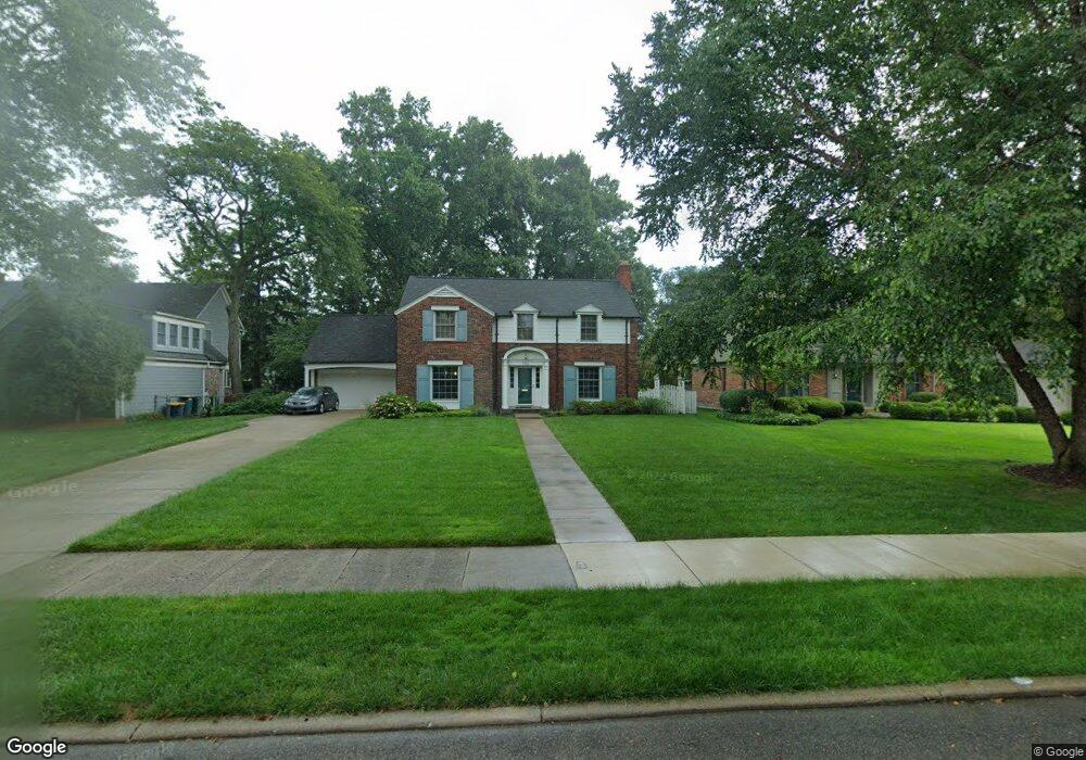
734 Middlesex Rd Grosse Pointe Park, MI 48230
Grosse Pointe Park AreaEstimated Value: $689,000 - $831,000
About This Home
This home is located at 734 Middlesex Rd, Grosse Pointe Park, MI 48230 and is currently estimated at $777,484, approximately $285 per square foot. 734 Middlesex Rd is a home located in Wayne County with nearby schools including Pierce Middle School, Grosse Pointe South High School, and Detroit Merit Charter Academy.
Ownership History
We collect this data history from publicly available records. To have your information removed, we recommend requesting removal directly through your county’s website.
Purchase Details
Purchase Details
Purchase Details
Purchase Details
Home Values in the Area
Average Home Value in this Area
Purchase History
We collect this data history from publicly available records. To have your information removed, we recommend requesting removal directly through your county’s website.
| Date | Buyer | Sale Price | Title Company |
|---|---|---|---|
| $500,000 | Lawyers Title Insurance Co | ||
| -- | -- | ||
| $270,347 | -- | ||
| $270,347 | -- |
Tax History
We collect this data history from publicly available records. To have your information removed, we recommend requesting removal directly through your county’s website.
| Year | Tax Paid | Tax Assessment Tax Assessment Total Assessment is a certain percentage of the fair market value that is determined by local assessors to be the total taxable value of land and additions on the property. | Land | Improvement |
|---|---|---|---|---|
| 2025 | $5,887 | $348,000 | $0 | $0 |
| 2024 | $5,666 | $327,000 | $0 | $0 |
| 2023 | $5,411 | $310,200 | $0 | $0 |
| 2022 | $5,141 | $246,100 | $0 | $0 |
| 2021 | $10,137 | $226,000 | $0 | $0 |
| 2019 | $10,431 | $217,500 | $0 | $0 |
| 2018 | $4,902 | $193,600 | $0 | $0 |
| 2017 | $10,913 | $139,500 | $0 | $0 |
| 2016 | $10,214 | $208,400 | $0 | $0 |
| 2015 | $18,343 | $200,800 | $0 | $0 |
| 2013 | $17,770 | $180,800 | $0 | $0 |
| 2012 | $4,974 | $190,200 | $68,900 | $121,300 |
Map
- 758 Middlesex Rd
- 757 Middlesex Rd
- 701 Balfour St
- 784 Barrington Rd
- 688 Balfour St
- 821 Pemberton Rd
- 873 - 875 Nottingham Rd
- 615 Lakepointe St
- 600 Middlesex Rd
- 580 Alter Rd
- 925 Nottingham Rd Unit 927
- 648 Alter Rd
- 542 Lakepointe St
- 795 Harcourt Rd Unit 97
- 432 Manistique St
- 576 Manistique St
- 764 Harcourt Rd
- 979 Lakepointe St
- 487 Philip St
- 644 Philip St
- 766 Middlesex Rd
- 750 Middlesex Rd
- 774 Middlesex Rd
- 742 Middlesex Rd
- 757 Westchester Rd
- 749 Westchester Rd
- 765 Westchester Rd
- 782 Middlesex Rd
- 773 Westchester Rd
- 741 Westchester Rd
- 726 Middlesex Rd
- 765 Middlesex Rd
- 749 Middlesex Rd
- 733 Westchester Rd
- 781 Westchester Rd
- 790 Middlesex Rd
- 741 Middlesex Rd
- 725 Westchester Rd
- 789 Westchester Rd
- 733 Middlesex Rd
Ask me questions while you tour the home.