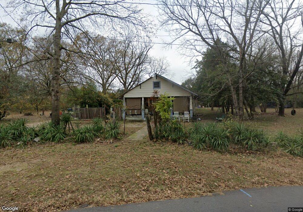
734 Quantz Rd Benton, AR 72015
Estimated Value: $93,608 - $152,000
Studio
1
Bath
1,024
Sq Ft
$128/Sq Ft
Est. Value
About This Home
This home is located at 734 Quantz Rd, Benton, AR 72015 and is currently estimated at $130,902, approximately $127 per square foot. 734 Quantz Rd is a home located in Saline County with nearby schools including Westbrook Elementary School, Harmony Grove Middle School, and Harmony Grove High School.
Ownership History
Date
Name
Owned For
Owner Type
Purchase Details
Closed on
Sep 14, 2023
Sold by
Commissioner Of State Lands
Bought by
Rose Ralph W and Rose Norma J
Current Estimated Value
Purchase Details
Closed on
Dec 12, 2001
Bought by
Rose
Purchase Details
Closed on
Jul 3, 2000
Bought by
State
Purchase Details
Closed on
Jan 7, 1994
Bought by
Mills and Mills Mobley
Purchase Details
Closed on
Oct 27, 1983
Bought by
Rose
Purchase Details
Closed on
Oct 20, 1983
Bought by
Mills and Mills Mobley
Create a Home Valuation Report for This Property
The Home Valuation Report is an in-depth analysis detailing your home's value as well as a comparison with similar homes in the area
Home Values in the Area
Average Home Value in this Area
Purchase History
| Date | Buyer | Sale Price | Title Company |
|---|---|---|---|
| Rose Ralph W | $2,437 | None Listed On Document | |
| Rose | $800 | -- | |
| State | -- | -- | |
| Mills | -- | -- | |
| Rose | $9,500 | -- | |
| Mills | -- | -- |
Source: Public Records
Tax History
| Year | Tax Paid | Tax Assessment Tax Assessment Total Assessment is a certain percentage of the fair market value that is determined by local assessors to be the total taxable value of land and additions on the property. | Land | Improvement |
|---|---|---|---|---|
| 2025 | $564 | $12,474 | $5,574 | $6,900 |
| 2024 | $538 | $12,474 | $5,574 | $6,900 |
| 2023 | $521 | $12,474 | $5,574 | $6,900 |
| 2022 | $478 | $12,474 | $5,574 | $6,900 |
| 2021 | $435 | $7,340 | $3,480 | $3,860 |
| 2020 | $435 | $7,340 | $3,480 | $3,860 |
| 2019 | $415 | $7,340 | $3,480 | $3,860 |
| 2018 | $415 | $7,340 | $3,480 | $3,860 |
| 2017 | $415 | $7,340 | $3,480 | $3,860 |
| 2016 | $407 | $7,200 | $3,480 | $3,720 |
| 2015 | $407 | $7,200 | $3,480 | $3,720 |
| 2014 | $407 | $7,200 | $3,480 | $3,720 |
Source: Public Records
Map
Nearby Homes
- 112 Kee Cove
- 5060 N Highway 229
- 306 Meadow Creek Dr
- 350 Meadow Creek Dr
- 815 Graham Rd
- 370 Meadow Creek Dr
- 810 Troutman Rd
- 000 Desi Ln
- 401 Aden Ave
- 114 Hayes Haskell St
- 1310 Caroline Cove
- 1019 Grand Ave
- 1445 Pine
- 5017 Rolling Meadow Loop
- 4001 Rolling Meadow Ln
- Oklahoma Inn Rd
- 0000 Deer Creek Rd
- 0 Oklahoma Inn Rd Unit 24728946
- 0 Oklahoma Inn Rd Unit 24728947
- 4133 Brody Crossing
- 716 Quantz Rd
- 405 Raper Rd
- 364 Smith Haskell Rd
- 367 Smith Haskell Rd
- 501 Raper Rd
- 706 Quantz Rd
- 104 Willow Point Dr
- 705 Quantz Rd
- 102 Willow Point Dr
- 0 Willow Point Dr Unit 16032800
- 106 Willow Point Dr
- 108 Willow Point Dr
- 110 Willow Point Dr
- 103 Willow Point Dr
- 823 Smith Haskell Ln
- 834 Quantz Rd
- 513 Quantz Rd
- 105 Willow Point Dr
- 847 Quantz Rd
- 107 Willow Point Dr
Your Personal Tour Guide
Ask me questions while you tour the home.