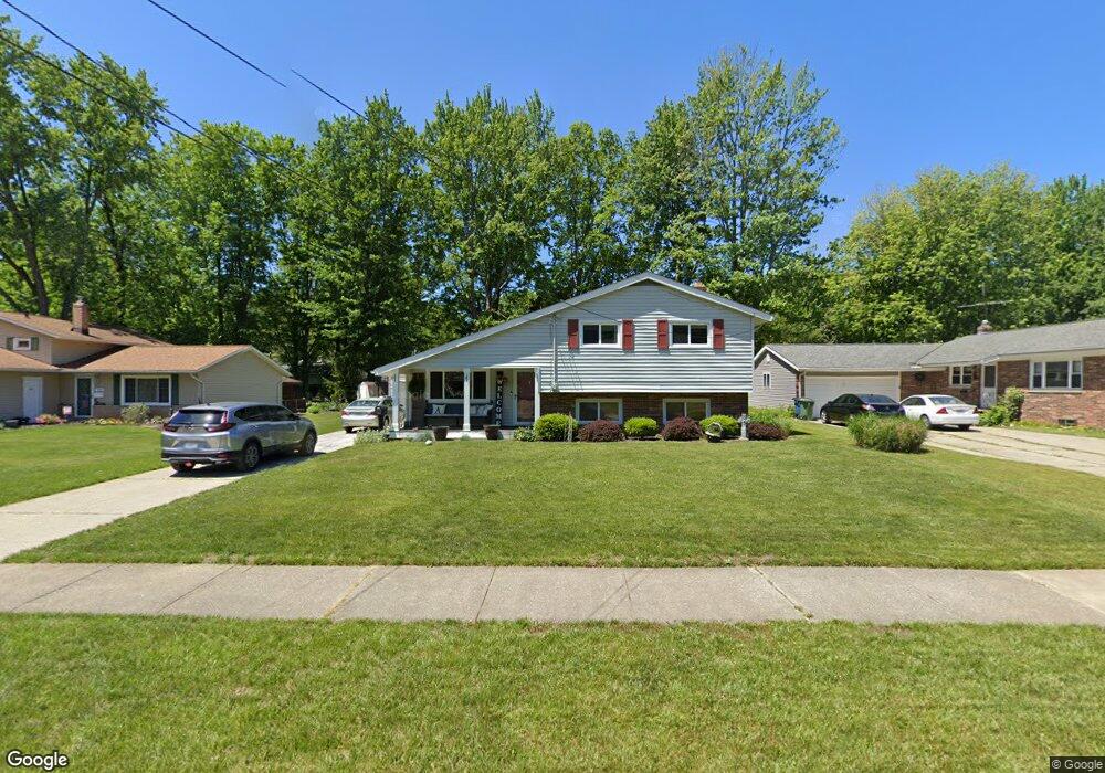
734 Robin Dr Eastlake, OH 44095
Estimated Value: $237,000 - $259,000
3
Beds
2
Baths
1,625
Sq Ft
$153/Sq Ft
Est. Value
About This Home
This home is located at 734 Robin Dr, Eastlake, OH 44095 and is currently estimated at $248,114, approximately $152 per square foot. 734 Robin Dr is a home located in Lake County with nearby schools including Grant Elementary School, Willoughby Middle School, and North High School.
Ownership History
Date
Name
Owned For
Owner Type
Purchase Details
Closed on
Oct 27, 2009
Sold by
Beattie Russell M and Beattie R
Bought by
Amundsen James P and Amundsen Shanda M
Current Estimated Value
Home Financials for this Owner
Home Financials are based on the most recent Mortgage that was taken out on this home.
Original Mortgage
$117,000
Outstanding Balance
$75,425
Interest Rate
5.07%
Mortgage Type
New Conventional
Estimated Equity
$172,689
Purchase Details
Closed on
Aug 26, 2002
Sold by
Stevens Margaret M and Stevens Margaret M
Bought by
Beattie Russell M
Home Financials for this Owner
Home Financials are based on the most recent Mortgage that was taken out on this home.
Original Mortgage
$154,771
Interest Rate
6.56%
Mortgage Type
FHA
Purchase Details
Closed on
Jun 15, 1998
Sold by
Herman Lawrence P and Herman Lawrence
Bought by
Stevens Margaret M and Herman Margaret M
Home Financials for this Owner
Home Financials are based on the most recent Mortgage that was taken out on this home.
Original Mortgage
$37,200
Interest Rate
7.15%
Purchase Details
Closed on
Jan 1, 1990
Bought by
Herman Lawrence P
Create a Home Valuation Report for This Property
The Home Valuation Report is an in-depth analysis detailing your home's value as well as a comparison with similar homes in the area
Home Values in the Area
Average Home Value in this Area
Purchase History
| Date | Buyer | Sale Price | Title Company |
|---|---|---|---|
| Amundsen James P | $157,000 | Enterprise Title Agency Inc | |
| Beattie Russell M | $157,200 | Title Xperts Agency Inc | |
| Stevens Margaret M | -- | Midland Title Security Inc | |
| Herman Lawrence P | -- | -- |
Source: Public Records
Mortgage History
| Date | Status | Borrower | Loan Amount |
|---|---|---|---|
| Open | Amundsen James P | $117,000 | |
| Previous Owner | Beattie Russell M | $154,771 | |
| Previous Owner | Stevens Margaret M | $37,200 |
Source: Public Records
Tax History
| Year | Tax Paid | Tax Assessment Tax Assessment Total Assessment is a certain percentage of the fair market value that is determined by local assessors to be the total taxable value of land and additions on the property. | Land | Improvement |
|---|---|---|---|---|
| 2025 | -- | $79,400 | $14,190 | $65,210 |
| 2024 | -- | $79,400 | $14,190 | $65,210 |
| 2023 | $5,827 | $60,300 | $11,270 | $49,030 |
| 2022 | $3,858 | $60,300 | $11,270 | $49,030 |
| 2021 | $3,875 | $60,300 | $11,270 | $49,030 |
| 2020 | $3,791 | $52,440 | $9,800 | $42,640 |
| 2019 | $3,528 | $52,440 | $9,800 | $42,640 |
| 2018 | $3,483 | $43,740 | $12,350 | $31,390 |
| 2017 | $3,093 | $43,740 | $12,350 | $31,390 |
| 2016 | $2,890 | $43,740 | $12,350 | $31,390 |
| 2015 | $2,839 | $43,740 | $12,350 | $31,390 |
| 2014 | $2,692 | $43,740 | $12,350 | $31,390 |
| 2013 | $2,693 | $43,740 | $12,350 | $31,390 |
Source: Public Records
Map
Nearby Homes
- 541 Howells Ct
- 38396 Poplar Dr
- 2640 Lost Nation Rd
- 462 Waterbury Dr
- 0 Lost Nation Rd
- 2401 Bunker Ln Unit A
- 407 Ridgewood Dr
- 35931 Woodland Dr
- 36988 Clearway Dr
- 38612 Bell Rd
- 35783 Lake Shore Blvd
- 3000 Steve Guard Ct
- 35965 Lake Shore Blvd
- 2048 Forest Dr
- 211 W Overlook Dr
- V/L 13-14 Carlton Dr
- V/L 12 Carlton Dr
- V/L 11 Carlton Dr
- 36360 Sunset Dr
- 37608 Sturbridge Ln
Your Personal Tour Guide
Ask me questions while you tour the home.