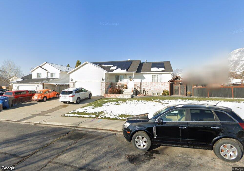
734 W 850 N Pleasant Grove, UT 84062
Estimated Value: $505,000 - $579,000
3
Beds
3
Baths
1,469
Sq Ft
$379/Sq Ft
Est. Value
About This Home
This home is located at 734 W 850 N, Pleasant Grove, UT 84062 and is currently estimated at $556,840, approximately $379 per square foot. 734 W 850 N is a home located in Utah County with nearby schools including Mount Mahogany School, Pleasant Grove Junior High School, and Pleasant Grove High School.
Ownership History
Date
Name
Owned For
Owner Type
Purchase Details
Closed on
Mar 16, 1998
Sold by
Woods Fred
Bought by
Nelson Lloyd H and Nelson Linda J
Current Estimated Value
Purchase Details
Closed on
Mar 12, 1998
Sold by
Woods Carrie and Read Garth T
Bought by
Nelson Lloyd H and Nelson Linda J
Create a Home Valuation Report for This Property
The Home Valuation Report is an in-depth analysis detailing your home's value as well as a comparison with similar homes in the area
Home Values in the Area
Average Home Value in this Area
Purchase History
| Date | Buyer | Sale Price | Title Company |
|---|---|---|---|
| Nelson Lloyd H | -- | -- | |
| Nelson Lloyd H | -- | -- |
Source: Public Records
Tax History Compared to Growth
Tax History
| Year | Tax Paid | Tax Assessment Tax Assessment Total Assessment is a certain percentage of the fair market value that is determined by local assessors to be the total taxable value of land and additions on the property. | Land | Improvement |
|---|---|---|---|---|
| 2025 | $2,299 | $294,910 | $197,400 | $338,800 |
| 2024 | $2,299 | $268,290 | $0 | $0 |
| 2023 | $2,187 | $267,190 | $0 | $0 |
| 2022 | $2,278 | $276,980 | $0 | $0 |
| 2021 | $2,023 | $374,500 | $132,200 | $242,300 |
| 2020 | $1,853 | $336,300 | $118,000 | $218,300 |
| 2019 | $1,621 | $304,200 | $114,400 | $189,800 |
| 2018 | $1,407 | $249,600 | $107,300 | $142,300 |
| 2017 | $1,411 | $133,320 | $0 | $0 |
| 2016 | $1,325 | $120,835 | $0 | $0 |
| 2015 | $1,334 | $115,225 | $0 | $0 |
| 2014 | $1,310 | $112,090 | $0 | $0 |
Source: Public Records
Map
Nearby Homes
- 685 W 1000 N
- 854 N 1010 W
- 909 W 1180 N
- 1130 W State Rd
- 1051 N 600 W
- 1031 N 600 W
- 1041 N 600 W
- 1152 N 200 W
- 1534 N 750 W Unit 16
- Konlee Plan at Makin Dreams
- Alexa Plan at Makin Dreams
- Callahan Plan at Makin Dreams
- Hailey Plan at Makin Dreams
- Alydia Plan at Makin Dreams
- Addison Plan at Makin Dreams
- Julia Plan at Makin Dreams
- 1531 N 750 W Unit 4
- Aaron Plan at Makin Dreams
- Amie Plan at Makin Dreams
- Nora Plan at Makin Dreams