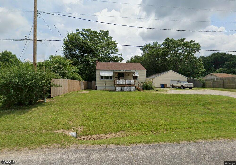
7340 Old State Route 21 Barnhart, MO 63012
Estimated Value: $146,826 - $223,000
Studio
--
Bath
1,030
Sq Ft
$177/Sq Ft
Est. Value
About This Home
This home is located at 7340 Old State Route 21, Barnhart, MO 63012 and is currently estimated at $181,957, approximately $176 per square foot. 7340 Old State Route 21 is a home located in Jefferson County with nearby schools including Antonia Elementary School, Antonia Middle School, and Seckman Senior High School.
Ownership History
Date
Name
Owned For
Owner Type
Purchase Details
Closed on
Aug 17, 2021
Sold by
Evans Leeman H and Evans Jay D
Bought by
Snead Jodi R
Current Estimated Value
Purchase Details
Closed on
Sep 11, 2017
Sold by
Snead Lawrence R and Snead Beverly G
Bought by
Evans Leeman H and Evans Jay D
Purchase Details
Closed on
Sep 27, 2000
Sold by
Evans Nelda F
Bought by
Evans Leeman H and Evans Jay D
Create a Home Valuation Report for This Property
The Home Valuation Report is an in-depth analysis detailing your home's value as well as a comparison with similar homes in the area
Purchase History
| Date | Buyer | Sale Price | Title Company |
|---|---|---|---|
| Snead Jodi R | -- | None Listed On Document | |
| Evans Leeman H | -- | None Available | |
| Evans Leeman H | -- | -- |
Source: Public Records
Tax History
| Year | Tax Paid | Tax Assessment Tax Assessment Total Assessment is a certain percentage of the fair market value that is determined by local assessors to be the total taxable value of land and additions on the property. | Land | Improvement |
|---|---|---|---|---|
| 2025 | $817 | $12,300 | $2,300 | $10,000 |
| 2024 | $817 | $12,000 | $2,300 | $9,700 |
| 2023 | $817 | $12,000 | $2,300 | $9,700 |
| 2022 | $817 | $12,000 | $2,300 | $9,700 |
| 2021 | $817 | $12,000 | $2,300 | $9,700 |
| 2020 | $816 | $11,200 | $2,100 | $9,100 |
| 2019 | $815 | $11,200 | $2,100 | $9,100 |
| 2018 | $808 | $11,200 | $2,100 | $9,100 |
| 2017 | $781 | $11,200 | $2,100 | $9,100 |
| 2016 | $691 | $9,900 | $2,100 | $7,800 |
| 2015 | $692 | $9,900 | $2,100 | $7,800 |
| 2013 | -- | $9,400 | $1,900 | $7,500 |
Source: Public Records
Map
Nearby Homes
- 4598 Schenk Rd
- 0 Wooded Acres
- 6748 Old State Route 21
- 8239 Rocky Woods
- 7350 Deborah Ln
- 5591 Old State Route 21
- 4260 N Shore Dr
- 6606 Old Lemay Ferry Rd
- 6420 Glennsway Dr
- 0 Antonia Estates - Brittany Unit MIS26000740
- 0 Antonia Estates - Amanda Unit MIS26000704
- 0 Antonia Estates - Madison Unit MIS26000723
- 0 Antonia Estates - Marylyn Unit MIS26000716
- 0 Antonia Estates - Julieann II Unit MIS26000730
- 0 Antonia Estates - Julieann I Unit MIS26000731
- 0 Antonia Estates - Kayla Unit MIS26000708
- 0 Antonia Estates - Blake II Unit MIS26000734
- 3655 Bullsway Dr
- 0 Upper Moss Hollow Rd
- 8631 W Shore Dr
- 7346 Old State Route 21
- 7334 Old State Route 21
- 7316 Old State Route 21
- 7394 Old State Route 21
- 7394 Old Highway 21
- 7360 Old Missouri 21
- 1 74 Acres Old Missouri 21
- 7299 Old State Route 21
- 7302 Old State Route 21
- 7407 Habel Rd
- 7396 Sunridge Dr
- 7401 Habel Rd
- 7411 Habel Rd
- 4623 Schenk Rd
- 7291 Old State Route 21
- 7425 Habel Rd
- 7388 Sunridge Dr
- 7390 Sunridge Dr
- 4645 Schenk Rd
- 7447 Old State Route 21
Your Personal Tour Guide
Ask me questions while you tour the home.