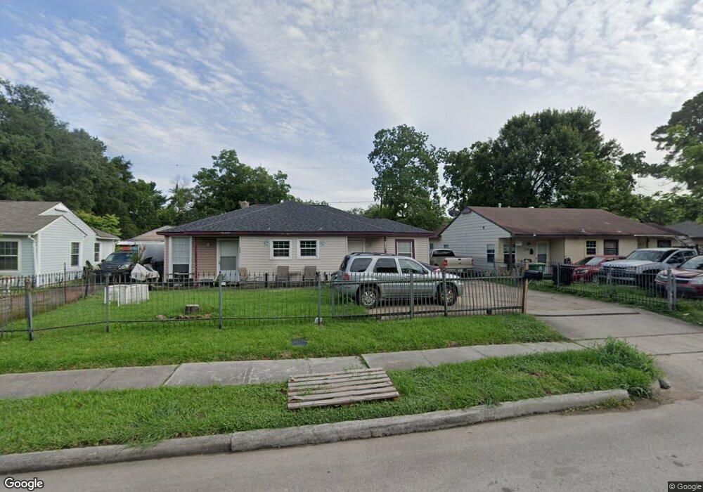
7342 Dixie Dr Houston, TX 77087
Golfcrest-Bellfort-Reveille NeighborhoodEstimated Value: $208,000 - $256,000
4
Beds
2
Baths
1,461
Sq Ft
$155/Sq Ft
Est. Value
About This Home
This home is located at 7342 Dixie Dr, Houston, TX 77087 and is currently estimated at $225,992, approximately $154 per square foot. 7342 Dixie Dr is a home located in Harris County with nearby schools including Cornelius Elementary School, Hartman Middle School, and Ross Shaw Sterling Aviation High School.
Ownership History
Date
Name
Owned For
Owner Type
Purchase Details
Closed on
Nov 8, 2022
Sold by
Chayeb Norris
Bought by
Amsalem Realty Company
Current Estimated Value
Purchase Details
Closed on
Apr 2, 2007
Sold by
Luna Maria
Bought by
Martine Jorge L and Martinez Claudia A
Home Financials for this Owner
Home Financials are based on the most recent Mortgage that was taken out on this home.
Original Mortgage
$50,000
Interest Rate
6.24%
Mortgage Type
Seller Take Back
Purchase Details
Closed on
Nov 17, 1994
Sold by
Moorhead Fred and Moorhead Geneva Sue
Bought by
Robledo Efren T and Robledo Flora
Home Financials for this Owner
Home Financials are based on the most recent Mortgage that was taken out on this home.
Original Mortgage
$13,000
Interest Rate
8.88%
Mortgage Type
Seller Take Back
Create a Home Valuation Report for This Property
The Home Valuation Report is an in-depth analysis detailing your home's value as well as a comparison with similar homes in the area
Home Values in the Area
Average Home Value in this Area
Purchase History
| Date | Buyer | Sale Price | Title Company |
|---|---|---|---|
| Amsalem Realty Company | -- | University Title | |
| Martine Jorge L | -- | None Available | |
| Robledo Efren T | -- | Stewart Title |
Source: Public Records
Mortgage History
| Date | Status | Borrower | Loan Amount |
|---|---|---|---|
| Previous Owner | Martine Jorge L | $50,000 | |
| Previous Owner | Robledo Efren T | $13,000 |
Source: Public Records
Tax History
| Year | Tax Paid | Tax Assessment Tax Assessment Total Assessment is a certain percentage of the fair market value that is determined by local assessors to be the total taxable value of land and additions on the property. | Land | Improvement |
|---|---|---|---|---|
| 2025 | $2,115 | $195,089 | $46,200 | $148,889 |
| 2024 | $2,115 | $193,965 | $46,200 | $147,765 |
| 2023 | $2,115 | $219,397 | $46,200 | $173,197 |
| 2022 | $3,458 | $190,100 | $46,200 | $143,900 |
| 2021 | $3,115 | $152,975 | $18,150 | $134,825 |
| 2020 | $3,125 | $122,053 | $18,150 | $103,903 |
| 2019 | $2,961 | $110,462 | $18,150 | $92,312 |
| 2018 | $1,771 | $101,871 | $18,150 | $83,721 |
| 2017 | $2,588 | $101,871 | $18,150 | $83,721 |
| 2016 | $2,353 | $101,871 | $18,150 | $83,721 |
| 2015 | $1,321 | $94,894 | $18,150 | $76,744 |
| 2014 | $1,321 | $94,894 | $18,150 | $76,744 |
Source: Public Records
Map
Nearby Homes
- 7341 Oak Hill Dr
- 7309 Moline St
- 7226 Kingsway Dr
- 7614 Dixie Dr
- 7530 Park Place Blvd
- 7184 Moline St
- 7601 Park Place Blvd
- 7301 Brockley Ln
- 7355 Bellfort St
- 3731 Reveille St
- 7878 Leonora St
- 6102 Harbrook Dr
- 5209 Plum Dr
- 7902 Grove Ridge Dr
- 7818 Grove Ridge Dr Unit 3
- 6004 Bois d Arc St
- 7954 Grove Ridge Dr
- 7936 Grove Ridge Dr
- 7507 Greenstone St
- 7393 Fairway Dr Unit B
- 7338 Dixie Dr
- 7346 Dixie Dr
- 7336 Dixie Dr
- 7339 Oak Hill Dr
- 7337 Oak Hill Dr
- 7335 Oak Hill Dr
- 7332 Dixie Dr
- 7343 Oak Hill Dr
- 7333 Oak Hill Dr
- 7330 Dixie Dr
- 7369 Dixie Dr
- 7331 Oak Hill Dr
- 7345 Oak Hill Dr
- 7363 Dixie Dr
- 7328 Dixie Dr
- 7340 Oak Hill Dr
- 7342 Oak Hill Dr
- 7338 Oak Hill Dr
- 7329 Oak Hill Dr
- 7347 Oak Hill Dr
Your Personal Tour Guide
Ask me questions while you tour the home.