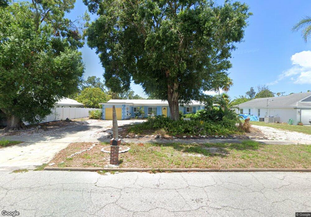
7342 Shepherd St Sarasota, FL 34243
Estimated Value: $486,000 - $563,058
2
Beds
2
Baths
1,640
Sq Ft
$317/Sq Ft
Est. Value
About This Home
This home is located at 7342 Shepherd St, Sarasota, FL 34243 and is currently estimated at $519,515, approximately $316 per square foot. 7342 Shepherd St is a home located in Manatee County with nearby schools including Florine J. Abel Elementary School, Electa Lee Magnet Middle School, and Bayshore High School.
Ownership History
Date
Name
Owned For
Owner Type
Purchase Details
Closed on
Jul 27, 2023
Sold by
Mcrae Joy and Mcrae William
Bought by
Mcrae Joy Deborah and Mcrae William
Current Estimated Value
Purchase Details
Closed on
Nov 28, 2014
Sold by
Wilson Larry E and Wilson Linda L
Bought by
Mcrae William and Mcrae Joy
Home Financials for this Owner
Home Financials are based on the most recent Mortgage that was taken out on this home.
Original Mortgage
$201,600
Interest Rate
4%
Mortgage Type
New Conventional
Purchase Details
Closed on
Jun 18, 1998
Sold by
Sarasota & Manatee Airport Authority
Bought by
Wilson Larry E and Wilson Linda L
Home Financials for this Owner
Home Financials are based on the most recent Mortgage that was taken out on this home.
Original Mortgage
$91,800
Interest Rate
7.14%
Create a Home Valuation Report for This Property
The Home Valuation Report is an in-depth analysis detailing your home's value as well as a comparison with similar homes in the area
Home Values in the Area
Average Home Value in this Area
Purchase History
| Date | Buyer | Sale Price | Title Company |
|---|---|---|---|
| Mcrae Joy Deborah | $125,000 | None Listed On Document | |
| Mcrae William | $252,000 | Attorney | |
| Wilson Larry E | $108,000 | -- |
Source: Public Records
Mortgage History
| Date | Status | Borrower | Loan Amount |
|---|---|---|---|
| Previous Owner | Mcrae William | $201,600 | |
| Previous Owner | Wilson Larry E | $91,800 |
Source: Public Records
Tax History
| Year | Tax Paid | Tax Assessment Tax Assessment Total Assessment is a certain percentage of the fair market value that is determined by local assessors to be the total taxable value of land and additions on the property. | Land | Improvement |
|---|---|---|---|---|
| 2025 | $3,210 | $251,656 | -- | -- |
| 2024 | $3,210 | $244,564 | -- | -- |
| 2023 | $3,151 | $237,441 | $0 | $0 |
| 2022 | $3,124 | $230,525 | $0 | $0 |
| 2021 | $2,984 | $223,811 | $0 | $0 |
| 2020 | $3,079 | $220,721 | $0 | $0 |
| 2019 | $3,023 | $215,759 | $0 | $0 |
| 2018 | $2,987 | $211,736 | $0 | $0 |
| 2017 | $2,774 | $207,381 | $0 | $0 |
| 2016 | $3,584 | $216,278 | $0 | $0 |
Source: Public Records
Map
Nearby Homes
- 7326 Shepherd St
- 7332 Phillips St
- 7324 Phillips St
- 7510 Westmoreland Dr
- 7549 Westmoreland Dr
- 7418 Westmoreland Dr
- 7230 Shepherd St
- 7332 Broughton St
- 147 Adair Ave
- 139 Adair Ave
- 322 Buena Vista Ave
- 121 Holly Ave
- 7322 Westmoreland Dr
- 7318 Westmoreland Dr
- 7125 Westmoreland Dr
- 7314 Westmoreland Dr
- 7150 N Tamiami Trail Unit S-612
- 7150 N Tamiami Trail Unit S-512
- 7150 N Tamiami Trail Unit S-521
- 7150 N Tamiami Trail Unit C-233
- 7338 Shepherd St
- 219 Whitfield Ave
- 7353 Phillips St
- 7357 Phillips St
- 7349 Phillips St
- 7330 Shepherd St
- 7343 Shepherd St
- 7351 Shepherd St
- 7341 Phillips St
- 0 Phillips St
- 7332 & 7336 Phillips St
- Lot 14 Phillips St
- 7327 Street
- 7327 Shepherd St
- 7340 N Tamiami Trail
- 7352 Phillips St
- 7337 Phillips St
- 241 Whitfield Ave
- 7314 Shepherd St
- 7319 Shepherd St
Your Personal Tour Guide
Ask me questions while you tour the home.