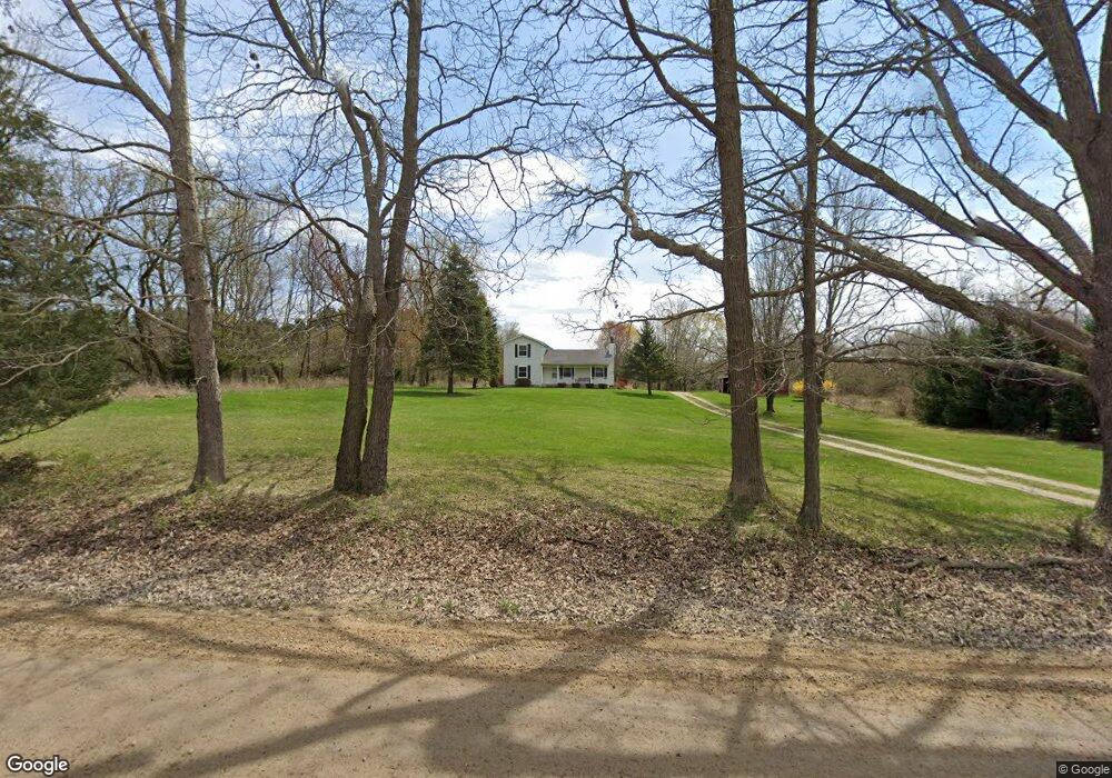
7346 Faussett Rd Fenton, MI 48430
Estimated Value: $318,500 - $416,000
--
Bed
--
Bath
1,688
Sq Ft
$205/Sq Ft
Est. Value
About This Home
This home is located at 7346 Faussett Rd, Fenton, MI 48430 and is currently estimated at $345,875, approximately $204 per square foot. 7346 Faussett Rd is a home located in Livingston County with nearby schools including Hartland High School.
Ownership History
Date
Name
Owned For
Owner Type
Purchase Details
Closed on
Aug 15, 2024
Sold by
Newman Allen E and Newman Sandra A
Bought by
Newman John R and Newman Clare
Current Estimated Value
Home Financials for this Owner
Home Financials are based on the most recent Mortgage that was taken out on this home.
Original Mortgage
$92,000
Outstanding Balance
$90,975
Interest Rate
6.95%
Mortgage Type
New Conventional
Estimated Equity
$254,900
Purchase Details
Closed on
Aug 9, 2024
Sold by
Newman Allen E and Newman Sandra A
Bought by
Newman John R and Newman Clare
Home Financials for this Owner
Home Financials are based on the most recent Mortgage that was taken out on this home.
Original Mortgage
$92,000
Outstanding Balance
$90,975
Interest Rate
6.95%
Mortgage Type
New Conventional
Estimated Equity
$254,900
Purchase Details
Closed on
Oct 16, 2013
Sold by
Newman Allen E and Newman Sandra A
Bought by
Newman Allen E and Newman Sandra A
Create a Home Valuation Report for This Property
The Home Valuation Report is an in-depth analysis detailing your home's value as well as a comparison with similar homes in the area
Home Values in the Area
Average Home Value in this Area
Purchase History
| Date | Buyer | Sale Price | Title Company |
|---|---|---|---|
| Newman John R | $225,000 | Liberty Title | |
| Newman John R | $225,000 | Liberty Title | |
| Newman Allen E | -- | -- |
Source: Public Records
Mortgage History
| Date | Status | Borrower | Loan Amount |
|---|---|---|---|
| Open | Newman John R | $92,000 | |
| Closed | Newman John R | $92,000 |
Source: Public Records
Tax History Compared to Growth
Tax History
| Year | Tax Paid | Tax Assessment Tax Assessment Total Assessment is a certain percentage of the fair market value that is determined by local assessors to be the total taxable value of land and additions on the property. | Land | Improvement |
|---|---|---|---|---|
| 2025 | $2,613 | $140,400 | $0 | $0 |
| 2024 | $1,130 | $149,100 | $0 | $0 |
| 2023 | $1,080 | $139,100 | $0 | $0 |
| 2022 | $2,308 | $121,300 | $0 | $0 |
| 2021 | $2,308 | $115,400 | $0 | $0 |
| 2020 | $2,290 | $111,900 | $0 | $0 |
| 2019 | $2,133 | $108,600 | $0 | $0 |
| 2018 | $2,086 | $97,774 | $0 | $0 |
| 2017 | $2,023 | $97,774 | $0 | $0 |
| 2016 | $1,997 | $94,343 | $0 | $0 |
| 2014 | $1,806 | $75,631 | $0 | $0 |
| 2012 | $1,806 | $68,249 | $0 | $0 |
Source: Public Records
Map
Nearby Homes
- 6140 Mcguire Rd
- 00-Lot 128 Ledgewood Dr
- 000-Unit 3 Ledgewood Ravine
- 7386 Dean Rd
- 7477 Ore Knob Dr
- 001 Driftwood Dr S
- 7447 Driftwood Dr S
- 7334 Parkwood Dr
- 8373 Riverwalk Dr
- 0 Parkwood Dr
- 8425 Parshallville Rd
- 7680 Parshallville Rd
- 7670 Parshallville Rd
- 6612 Prince Blvd
- V/L Parshallville Rd
- 6418 Apple Way
- 7741 Clyde Rd
- 5359 Faussett Rd
- 9680 Townsquare Blvd
- 6278 Princess Blvd
- 7312 Faussett Rd
- 7388 Faussett Rd
- 7300 Faussett Rd
- 7324 Faussett Rd
- 7381 Faussett Rd
- 7367 Faussett Rd
- 7287 Faussett Rd
- Parcel B Ravens Roost Dr
- 7286 Faussett Rd
- 0 Ravens Roost Dr
- 7394 Faussett Rd
- 7268 Faussett Rd
- 7410 Faussett Rd
- 7115 Ravens Roost Dr Unit Bldg-Unit
- 7115 Ravens Roost Dr
- 7415 Faussett Rd
- 7250 Faussett Rd
- 7070 Randall Dr
- 7070 Randall Dr
- 7230 Faussett Rd