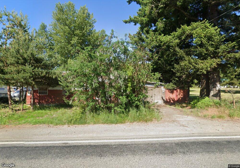
7349 N Enterprise Rd Ferndale, WA 98248
Estimated Value: $257,000 - $554,000
6
Beds
1
Bath
1,008
Sq Ft
$414/Sq Ft
Est. Value
About This Home
This home is located at 7349 N Enterprise Rd, Ferndale, WA 98248 and is currently estimated at $417,473, approximately $414 per square foot. 7349 N Enterprise Rd is a home located in Whatcom County with nearby schools including Custer Elementary School, Horizon Middle School, and Ferndale High School.
Ownership History
Date
Name
Owned For
Owner Type
Purchase Details
Closed on
Dec 30, 2024
Sold by
Beeman Shamani
Bought by
Clark Roy
Current Estimated Value
Purchase Details
Closed on
Nov 5, 2024
Sold by
Singh Rajinder
Bought by
Beeman Shamani
Purchase Details
Closed on
Oct 12, 2004
Sold by
Clark Keith Warne
Bought by
Beeman Shamani D
Purchase Details
Closed on
Sep 24, 2004
Sold by
Clark Archie Arthur
Bought by
Clark Keith W
Purchase Details
Closed on
Jan 2, 2004
Sold by
Clark Archie Arthur
Bought by
Clark Keith Warbe
Purchase Details
Closed on
Oct 4, 2002
Sold by
Clark Roy
Bought by
Clark Archie A
Purchase Details
Closed on
Mar 1, 1999
Sold by
Clark Archie and Clark Elois
Bought by
Clark Roy
Create a Home Valuation Report for This Property
The Home Valuation Report is an in-depth analysis detailing your home's value as well as a comparison with similar homes in the area
Home Values in the Area
Average Home Value in this Area
Purchase History
| Date | Buyer | Sale Price | Title Company |
|---|---|---|---|
| Clark Roy | $313 | None Listed On Document | |
| Beeman Shamani | $313 | None Listed On Document | |
| Beeman Shamani D | -- | -- | |
| Clark Keith W | -- | -- | |
| Clark Keith Warbe | -- | -- | |
| Clark Archie A | -- | -- | |
| Clark Roy | -- | -- |
Source: Public Records
Tax History Compared to Growth
Tax History
| Year | Tax Paid | Tax Assessment Tax Assessment Total Assessment is a certain percentage of the fair market value that is determined by local assessors to be the total taxable value of land and additions on the property. | Land | Improvement |
|---|---|---|---|---|
| 2024 | $1,938 | $242,193 | $209,641 | $32,552 |
| 2023 | $1,938 | $268,800 | $237,500 | $31,300 |
| 2022 | $1,136 | $148,620 | $113,292 | $35,328 |
| 2021 | $1,157 | $122,827 | $93,630 | $29,197 |
| 2020 | $1,118 | $113,732 | $86,697 | $27,035 |
| 2019 | $901 | $99,057 | $75,510 | $23,547 |
| 2018 | $1,031 | $90,565 | $69,037 | $21,528 |
| 2017 | $1,063 | $79,366 | $60,500 | $18,866 |
| 2016 | $1,002 | $86,546 | $60,632 | $25,914 |
| 2015 | $1,007 | $81,724 | $57,404 | $24,320 |
| 2014 | -- | $79,943 | $56,100 | $23,843 |
| 2013 | -- | $78,584 | $55,000 | $23,584 |
Source: Public Records
Map
Nearby Homes
- 0 2151xx Harksell Rd
- 7442 Woodland Rd
- 7181 Enterprise Rd
- 1711 Garden Farms Rd
- 7020 Dahlberg Rd
- 1939 Grandview Rd
- 2070 Grandview Rd
- 2020 Grandview Rd
- 2036 Grandview Rd
- 6850 Portal Way
- 2265 Grandview Rd
- 7136 Portal Way Unit 18
- 6600 Portal Way
- 1862 Destiny St
- 1273 Vista Cir
- 8065 Lyn Dale Dr
- 1942 Trigg Rd Unit 26
- 1942 Trigg Rd Unit 38
- 0 Aldergrove Rd Unit NWM2355925
- 0 xxx Brown Rd
- 7354 N Enterprise Rd
- 7342 N Enterprise Rd
- 7365 N Enterprise Rd
- 7370 N Enterprise Rd
- 7339 N Enterprise Rd
- 1770 Harksell Rd
- 1776 Harksell Rd
- 7396 N Enterprise Rd
- 1747 Harksell Rd
- 1800 Harksell Rd
- 1780 Harksell Rd
- 1796 Harksell Rd
- 1784 Harksell Rd
- 7365 Sunnybrook Ln
- 7404 N Enterprise Rd
- 7411 N Enterprise Rd
- 1709 Harksell Rd
- 1792 Harksell Rd
- 0 169x Harksell Rd Unit 1320916
- 1791 Harksell Rd