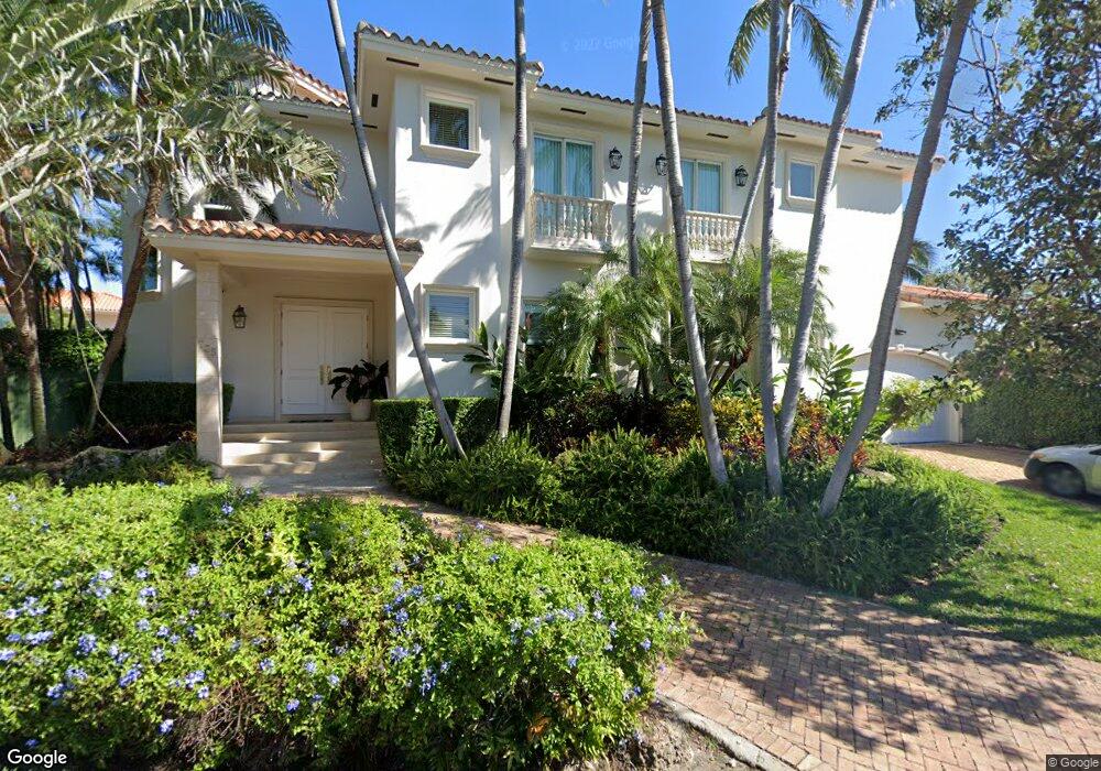
735 Allendale Rd Key Biscayne, FL 33149
Estimated Value: $4,793,903 - $6,872,000
5
Beds
6
Baths
4,646
Sq Ft
$1,270/Sq Ft
Est. Value
About This Home
This home is located at 735 Allendale Rd, Key Biscayne, FL 33149 and is currently estimated at $5,898,226, approximately $1,269 per square foot. 735 Allendale Rd is a home located in Miami-Dade County with nearby schools including Key Biscayne K-8 Center, Ponce de Leon Middle School, and Coral Gables Senior High School.
Ownership History
Date
Name
Owned For
Owner Type
Purchase Details
Closed on
Sep 19, 2002
Sold by
Roberto Porcari M and Roberto Mercedes Porcari
Bought by
Laredo R/E Investments Inc
Current Estimated Value
Home Financials for this Owner
Home Financials are based on the most recent Mortgage that was taken out on this home.
Original Mortgage
$183,500
Outstanding Balance
$77,212
Interest Rate
6.21%
Mortgage Type
New Conventional
Estimated Equity
$5,821,014
Purchase Details
Closed on
Apr 26, 1996
Sold by
Suntrust Bank Pr
Bought by
Porcari Roberto and Porcari Mercedes
Home Financials for this Owner
Home Financials are based on the most recent Mortgage that was taken out on this home.
Original Mortgage
$207,000
Interest Rate
7.8%
Mortgage Type
New Conventional
Create a Home Valuation Report for This Property
The Home Valuation Report is an in-depth analysis detailing your home's value as well as a comparison with similar homes in the area
Home Values in the Area
Average Home Value in this Area
Purchase History
| Date | Buyer | Sale Price | Title Company |
|---|---|---|---|
| Laredo R/E Investments Inc | $1,835,000 | -- | |
| Porcari Roberto | $350,000 | -- |
Source: Public Records
Mortgage History
| Date | Status | Borrower | Loan Amount |
|---|---|---|---|
| Open | Porcari Roberto | $183,500 | |
| Previous Owner | Porcari Roberto | $207,000 |
Source: Public Records
Tax History
| Year | Tax Paid | Tax Assessment Tax Assessment Total Assessment is a certain percentage of the fair market value that is determined by local assessors to be the total taxable value of land and additions on the property. | Land | Improvement |
|---|---|---|---|---|
| 2025 | $49,356 | $3,181,219 | -- | -- |
| 2024 | $47,829 | $2,892,018 | -- | -- |
| 2023 | $47,829 | $2,629,108 | $0 | $0 |
| 2022 | $42,287 | $2,390,099 | $0 | $0 |
| 2021 | $36,846 | $2,172,818 | $1,210,490 | $962,328 |
| 2020 | $33,901 | $2,051,414 | $1,077,205 | $974,209 |
| 2019 | $37,328 | $2,253,389 | $1,267,300 | $986,089 |
| 2018 | $36,311 | $2,265,270 | $1,267,300 | $997,970 |
| 2017 | $42,035 | $2,600,530 | $0 | $0 |
| 2016 | $43,254 | $2,612,410 | $0 | $0 |
| 2015 | $41,327 | $2,425,568 | $0 | $0 |
| 2014 | $38,691 | $2,205,062 | $0 | $0 |
Source: Public Records
Map
Nearby Homes
- 760 Allendale Rd
- 691 Ridgewood Rd
- 797 Ridgewood Rd
- 285 W Enid Dr
- 741 Harbor Dr
- 635 Curtiswood Dr
- 420 Island Dr
- 164 W Mashta Dr
- 861 Harbor Dr
- 738 Fernwood Rd
- 545 Sabal Palm Dr
- 960 Mariner Dr
- 550 Harbor Dr
- 798 Crandon Blvd Unit 55B
- 798 Crandon Blvd Unit 13C
- 798 Crandon Blvd Unit 16C
- 465 Hampton Ln
- 544 Fernwood Rd Unit 544
- 591 N Mashta Dr
- 315 Palmwood Ln
- 264 Westwood Dr
- 745 Allendale Rd
- 276 Westwood Dr
- 252 Westwood Dr
- 750 Allendale Rd
- 730 Allendale Rd
- 755 Allendale Rd
- 240 Westwood Dr
- 700 Allendale Rd
- 770 Allendale Rd
- 690 Warren Ln
- 775 Curtiswood Dr
- 765 Curtiswood Dr
- 685 Allendale Rd
- 735 Curtiswood Dr
- 745 Curtiswood Dr
- 785 Curtiswood Dr
- 228 Westwood Dr
- 715 Curtiswood Dr
Your Personal Tour Guide
Ask me questions while you tour the home.