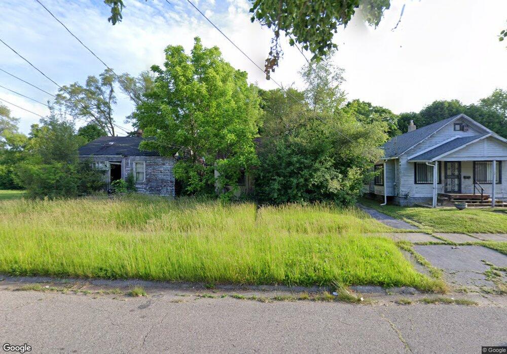
735 E Lyndon Ave Flint, MI 48505
Northeast Village NeighborhoodEstimated Value: $37,000 - $40,000
2
Beds
1
Bath
624
Sq Ft
$62/Sq Ft
Est. Value
About This Home
This home is located at 735 E Lyndon Ave, Flint, MI 48505 and is currently estimated at $38,500, approximately $61 per square foot. 735 E Lyndon Ave is a home located in Genesee County with nearby schools including Brownell STEM Academy, The New Standard Academy, and Eagle's Nest Academy.
Ownership History
Date
Name
Owned For
Owner Type
Purchase Details
Closed on
Dec 20, 2016
Sold by
Cherry Deborah L
Bought by
Genese County Land Bank
Current Estimated Value
Purchase Details
Closed on
Sep 24, 1979
Sold by
City Of Flint
Bought by
Sanders T B
Purchase Details
Closed on
Sep 6, 1979
Sold by
City Of Flint
Bought by
Monroe Loren E
Purchase Details
Closed on
May 24, 1979
Sold by
Sanders Gaye C
Bought by
Sanders T B
Purchase Details
Closed on
May 18, 1972
Sold by
Barber Elwood T and Barber Erma M
Bought by
Sanders T B and Sanders Gaye C
Create a Home Valuation Report for This Property
The Home Valuation Report is an in-depth analysis detailing your home's value as well as a comparison with similar homes in the area
Home Values in the Area
Average Home Value in this Area
Purchase History
| Date | Buyer | Sale Price | Title Company |
|---|---|---|---|
| Genese County Land Bank | -- | None Available | |
| Sanders T B | -- | None Available | |
| Monroe Loren E | -- | None Available | |
| Sanders T B | -- | None Available | |
| Sanders T B | $8,900 | None Available |
Source: Public Records
Tax History
| Year | Tax Paid | Tax Assessment Tax Assessment Total Assessment is a certain percentage of the fair market value that is determined by local assessors to be the total taxable value of land and additions on the property. | Land | Improvement |
|---|---|---|---|---|
| 2025 | -- | $0 | $0 | $0 |
| 2024 | -- | $0 | $0 | $0 |
| 2023 | -- | $0 | $0 | $0 |
| 2022 | $0 | $0 | $0 | $0 |
| 2021 | $0 | $0 | $0 | $0 |
| 2020 | $0 | $0 | $0 | $0 |
| 2019 | $428 | $0 | $0 | $0 |
| 2018 | $221 | $0 | $0 | $0 |
| 2017 | $1,990 | $0 | $0 | $0 |
| 2016 | $428 | $0 | $0 | $0 |
| 2015 | $0 | $0 | $0 | $0 |
| 2014 | -- | $0 | $0 | $0 |
| 2012 | -- | $4,100 | $0 | $0 |
Source: Public Records
Map
Nearby Homes
- 618 E Parkway Ave
- 680 E Pierson Rd
- 802 E Russell Ave
- 350 E Mott Ave
- 605 E Baltimore Blvd
- 418 E Foss Ave
- 638 E Foss Ave
- 345 E Austin Ave
- 425 E Lorado Ave
- 421 E Lorado Ave
- 422 E Foss Ave
- 225 E Piper Ave
- 1218 E Piper Ave
- 426 E Holbrook Ave
- 738 E York Ave
- 4028 North St
- 302 E York Ave
- 124 W Flint Park Blvd
- 1062 Tremont Ave
- 329 W Baltimore Blvd
- 731 E Lyndon Ave
- 739 E Lyndon Ave
- 727 E Lyndon Ave
- 734 E Mott Ave
- 730 E Mott Ave
- 738 E Mott Ave
- 726 E Mott Ave
- 719 E Lyndon Ave
- 753 E Lyndon Ave
- 747 E Lyndon Ave
- 734 E Lyndon Ave
- 730 E Lyndon Ave
- 738 E Lyndon Ave
- 715 E Lyndon Ave
- 722 E Lyndon Ave
- 726 E Lyndon Ave
- 718 E Mott Ave
- 750 E Lyndon Ave
- 718 E Lyndon Ave
- 759 E Lyndon Ave
Your Personal Tour Guide
Ask me questions while you tour the home.